
| Memorials | : | 8 |
| Location | : | Chelan, Chelan County, USA |
| Coordinate | : | 47.8451000, -119.9946000 |
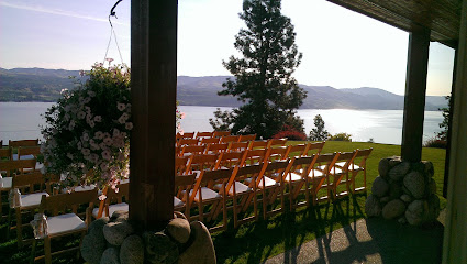
| Description | : | Location: Approximately 0.5 mi NE of Chelan via Highway 97 in Sec 7, T 27 N, R 23 E, W.M. History: Mount Olivet Cemetery was active within the greater Chelan community from July 1894 to 1928. Approximately 45 interments were made in this cemetery, and about half a dozen were relocated to Fraternal Cemetery in the 1960s. The site was called Chelan Cemetery from 1894 to 1901; in November 1901 a cemetery board was formed and the site formally named as Mount Olivet. Some interments are carried only in the St Andrew Episcopal Church records with obscure identification and... Read More |
frequently asked questions (FAQ):
-
Where is Mount Olivet Cemetery?
Mount Olivet Cemetery is located at Chelan, Chelan County ,Washington ,USA.
-
Mount Olivet Cemetery cemetery's updated grave count on graveviews.com?
8 memorials
-
Where are the coordinates of the Mount Olivet Cemetery?
Latitude: 47.8451000
Longitude: -119.9946000
Nearby Cemetories:
1. Chelan Fraternal Cemetery
Chelan, Chelan County, USA
Coordinate: 47.8502998, -120.0081024
2. Riverview Cemetery
Chelan, Chelan County, USA
Coordinate: 47.8335991, -119.9944000
3. Saint Andrews Episcopal Church
Chelan, Chelan County, USA
Coordinate: 47.8397460, -120.0183780
4. Manson Indian Cemetery
Manson, Chelan County, USA
Coordinate: 47.8800000, -120.1300000
5. Ballard Family Cemetery
Stayman, Chelan County, USA
Coordinate: 47.7811100, -120.1133300
6. Fletcher Cemetery
Douglas County, USA
Coordinate: 47.7430992, -119.9403000
7. Brays Landing Cemetery
Douglas County, USA
Coordinate: 47.7364120, -120.1704660
8. Kummer Cemetery
Waterville, Douglas County, USA
Coordinate: 47.6559000, -120.0332000
9. Packwood Memorial Cemetery
Dyer, Douglas County, USA
Coordinate: 48.0118305, -119.8178880
10. Waterville Cemetery
Waterville, Douglas County, USA
Coordinate: 47.6418500, -120.0685940
11. Dick Family Cemetery
Okanogan County, USA
Coordinate: 48.0502700, -119.9241700
12. Miller Family Cemetery
Okanogan County, USA
Coordinate: 48.0530300, -119.9288000
13. Gate of Heaven Catholic Cemetery
Waterville, Douglas County, USA
Coordinate: 47.6382100, -120.0671690
14. Pateros Cemetery
Pateros, Okanogan County, USA
Coordinate: 48.0516600, -119.9097300
15. Douglas Lutheran Cemetery
Douglas County, USA
Coordinate: 47.6189003, -119.9614029
16. Mansfield Cemetery
Mansfield, Douglas County, USA
Coordinate: 47.8088880, -119.6508330
17. Badger Mountain View Cemetery
Douglas County, USA
Coordinate: 47.6088000, -120.0476000
18. Orondo Community Cemetery
Orondo, Douglas County, USA
Coordinate: 47.6486015, -120.2136002
19. Buckingham Cemetery
Douglas County, USA
Coordinate: 47.8669014, -119.6286011
20. Happy Home Cemetery
Farmer, Douglas County, USA
Coordinate: 47.6268997, -119.8125000
21. Methow Cemetery
Methow, Okanogan County, USA
Coordinate: 48.1102982, -120.0124969
22. Bridgeport Cemetery
Bridgeport, Douglas County, USA
Coordinate: 48.0050000, -119.6738800
23. Entiat Cemetery
Entiat, Chelan County, USA
Coordinate: 47.6755981, -120.3043976
24. Jameson Cemetery
Douglas County, USA
Coordinate: 47.6857986, -119.6624985