
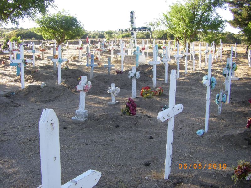
| Memorials | : | 18 |
| Location | : | Campo, San Diego County, USA |
| Coordinate | : | 32.7603510, -116.3247440 |
| Description | : | Juancito Cemetery is on the Campo Indian Reservation in San Diego County, California. Directions: To reach the cemetery, take Interstate 8 to the Live Oak Springs exit. Proceed south on Old Hwy 80 until you reach the town of Live Oak Springs. Turn left on Royal Rd, heading towards the back of the community; the road turns into "Like Oak Trail". Continue on and you will cross over a cattle guard. Continue for about 4.2 miles and you will reach a fork, where the right fork leads to the Horse Camp, but you want to take the left fork. The... Read More |
frequently asked questions (FAQ):
-
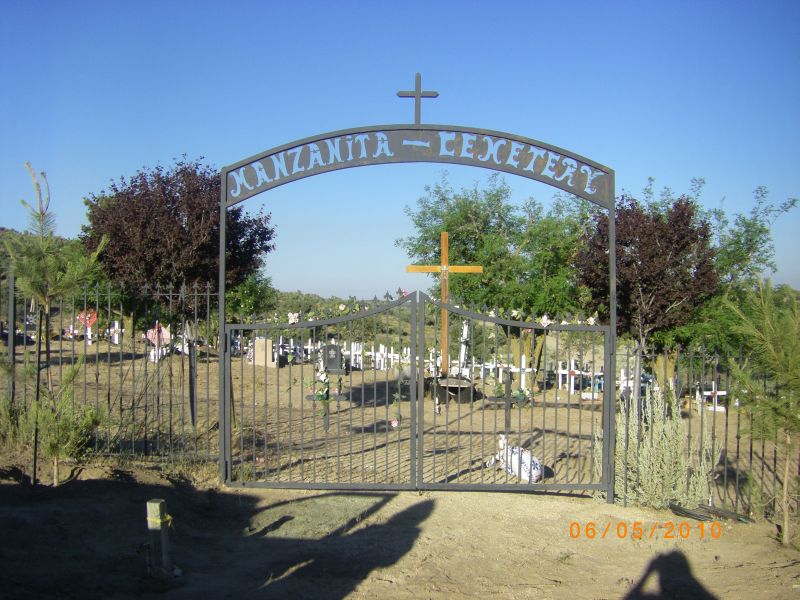
Where is Manzanita Cemetery?
Manzanita Cemetery is located at Campo, San Diego County ,California ,USA.
-
Manzanita Cemetery cemetery's updated grave count on graveviews.com?
18 memorials
-
Where are the coordinates of the Manzanita Cemetery?
Latitude: 32.7603510
Longitude: -116.3247440
Nearby Cemetories:
1. Saint Carmel Cemetery
Live Oak Springs, San Diego County, USA
Coordinate: 32.6502991, -116.3638992
2. Amos Buckman Gravesite
San Diego County, USA
Coordinate: 32.7695090, -116.4901530
3. Campbell-Chilwell-Mount Laguna Cemetery
Mount Laguna, San Diego County, USA
Coordinate: 32.8670710, -116.4538330
4. Ortega Cemetery
Campo, San Diego County, USA
Coordinate: 32.6292800, -116.4566300
5. Milquatay Cemetery
Campo, San Diego County, USA
Coordinate: 32.6291490, -116.4566830
6. Vallecito Stage Station Cemetery
Vallecito, San Diego County, USA
Coordinate: 32.9753990, -116.3485031
7. S R Gillette Burial Site
Alpine, San Diego County, USA
Coordinate: 32.8144370, -116.6219870
8. Ellis Ranch Cemetery
Descanso, San Diego County, USA
Coordinate: 32.8316040, -116.6209620
9. Potrero Cemetery
Potrero, San Diego County, USA
Coordinate: 32.6109700, -116.6133470
10. Panteón Municipal No. 1
Tecate, Tecate Municipality, Mexico
Coordinate: 32.5766930, -116.6089980
11. Viejas Indian Reservation Cemetery
Alpine, San Diego County, USA
Coordinate: 32.8622400, -116.6981200
12. Inaja Indian Reservation Cemetery
Pine Hills, San Diego County, USA
Coordinate: 33.0058770, -116.6356130
13. Panteón Renacimiento
Paso del Aguila, Tecate Municipality, Mexico
Coordinate: 32.5339628, -116.6866657
14. Alpine Cemetery
Alpine, San Diego County, USA
Coordinate: 32.8429985, -116.7664032
15. Panteón Municipal No. 2
Tecate, Tecate Municipality, Mexico
Coordinate: 32.5244020, -116.6985279
16. Julian Cemetery
Julian, San Diego County, USA
Coordinate: 33.0797005, -116.6042023
17. Alpine Mount Pisgah Pioneer Cemetery
Alpine, San Diego County, USA
Coordinate: 32.8123930, -116.7981940
18. Sycuan Indian Reservation Cemetery
El Cajon, San Diego County, USA
Coordinate: 32.7827560, -116.8373550
19. Inaja Memorial Park
Santa Ysabel, San Diego County, USA
Coordinate: 33.0983009, -116.6641006
20. Parque Memorial Puerta del Edén
Valle Redondo, Tijuana Municipality, Mexico
Coordinate: 32.5135372, -116.7704848
21. Panteón Municipal No. 12
Valle Redondo, Tijuana Municipality, Mexico
Coordinate: 32.5103770, -116.7680600
22. Pantéon Municipal No. 13
Valle Redondo, Tijuana Municipality, Mexico
Coordinate: 32.5001121, -116.7620491
23. Golden Eagle Farm Burial Site
Ramona, San Diego County, USA
Coordinate: 33.0694720, -116.7324610
24. Wilson Family Cemetery
San Diego County, USA
Coordinate: 33.1708660, -116.5783630