
| Memorials | : | 0 |
| Location | : | Crow Wing County, USA |
| Coordinate | : | 46.3297005, -93.9993973 |
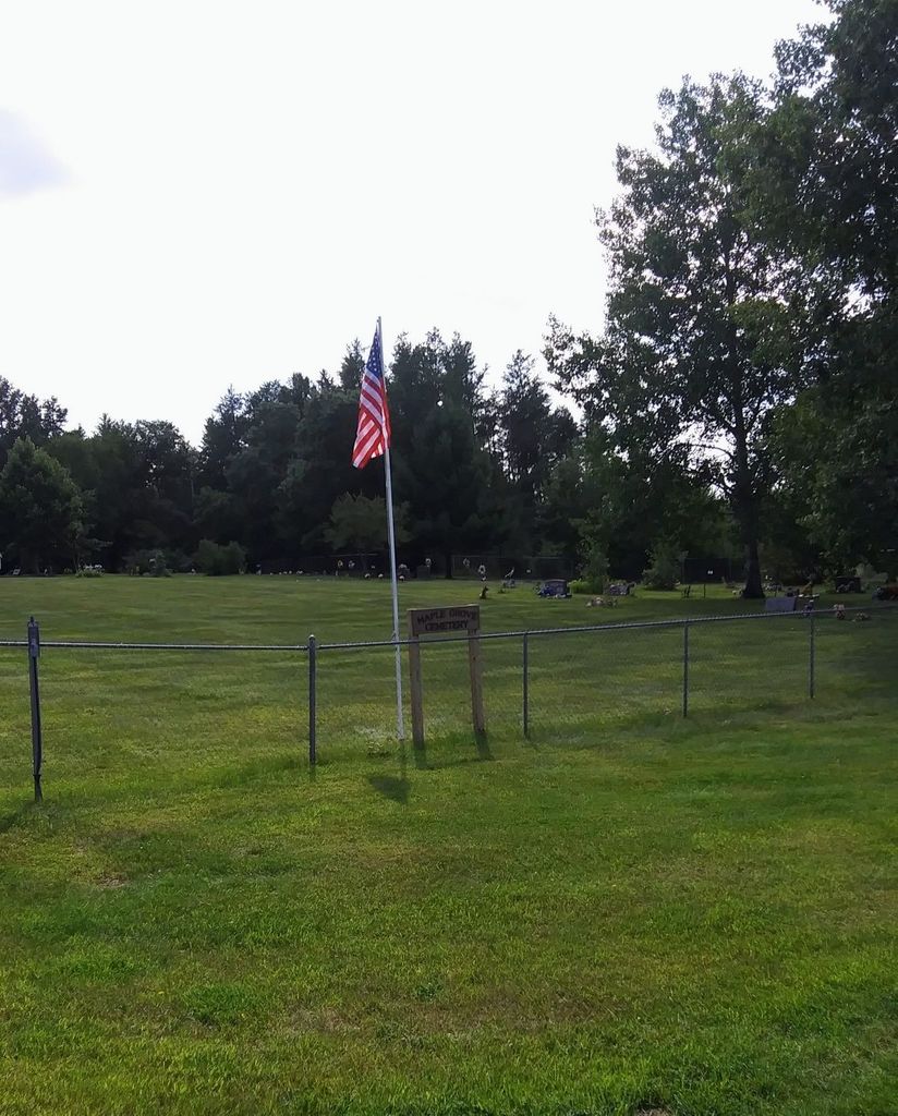
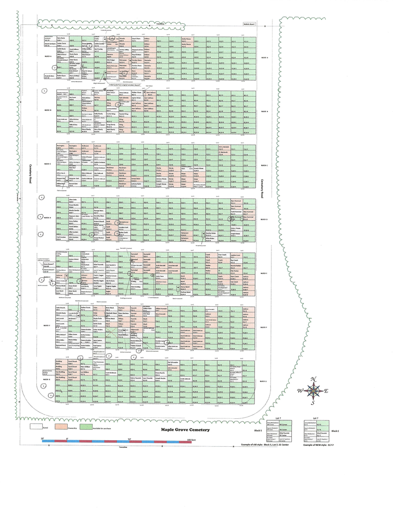
| Description | : | Maple Grove Cemetery is located in Crow Wing County Minnesota and is approximately 10 miles east of Brainerd near the junction of Co. Rd. 8 and Co. Rd. 24. Maple Grove Township owns and maintains the cemetery. The cemetery was established in 1928 and is open to residents and non-residents of Maple Grove Township. The cemetery is rectangular in shape and is neatly organized into Blocks, Lots and Plots/single grave. There are 7 Blocks within the cemetery and are labeled A through G. Each Block contains 16 Lots numbered 1 through 16 and each Lot contains 8 Plots/graves numbered 1 through 8. The Block... Read More |
frequently asked questions (FAQ):
-
Where is Maple Grove Cemetery?
Maple Grove Cemetery is located at Crow Wing County ,Minnesota ,USA.
-
Maple Grove Cemetery cemetery's updated grave count on graveviews.com?
0 memorials
-
Where are the coordinates of the Maple Grove Cemetery?
Latitude: 46.3297005
Longitude: -93.9993973

Nearby Cemetories:
1. Oak Grove Cemetery
Brainerd, Crow Wing County, USA
Coordinate: 46.3485985, -93.9856033
2. Vaale Cemetery
Brainerd, Crow Wing County, USA
Coordinate: 46.3224800, -94.0493950
3. Bethel Lutheran Cemetery
Crow Wing County, USA
Coordinate: 46.3147200, -94.0827800
4. Dykeman Union Cemetery
Crow Wing County, USA
Coordinate: 46.2792015, -93.9263992
5. Crosslake Lutheran Church Columbarium
Crosslake, Crow Wing County, USA
Coordinate: 46.4048300, -94.0650900
6. Hillside Cemetery
Long Lake Township, Crow Wing County, USA
Coordinate: 46.2577000, -94.1037000
7. Bay Lake Cemetery
Deerwood, Crow Wing County, USA
Coordinate: 46.4138000, -93.8730000
8. Garrison Cemetery
Garrison, Crow Wing County, USA
Coordinate: 46.3078000, -93.8264000
9. Woodland Cemetery
Ironton, Crow Wing County, USA
Coordinate: 46.4599991, -93.9880981
10. Evergreen Cemetery
Brainerd, Crow Wing County, USA
Coordinate: 46.3708000, -94.1859000
11. Lakewood Cemetery
Crosby, Crow Wing County, USA
Coordinate: 46.4625015, -93.9456024
12. Evergreen Memorial Gardens
Brainerd, Crow Wing County, USA
Coordinate: 46.4010010, -94.1740036
13. Saint Pauls Episcopal Church Columbarium
Brainerd, Crow Wing County, USA
Coordinate: 46.3604205, -94.1988906
14. Pine Tree Cemetery
Crow Wing County, USA
Coordinate: 46.2122000, -94.1214000
15. Deerwood Cemetery
Deerwood Township, Crow Wing County, USA
Coordinate: 46.4566994, -93.8839035
16. Salem Lutheran Columbarium
Deerwood, Crow Wing County, USA
Coordinate: 46.4750050, -93.9011460
17. Riverside Cemetery
Crow Wing County, USA
Coordinate: 46.2224998, -94.1893997
18. Bennettville Cemetery
Bennettville, Aitkin County, USA
Coordinate: 46.4025002, -93.7703018
19. Holy Family Cemetery
Pine Center, Crow Wing County, USA
Coordinate: 46.1741700, -93.8816500
20. Holy Family Catholic Church Cemetery
Hillman, Morrison County, USA
Coordinate: 46.1740870, -93.8813640
21. Baxter Cemetery
Baxter, Crow Wing County, USA
Coordinate: 46.3455600, -94.2855600
22. Evergreen Cemetery
Merrifield, Crow Wing County, USA
Coordinate: 46.5180500, -94.0917500
23. Dorris Cemetery
Aitkin County, USA
Coordinate: 46.4611092, -93.7766724
24. Saint Mathias Catholic Cemetery
Saint Mathias, Crow Wing County, USA
Coordinate: 46.2200000, -94.2517000