
| Memorials | : | 0 |
| Location | : | Brainerd, Crow Wing County, USA |
| Phone | : | (218) 829-3834 |
| Coordinate | : | 46.3604205, -94.1988906 |
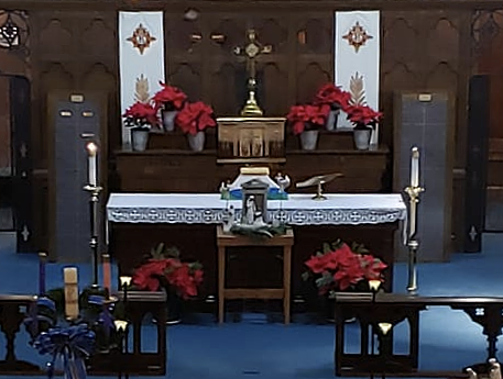
| Description | : | The columbarium of St. Paul's Episcopal church consists of niches located in the altar, itself, and in a nearby wall. |
frequently asked questions (FAQ):
-
Where is Saint Pauls Episcopal Church Columbarium?
Saint Pauls Episcopal Church Columbarium is located at 408 N 7th Street Brainerd, Crow Wing County ,Minnesota , 56401USA.
-
Saint Pauls Episcopal Church Columbarium cemetery's updated grave count on graveviews.com?
0 memorials
-
Where are the coordinates of the Saint Pauls Episcopal Church Columbarium?
Latitude: 46.3604205
Longitude: -94.1988906
Nearby Cemetories:
1. Evergreen Cemetery
Brainerd, Crow Wing County, USA
Coordinate: 46.3708000, -94.1859000
2. Evergreen Memorial Gardens
Brainerd, Crow Wing County, USA
Coordinate: 46.4010010, -94.1740036
3. Baxter Cemetery
Baxter, Crow Wing County, USA
Coordinate: 46.3455600, -94.2855600
4. Bethel Lutheran Cemetery
Crow Wing County, USA
Coordinate: 46.3147200, -94.0827800
5. Crosslake Lutheran Church Columbarium
Crosslake, Crow Wing County, USA
Coordinate: 46.4048300, -94.0650900
6. Vaale Cemetery
Brainerd, Crow Wing County, USA
Coordinate: 46.3224800, -94.0493950
7. Oak Land Cemetery
Crow Wing County, USA
Coordinate: 46.2722015, -94.3043976
8. Gull River Cemetery
Cass County, USA
Coordinate: 46.3356018, -94.3685989
9. Hillside Cemetery
Long Lake Township, Crow Wing County, USA
Coordinate: 46.2577000, -94.1037000
10. Saint John Holy Cross Cemetery
Brainerd, Crow Wing County, USA
Coordinate: 46.2790970, -94.3328890
11. Saint Francis Assisi Cemetery
Brainerd, Crow Wing County, USA
Coordinate: 46.2752980, -94.3352060
12. Saint Thomas of the Pines Cemetery
East Gull Lake, Cass County, USA
Coordinate: 46.3921300, -94.3809900
13. Lake Edward Cemetery
Crow Wing County, USA
Coordinate: 46.4981003, -94.2035980
14. Riverside Cemetery
Crow Wing County, USA
Coordinate: 46.2224998, -94.1893997
15. Maple Grove Cemetery
Crow Wing County, USA
Coordinate: 46.3297005, -93.9993973
16. Saint Mathias Catholic Cemetery
Saint Mathias, Crow Wing County, USA
Coordinate: 46.2200000, -94.2517000
17. Thorp-Heald Cemetery
Lake Hubert, Crow Wing County, USA
Coordinate: 46.5022000, -94.2537000
18. Pineswood Cemetery
Lake Hubert, Crow Wing County, USA
Coordinate: 46.4964400, -94.2820200
19. Oak Grove Cemetery
Brainerd, Crow Wing County, USA
Coordinate: 46.3485985, -93.9856033
20. Sylvan Cemetery
Sylvan, Cass County, USA
Coordinate: 46.3333300, -94.4113900
21. Lutheran Church of the Cross Memorial Garden
Nisswa, Crow Wing County, USA
Coordinate: 46.5011200, -94.2955600
22. Pine Tree Cemetery
Crow Wing County, USA
Coordinate: 46.2122000, -94.1214000
23. Dixon Cemetery
Fort Ripley, Crow Wing County, USA
Coordinate: 46.2154930, -94.3246630
24. Oak Hill Cemetery
Crow Wing County, USA
Coordinate: 46.2158012, -94.3285980