
| Memorials | : | 0 |
| Location | : | Brainerd, Crow Wing County, USA |
| Coordinate | : | 46.3224800, -94.0493950 |
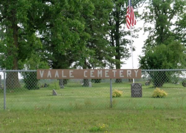
| Description | : | Vaale Cemetery is located southeast of Brainerd, on County Road 24, near Upper South Long Lake. A well, a new fence, tarred roads and a small storage building – a replica of the first church – have been added in recent years. The cemetery is over an acre in size, divided into four blocks with a total of 850 plots. |
frequently asked questions (FAQ):
-
Where is Vaale Cemetery?
Vaale Cemetery is located at Brainerd, Crow Wing County ,Minnesota ,USA.
-
Vaale Cemetery cemetery's updated grave count on graveviews.com?
0 memorials
-
Where are the coordinates of the Vaale Cemetery?
Latitude: 46.3224800
Longitude: -94.0493950
Nearby Cemetories:
1. Bethel Lutheran Cemetery
Crow Wing County, USA
Coordinate: 46.3147200, -94.0827800
2. Maple Grove Cemetery
Crow Wing County, USA
Coordinate: 46.3297005, -93.9993973
3. Oak Grove Cemetery
Brainerd, Crow Wing County, USA
Coordinate: 46.3485985, -93.9856033
4. Hillside Cemetery
Long Lake Township, Crow Wing County, USA
Coordinate: 46.2577000, -94.1037000
5. Crosslake Lutheran Church Columbarium
Crosslake, Crow Wing County, USA
Coordinate: 46.4048300, -94.0650900
6. Dykeman Union Cemetery
Crow Wing County, USA
Coordinate: 46.2792015, -93.9263992
7. Evergreen Cemetery
Brainerd, Crow Wing County, USA
Coordinate: 46.3708000, -94.1859000
8. Saint Pauls Episcopal Church Columbarium
Brainerd, Crow Wing County, USA
Coordinate: 46.3604205, -94.1988906
9. Evergreen Memorial Gardens
Brainerd, Crow Wing County, USA
Coordinate: 46.4010010, -94.1740036
10. Pine Tree Cemetery
Crow Wing County, USA
Coordinate: 46.2122000, -94.1214000
11. Riverside Cemetery
Crow Wing County, USA
Coordinate: 46.2224998, -94.1893997
12. Woodland Cemetery
Ironton, Crow Wing County, USA
Coordinate: 46.4599991, -93.9880981
13. Bay Lake Cemetery
Deerwood, Crow Wing County, USA
Coordinate: 46.4138000, -93.8730000
14. Garrison Cemetery
Garrison, Crow Wing County, USA
Coordinate: 46.3078000, -93.8264000
15. Lakewood Cemetery
Crosby, Crow Wing County, USA
Coordinate: 46.4625015, -93.9456024
16. Baxter Cemetery
Baxter, Crow Wing County, USA
Coordinate: 46.3455600, -94.2855600
17. Saint Mathias Catholic Cemetery
Saint Mathias, Crow Wing County, USA
Coordinate: 46.2200000, -94.2517000
18. Deerwood Cemetery
Deerwood Township, Crow Wing County, USA
Coordinate: 46.4566994, -93.8839035
19. Oak Land Cemetery
Crow Wing County, USA
Coordinate: 46.2722015, -94.3043976
20. Salem Lutheran Columbarium
Deerwood, Crow Wing County, USA
Coordinate: 46.4750050, -93.9011460
21. Holy Family Cemetery
Pine Center, Crow Wing County, USA
Coordinate: 46.1741700, -93.8816500
22. Holy Family Catholic Church Cemetery
Hillman, Morrison County, USA
Coordinate: 46.1740870, -93.8813640
23. Evergreen Cemetery
Merrifield, Crow Wing County, USA
Coordinate: 46.5180500, -94.0917500
24. Saint John Holy Cross Cemetery
Brainerd, Crow Wing County, USA
Coordinate: 46.2790970, -94.3328890