
| Memorials | : | 7 |
| Location | : | Oaktown, Knox County, USA |
| Coordinate | : | 38.8293991, -87.3758011 |
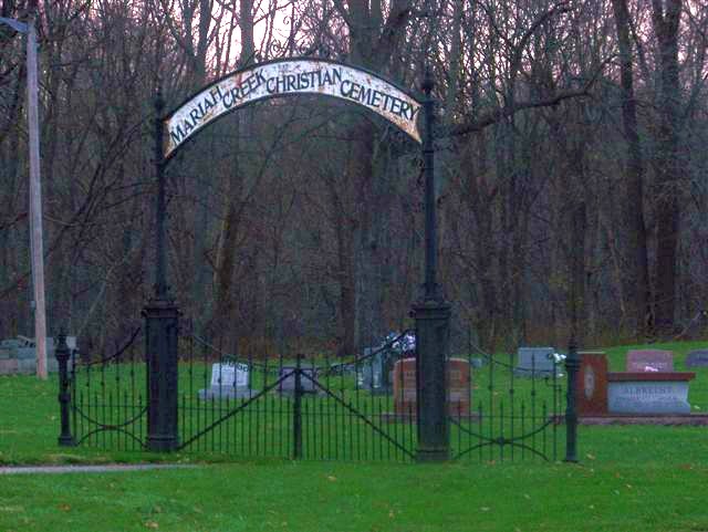
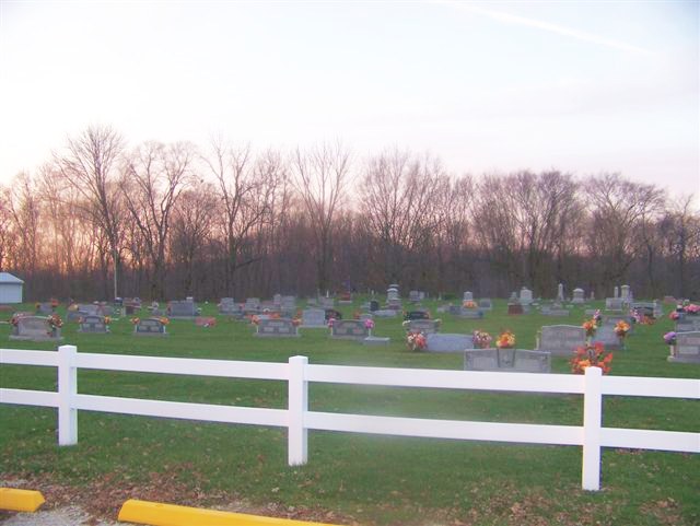
| Description | : | Mariah Creek Christian Church was originally part of Mariah Creek Baptist Church. They split in 1833 and Mariah Creek Christian Church was formed. Members met in each other's homes until 1837 when a log church was built with cemetery grounds nearby on the banks of Mariah Creek. A frame church was erected in 1852 when members needed more room to worship. The present day church, built in 1900, is the fourth on that spot...the second and third having burnt down. Many of the charter members of the church and their descendants rest in the cemetery. Names... Read More |
frequently asked questions (FAQ):
-
Where is Mariah Creek Christian Church Cemetery?
Mariah Creek Christian Church Cemetery is located at Oaktown, Knox County ,Indiana ,USA.
-
Mariah Creek Christian Church Cemetery cemetery's updated grave count on graveviews.com?
7 memorials
-
Where are the coordinates of the Mariah Creek Christian Church Cemetery?
Latitude: 38.8293991
Longitude: -87.3758011
Nearby Cemetories:
1. Martin-Thorne Cemetery
Knox County, USA
Coordinate: 38.8118000, -87.3834000
2. Mariah Creek Baptist Church Cemetery
Oaktown, Knox County, USA
Coordinate: 38.8518570, -87.3635040
3. Price Cemetery
Bruceville, Knox County, USA
Coordinate: 38.8075980, -87.3927690
4. Light Cemetery
Oaktown, Knox County, USA
Coordinate: 38.8512260, -87.3934880
5. Charley Cemetery
Knox County, USA
Coordinate: 38.8302994, -87.4107971
6. Chambers Cemetery
Knox County, USA
Coordinate: 38.8314018, -87.3405991
7. Walker Cemetery
Knox County, USA
Coordinate: 38.8600006, -87.3664017
8. Stanley Cemetery
Oaktown, Knox County, USA
Coordinate: 38.8462920, -87.4294310
9. Morris Chapel Cemetery
Knox County, USA
Coordinate: 38.8808937, -87.3774643
10. Ockiltree Cemetery
Busseron, Knox County, USA
Coordinate: 38.8235060, -87.4479850
11. John J. Stoelting Burial Site
Freelandville, Knox County, USA
Coordinate: 38.8588000, -87.3108000
12. Freelandville Christian Church Cemetery
Freelandville, Knox County, USA
Coordinate: 38.8679085, -87.3100815
13. Smith Family Cemetery
Widner Township, Knox County, USA
Coordinate: 38.8461900, -87.2933100
14. Oaktown Cemetery
Oaktown, Knox County, USA
Coordinate: 38.8693008, -87.4456406
15. Freelandville Memorial Cemetery
Freelandville, Knox County, USA
Coordinate: 38.8672829, -87.3027649
16. Bruceville Cemetery
Bruceville, Knox County, USA
Coordinate: 38.7658806, -87.4113998
17. John Schroeder Farm Cemetery
Freelandville, Knox County, USA
Coordinate: 38.8768520, -87.3080920
18. George Schmitt Family Cemetery
Knox County, USA
Coordinate: 38.8496510, -87.2875570
19. Old Bethel Evangelical Lutheran & Reformed Cemeter
Freelandville, Knox County, USA
Coordinate: 38.8585600, -87.2850300
20. Bethel Cemetery
Freelandville, Knox County, USA
Coordinate: 38.8633194, -87.2858734
21. Orndorff Cemetery
Oaktown, Knox County, USA
Coordinate: 38.8812120, -87.4521110
22. Threlkeld Cemetery
Bruceville, Knox County, USA
Coordinate: 38.7627510, -87.4498630
23. Asbury Chapel Cemetery
Ragsdale, Knox County, USA
Coordinate: 38.7463684, -87.3250961
24. Kruger Cemetery
Edwardsport, Knox County, USA
Coordinate: 38.8690000, -87.2683000