
| Memorials | : | 36 |
| Location | : | Marlboro, Stark County, USA |
| Coordinate | : | 40.9645025, -81.2145472 |
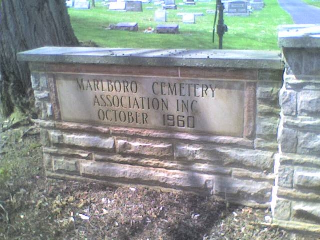
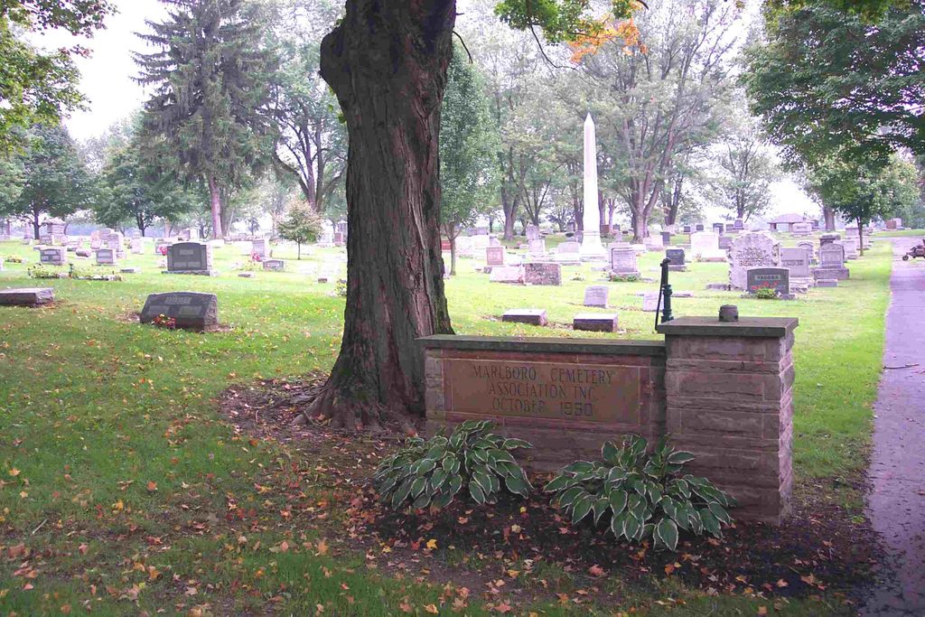
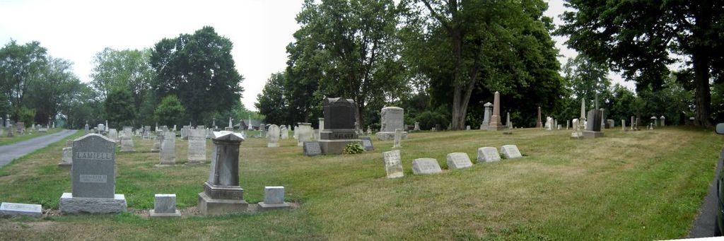
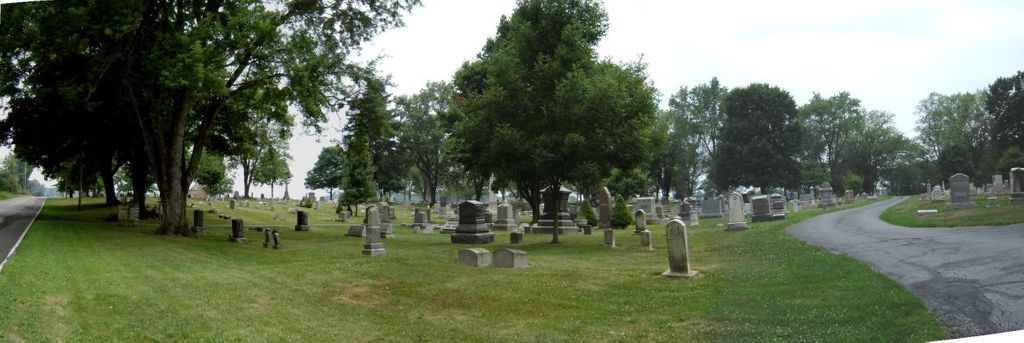
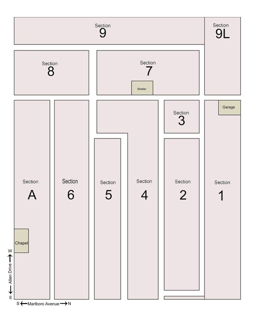
| Description | : | The cemetery is located on the northwest corner of the intersection of Allen Drive NE and Marlboro Avenue NE. The cemetery is located in Marlboro Township, Stark County, Ohio, and is # 11337 (Marlboro Cemetery) in “Ohio Cemeteries 1803-2003”, compiled by the Ohio Genealogical Society. The cemetery is registered with the Ohio Division of Real Estate and Professional Licensing (ODRE) as Marlboro Cemetery Association with registration license number CRC.2003010763. The U.S. Geological Survey (USGS) Geographic Names Information System (GNIS) feature ID for the cemetery is 1043001 (Marlboro Cemetery). |
frequently asked questions (FAQ):
-
Where is Marlboro Cemetery?
Marlboro Cemetery is located at 13171 – 13419 Marlboro Avenue NE Marlboro, Stark County ,Ohio , 44601USA.
-
Marlboro Cemetery cemetery's updated grave count on graveviews.com?
35 memorials
-
Where are the coordinates of the Marlboro Cemetery?
Latitude: 40.9645025
Longitude: -81.2145472
Nearby Cemetories:
1. Saint Pauls Reform Church Cemetery
Marlboro, Stark County, USA
Coordinate: 40.9796700, -81.2130800
2. Marlborough Quaker Burying Grounds
Alliance, Stark County, USA
Coordinate: 40.9507600, -81.2050000
3. New Baltimore Cemetery
Stark County, USA
Coordinate: 40.9832993, -81.2360992
4. Deer Creek Quaker Cemetery
Stark County, USA
Coordinate: 40.9881020, -81.1722570
5. Limaville Cemetery
Stark County, USA
Coordinate: 40.9799995, -81.1500015
6. Saint Peters Cemetery
Stark County, USA
Coordinate: 40.9225000, -81.2630600
7. Wood Family Cemetery
Lexington, Stark County, USA
Coordinate: 40.9524870, -81.1407710
8. Science Hill Cemetery
Alliance, Stark County, USA
Coordinate: 40.9213930, -81.1639020
9. French Baptist Church Cemetery
Harrisburg, Stark County, USA
Coordinate: 40.9082790, -81.2406660
10. Baptist Cemetery
Harrisburg, Stark County, USA
Coordinate: 40.8953640, -81.2296320
11. Dutch-Old German Church Cemetery
Atwater, Portage County, USA
Coordinate: 40.9886020, -81.1243970
12. Brumbaugh Cemetery
Hartville, Stark County, USA
Coordinate: 40.9752998, -81.3107986
13. Sacred Heart of Mary Cemetery
Harrisburg, Stark County, USA
Coordinate: 40.8913002, -81.2285995
14. Atwater Cemetery
Atwater, Portage County, USA
Coordinate: 41.0203030, -81.1481420
15. Ringer Cemetery
Nimishillen Township, Stark County, USA
Coordinate: 40.8916460, -81.2393030
16. Disciple Cemetery
Randolph, Portage County, USA
Coordinate: 41.0355988, -81.2489014
17. Lexington Quaker Cemetery
Lexington, Stark County, USA
Coordinate: 40.9617004, -81.1117020
18. German Reformed Cemetery
Randolph, Portage County, USA
Coordinate: 41.0316000, -81.2693500
19. Sand Hill Cemetery
Randolph, Portage County, USA
Coordinate: 41.0342610, -81.2686370
20. Hillside Cemetery
Randolph, Portage County, USA
Coordinate: 41.0348470, -81.2689910
21. Alliance City Cemetery
Alliance, Stark County, USA
Coordinate: 40.9309998, -81.1129990
22. Union Cemetery
Hartville, Stark County, USA
Coordinate: 40.9631004, -81.3281021
23. Hartville Lutheran Cemetery
Hartville, Stark County, USA
Coordinate: 40.9622910, -81.3286180
24. Saint Joseph Cemetery
Randolph, Portage County, USA
Coordinate: 41.0284240, -81.2961250