
| Memorials | : | 1 |
| Location | : | Parksplace, Panola County, USA |
| Coordinate | : | 34.5264282, -90.0444565 |
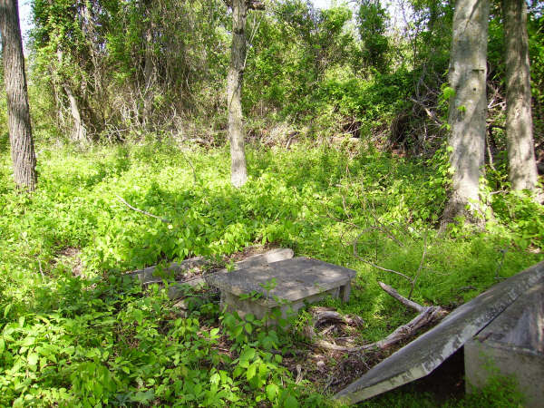
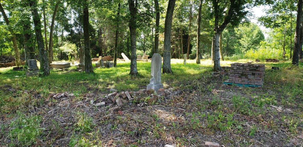
| Description | : | The old McGehee-White Family Cemetery is located about 6 miles West of Como on Harry Taylor Road. It is located in section 33, Township 6, Range 8 in Panola County, off the road, in the woods, on private property. |
frequently asked questions (FAQ):
-
Where is McGehee-White Cemetery?
McGehee-White Cemetery is located at Parksplace, Panola County ,Mississippi ,USA.
-
McGehee-White Cemetery cemetery's updated grave count on graveviews.com?
1 memorials
-
Where are the coordinates of the McGehee-White Cemetery?
Latitude: 34.5264282
Longitude: -90.0444565
Nearby Cemetories:
1. McGehees Chapel Cemetery
Longtown, Panola County, USA
Coordinate: 34.5003014, -90.0580978
2. Freeman Hewlett Porter Askew Dyson Cemetery
Como, Panola County, USA
Coordinate: 34.4960180, -90.0428180
3. Hammond Hill M. B. Church Cemetery
Como, Panola County, USA
Coordinate: 34.5542100, -90.0043340
4. Cedar Grove Cemetery
Como, Panola County, USA
Coordinate: 34.4771580, -90.0406110
5. Salem Cemetery
Senatobia, Tate County, USA
Coordinate: 34.5738980, -90.0655420
6. Abes Chapel Cemetery
Panola County, USA
Coordinate: 34.5396996, -89.9819031
7. New Salem Baptist Church Cemetery
Senatobia, Tate County, USA
Coordinate: 34.5823520, -90.0449430
8. Longtown Cemetery
Longtown, Panola County, USA
Coordinate: 34.5116997, -90.1181030
9. Askew Grove Cemetery
Crenshaw, Panola County, USA
Coordinate: 34.5184850, -90.1214850
10. Longtown Memorial Garden Cemetery
Panola County, USA
Coordinate: 34.5171650, -90.1215040
11. Braham Chapel CME Cemetery
Como, Panola County, USA
Coordinate: 34.4669000, -90.0743000
12. Mount Level Cemetery
Como, Panola County, USA
Coordinate: 34.4808006, -89.9860992
13. Como CME Cemetery
Como, Panola County, USA
Coordinate: 34.5119019, -89.9505997
14. Shady Grove Cemetery
Senatobia, Tate County, USA
Coordinate: 34.5822360, -89.9766410
15. Old Caroline Cemetery
Senatobia, Tate County, USA
Coordinate: 34.5792020, -89.9695500
16. Faith Chapel Holiness Church Cemetery
Senatobia, Tate County, USA
Coordinate: 34.5839510, -89.9669680
17. Paradise MB Church Cemetery
Senatobia, Tate County, USA
Coordinate: 34.6055820, -90.0034070
18. Oldham Cemetery
Panola County, USA
Coordinate: 34.5400009, -89.9400024
19. Harmony Cemetery
Strayhorn, Tate County, USA
Coordinate: 34.5801100, -90.1282630
20. Peach Creek Cemetery
Panola County, USA
Coordinate: 34.4389000, -90.0578003
21. Senatobia Memorial Cemetery
Senatobia, Tate County, USA
Coordinate: 34.5930610, -89.9672090
22. Harmonia Baptist Church Cemetery
Panola County, USA
Coordinate: 34.4340650, -90.0393460
23. Bucey-Matthews Cemetery
Senatobia, Tate County, USA
Coordinate: 34.6179000, -90.0681000
24. Featherston AME Chapel Cemetery
Senatobia, Tate County, USA
Coordinate: 34.6184400, -90.0653650