
| Memorials | : | 0 |
| Location | : | Senatobia, Tate County, USA |
| Coordinate | : | 34.5822360, -89.9766410 |
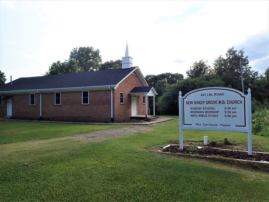
| Description | : | From the intersection of MS-740 & I-55, south of Senatobia, travel west on MS-740 for 1.2 mi.; turning south (left) onto US-51 N, going 0.3 mi., turning west onto L R L Rd., going 0.5 mi.; turning south (left) onto the driveway of the New Shady Grove MB Church & their 'deeded' cemetery to the south, as notated on USGS topo maps. |
frequently asked questions (FAQ):
-
Where is Shady Grove Cemetery?
Shady Grove Cemetery is located at 441 L R L Road Senatobia, Tate County ,Mississippi ,USA.
-
Shady Grove Cemetery cemetery's updated grave count on graveviews.com?
0 memorials
-
Where are the coordinates of the Shady Grove Cemetery?
Latitude: 34.5822360
Longitude: -89.9766410

Nearby Cemetories:
1. Old Caroline Cemetery
Senatobia, Tate County, USA
Coordinate: 34.5792020, -89.9695500
2. Faith Chapel Holiness Church Cemetery
Senatobia, Tate County, USA
Coordinate: 34.5839510, -89.9669680
3. Senatobia Memorial Cemetery
Senatobia, Tate County, USA
Coordinate: 34.5930610, -89.9672090
4. Bethesda Cemetery
Senatobia, Tate County, USA
Coordinate: 34.6116982, -89.9705963
5. Paradise MB Church Cemetery
Senatobia, Tate County, USA
Coordinate: 34.6055820, -90.0034070
6. Zion Hill Cemetery
Senatobia, Tate County, USA
Coordinate: 34.5844000, -89.9368973
7. Old County Poor House Cemetery
Senatobia, Tate County, USA
Coordinate: 34.6118590, -89.9941360
8. Hammond Hill M. B. Church Cemetery
Como, Panola County, USA
Coordinate: 34.5542100, -90.0043340
9. Abes Chapel Cemetery
Panola County, USA
Coordinate: 34.5396996, -89.9819031
10. Ebenezer Church Cemetery
Senatobia, Tate County, USA
Coordinate: 34.6257690, -90.0044860
11. Oldham Cemetery
Panola County, USA
Coordinate: 34.5400009, -89.9400024
12. Highway 51 Cemetery
Senatobia, Tate County, USA
Coordinate: 34.6346790, -89.9684220
13. Midway Cemetery
New Town, Tate County, USA
Coordinate: 34.6012500, -89.9138889
14. New Salem Baptist Church Cemetery
Senatobia, Tate County, USA
Coordinate: 34.5823520, -90.0449430
15. Macedonia Missionary Baptist Church Cemetery
Senatobia, Tate County, USA
Coordinate: 34.6116420, -89.9086090
16. Springfield M.B. Church Cemetery
Senatobia, Tate County, USA
Coordinate: 34.5675050, -89.8974980
17. Antioch M.B Church Cemetery #1
Coldwater, Tate County, USA
Coordinate: 34.6414140, -90.0212140
18. Como CME Cemetery
Como, Panola County, USA
Coordinate: 34.5119019, -89.9505997
19. Salem Cemetery
Senatobia, Tate County, USA
Coordinate: 34.5738980, -90.0655420
20. Hills Chapel Cemetery
Coldwater, Tate County, USA
Coordinate: 34.6551400, -90.0031600
21. Bowdre Cemetery
Senatobia, Tate County, USA
Coordinate: 34.6121280, -89.8901600
22. McGehee-White Cemetery
Parksplace, Panola County, USA
Coordinate: 34.5264282, -90.0444565
23. Diffee-Lowrie Cemetery
Senatobia, Tate County, USA
Coordinate: 34.5784350, -89.8808140
24. Cameron Road Jehovah Witness Cemetery
Coldwater, Tate County, USA
Coordinate: 34.6591845, -90.0048373