
| Memorials | : | 334 |
| Location | : | Raub, McLean County, USA |
| Coordinate | : | 47.7030900, -102.1339600 |
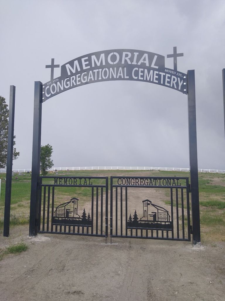
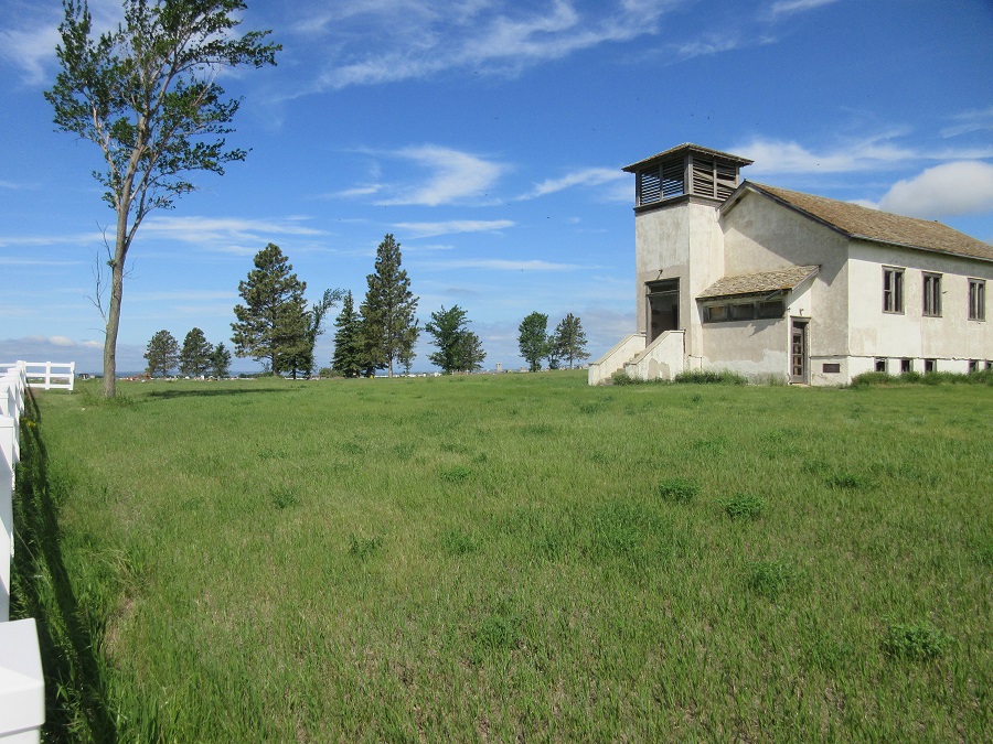
| Description | : | One on-line source states the church adjacent to this cemetery is now called Susan Webb Hall Memorial Congregational Church. It once served Elbowoods, North Dakota, a town now submerged by Lake Sakakawea. The cemetery is often listed as being in rural Parshall (Mountrail County). The Susan Webb Hall Memorial Congregational Church, adjacent to the cemetery, burned down in May 2019. |
frequently asked questions (FAQ):
-
Where is Memorial Congregational Church Cemetery?
Memorial Congregational Church Cemetery is located at 20th Street NW Raub, McLean County ,North Dakota , 58770USA.
-
Memorial Congregational Church Cemetery cemetery's updated grave count on graveviews.com?
332 memorials
-
Where are the coordinates of the Memorial Congregational Church Cemetery?
Latitude: 47.7030900
Longitude: -102.1339600
Nearby Cemetories:
1. Queen of Peace Cemetery
Raub, McLean County, USA
Coordinate: 47.7458000, -102.0532990
2. Bethesda Lutheran Church Cemetery
Raub, McLean County, USA
Coordinate: 47.7461800, -102.0486800
3. Immaculate Conception Cemetery
Raub, McLean County, USA
Coordinate: 47.6309540, -102.0590190
4. Church of God Cemetery
Raub, McLean County, USA
Coordinate: 47.8041344, -102.0656662
5. Crowsheart Cemetery
Dunn County, USA
Coordinate: 47.5797005, -102.2322006
6. Indian Scout Cemetery
McLean County, USA
Coordinate: 47.6472015, -101.9175034
7. Roseglen Baptist Cemetery
Roseglen, McLean County, USA
Coordinate: 47.7738991, -101.9246979
8. Lucky Mound Lutheran Cemetery
McLean County, USA
Coordinate: 47.8338990, -102.0010640
9. Bethlehem Lutheran Cemetery
Roseglen, McLean County, USA
Coordinate: 47.7602882, -101.9143037
10. Independence Congregational Church Cemetery
Dunn County, USA
Coordinate: 47.6944300, -102.3767700
11. Medicine Stone Cemetery
Mercer County, USA
Coordinate: 47.5367012, -102.1706009
12. Saint Josephs Catholic Cemetery
Twin Buttes, Dunn County, USA
Coordinate: 47.5420418, -102.2067841
13. Twin Buttes Congregational Cemetery
Twin Buttes, Dunn County, USA
Coordinate: 47.5378250, -102.2528820
14. Holen Cemetery
Mercer County, USA
Coordinate: 47.5149994, -102.1433029
15. Chase Cemetery
Mercer County, USA
Coordinate: 47.5074997, -102.1744003
16. Arickara Congregational Cemetery
McLean County, USA
Coordinate: 47.6596990, -101.8448640
17. Congregational Cemetery
Golden Valley, Mercer County, USA
Coordinate: 47.5016000, -102.0580600
18. Burr Family Cemetery
Halliday, Dunn County, USA
Coordinate: 47.5139320, -102.2801720
19. Immanuel Lutheran Cemetery
Roseglen, McLean County, USA
Coordinate: 47.7315070, -101.7976600
20. Beaver Creek Cemetery
Mercer County, USA
Coordinate: 47.5046900, -101.9553600
21. Parshall Cemetery
Parshall, Mountrail County, USA
Coordinate: 47.9357200, -102.1282000
22. Emrich Cemetery
Roseglen, McLean County, USA
Coordinate: 47.7947180, -101.8082670
23. Bureau of Catholic Indian Missions Cemetery
McLean County, USA
Coordinate: 47.5677460, -101.8410090
24. Saint Andrews Cemetery
McLean County, USA
Coordinate: 47.5483950, -101.8533860