
| Memorials | : | 37 |
| Location | : | Rexton, Kent County, Canada |
| Coordinate | : | 46.6042300, -64.9165060 |
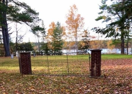
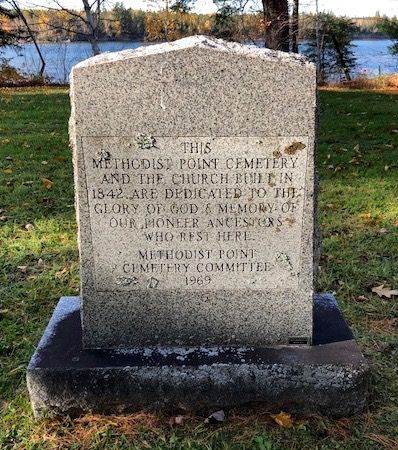
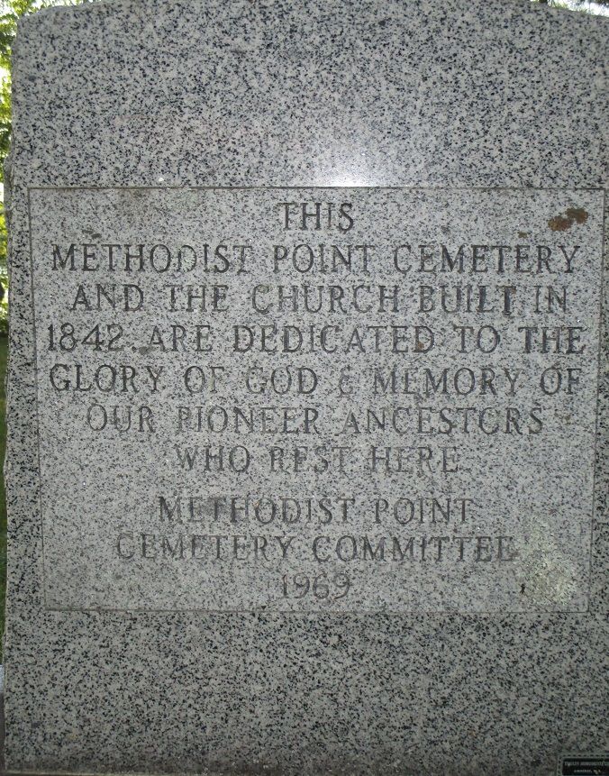
| Description | : | There was a church there now gone brothers Henry Warman and family buried on one side and Geroge Warman on the other. Other family and locals also buried some with no stones. |
frequently asked questions (FAQ):
-
Where is Methodist Point Cemetery?
Methodist Point Cemetery is located at Rexton, Kent County ,New Brunswick ,Canada.
-
Methodist Point Cemetery cemetery's updated grave count on graveviews.com?
37 memorials
-
Where are the coordinates of the Methodist Point Cemetery?
Latitude: 46.6042300
Longitude: -64.9165060
Nearby Cemetories:
1. Chapel Point Cemetery
Richibucto, Kent County, Canada
Coordinate: 46.5966300, -64.9202300
2. Galloway Cemetery
West Galloway, Kent County, Canada
Coordinate: 46.6124320, -64.8520750
3. Immaculate Conception Roman Catholic Cemetery
Rexton, Kent County, Canada
Coordinate: 46.6400100, -64.8712200
4. Saint Anne's Roman Catholic Cemetery
Big Cove, Kent County, Canada
Coordinate: 46.5854736, -64.9864107
5. Saint Andrew's United Church Cemetery
Rexton, Kent County, Canada
Coordinate: 46.6478700, -64.8724000
6. Kingdom Hall of Jehovah's Witnesses Cemetery
West Branch, Kent County, Canada
Coordinate: 46.5497546, -64.9345299
7. West Branch Presbyterian Cemetery
West Branch, Kent County, Canada
Coordinate: 46.5410340, -64.9480820
8. St. Charles Roman Catholic Cemetery
Saint-Charles, Kent County, Canada
Coordinate: 46.6689480, -64.9729100
9. Saint John's United Church Cemetery
West Branch, Kent County, Canada
Coordinate: 46.5339660, -64.9571180
10. Richibucto Protestant Cemetery
Richibucto, Kent County, Canada
Coordinate: 46.6730300, -64.8677700
11. Saint Louis de Gonzague
Richibucto, Kent County, Canada
Coordinate: 46.6882680, -64.8624160
12. Aldouane Roman Catholic Cemetery
Aldouane, Kent County, Canada
Coordinate: 46.7098670, -64.8985700
13. Saint Anne Roman Catholic Cemetery
Sainte-Anne-de-Kent, Kent County, Canada
Coordinate: 46.5509000, -64.7738340
14. St. Stephens United Church Cemetery
Molus River, Kent County, Canada
Coordinate: 46.5763290, -65.0817130
15. St. Bartholomew's Roman Catholic Cemetery
Molus River, Kent County, Canada
Coordinate: 46.5739550, -65.0830720
16. Saint Antoine de Padoue
Richibucto, Kent County, Canada
Coordinate: 46.6568030, -64.7537160
17. Saint-Louis-de-Kent Catholic Cemetery
Saint-Louis de Kent, Kent County, Canada
Coordinate: 46.7284860, -64.9799050
18. St. Mark's Presbyterian Cemetery
Bass River, Kent County, Canada
Coordinate: 46.5424130, -65.0894630
19. Saint Bartholomew Roman Catholic Cemetery
Bass River, Kent County, Canada
Coordinate: 46.5539410, -65.1073140
20. Saint-Norbert Parish Cemetery
Saint-Norbert, Kent County, Canada
Coordinate: 46.4662200, -64.9683100
21. Saint Paul’s Anglican Church Cemetery
Browns Yard, Kent County, Canada
Coordinate: 46.5211100, -65.0864800
22. Old MacIntosh Hill Burial Ground
Kent County, Canada
Coordinate: 46.5031240, -64.7459570
23. Fords Mills United Church Cemetery
Fords Mills, Kent County, Canada
Coordinate: 46.4873010, -65.0904990
24. St. James Presbyterian Church Cemetery
Beersville, Kent County, Canada
Coordinate: 46.4601550, -65.0827550