
| Memorials | : | 556 |
| Location | : | West Branch, Kent County, Canada |
| Coordinate | : | 46.5410340, -64.9480820 |
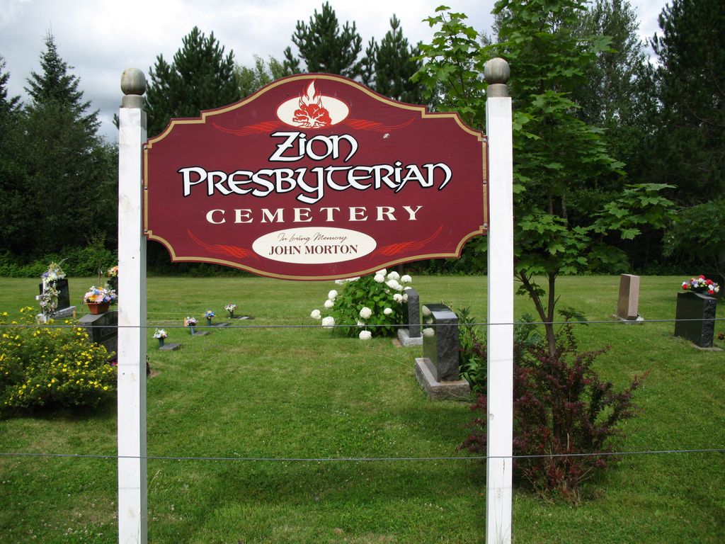
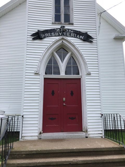
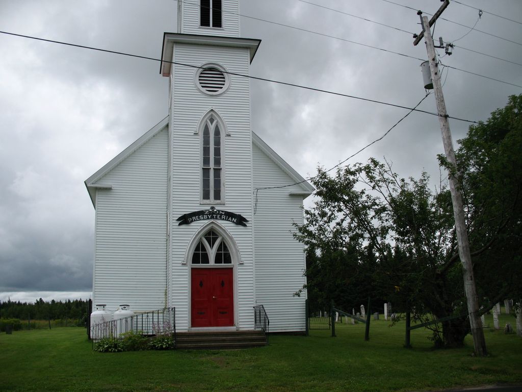
| Description | : | The West Branch Presbyterian Cemetery stands beside Knox (now Zion) Presbyterian Church in West Branch, Weldford Parish, Kent County, NB, Canada. There is also an annex located across the road, which contains approximately 60 of the newest stones. The older part, which surrounds the church on three sides, contains 228 stones, dating back to the 1840's. Many of the older stones belong to Scottish Immigrants who came to Kent county in the 1820's and 1830's. |
frequently asked questions (FAQ):
-
Where is West Branch Presbyterian Cemetery?
West Branch Presbyterian Cemetery is located at West Branch, Kent County ,New Brunswick ,Canada.
-
West Branch Presbyterian Cemetery cemetery's updated grave count on graveviews.com?
35 memorials
-
Where are the coordinates of the West Branch Presbyterian Cemetery?
Latitude: 46.5410340
Longitude: -64.9480820
Nearby Cemetories:
1. Saint John's United Church Cemetery
West Branch, Kent County, Canada
Coordinate: 46.5339660, -64.9571180
2. Kingdom Hall of Jehovah's Witnesses Cemetery
West Branch, Kent County, Canada
Coordinate: 46.5497546, -64.9345299
3. Saint Anne's Roman Catholic Cemetery
Big Cove, Kent County, Canada
Coordinate: 46.5854736, -64.9864107
4. Chapel Point Cemetery
Richibucto, Kent County, Canada
Coordinate: 46.5966300, -64.9202300
5. Methodist Point Cemetery
Rexton, Kent County, Canada
Coordinate: 46.6042300, -64.9165060
6. Saint-Norbert Parish Cemetery
Saint-Norbert, Kent County, Canada
Coordinate: 46.4662200, -64.9683100
7. Galloway Cemetery
West Galloway, Kent County, Canada
Coordinate: 46.6124320, -64.8520750
8. St. Mark's Presbyterian Cemetery
Bass River, Kent County, Canada
Coordinate: 46.5424130, -65.0894630
9. Saint Paul’s Anglican Church Cemetery
Browns Yard, Kent County, Canada
Coordinate: 46.5211100, -65.0864800
10. St. Stephens United Church Cemetery
Molus River, Kent County, Canada
Coordinate: 46.5763290, -65.0817130
11. St. Bartholomew's Roman Catholic Cemetery
Molus River, Kent County, Canada
Coordinate: 46.5739550, -65.0830720
12. Saint Bartholomew Roman Catholic Cemetery
Bass River, Kent County, Canada
Coordinate: 46.5539410, -65.1073140
13. Fords Mills United Church Cemetery
Fords Mills, Kent County, Canada
Coordinate: 46.4873010, -65.0904990
14. Immaculate Conception Roman Catholic Cemetery
Rexton, Kent County, Canada
Coordinate: 46.6400100, -64.8712200
15. Saint Andrew's United Church Cemetery
Rexton, Kent County, Canada
Coordinate: 46.6478700, -64.8724000
16. Saint Anne Roman Catholic Cemetery
Sainte-Anne-de-Kent, Kent County, Canada
Coordinate: 46.5509000, -64.7738340
17. St. James Presbyterian Church Cemetery
Beersville, Kent County, Canada
Coordinate: 46.4601550, -65.0827550
18. St. Charles Roman Catholic Cemetery
Saint-Charles, Kent County, Canada
Coordinate: 46.6689480, -64.9729100
19. United-Methodist Church Cemetery
Beersville, Kent County, Canada
Coordinate: 46.4319880, -65.0778700
20. Richibucto Protestant Cemetery
Richibucto, Kent County, Canada
Coordinate: 46.6730300, -64.8677700
21. Old MacIntosh Hill Burial Ground
Kent County, Canada
Coordinate: 46.5031240, -64.7459570
22. Sainte-Marie-de-Kent Cemetery
Sainte-Marie-de-Kent, Kent County, Canada
Coordinate: 46.4147570, -64.8287280
23. Saint Louis de Gonzague
Richibucto, Kent County, Canada
Coordinate: 46.6882680, -64.8624160
24. Aldouane Roman Catholic Cemetery
Aldouane, Kent County, Canada
Coordinate: 46.7098670, -64.8985700