
| Memorials | : | 18 |
| Location | : | Gilmer County, USA |
| Coordinate | : | 38.9157200, -80.6316400 |
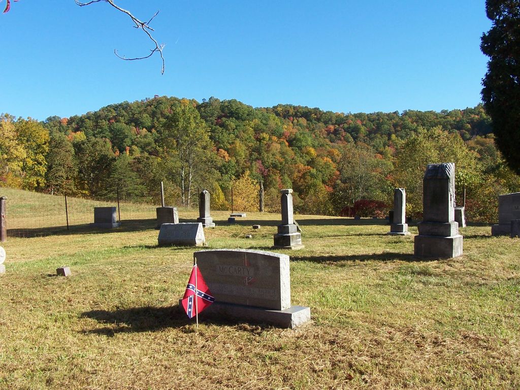
| Description | : | Cemetery started by Solomon Mick. On a hill, north side of Rocky Fork Road, about 200 yards East of the Rocky Fork Methodist Church to the named entrance gate to road leading up hill to cemetery. |
frequently asked questions (FAQ):
-
Where is Mick Cemetery?
Mick Cemetery is located at Rocky Fork Gilmer County ,West Virginia ,USA.
-
Mick Cemetery cemetery's updated grave count on graveviews.com?
18 memorials
-
Where are the coordinates of the Mick Cemetery?
Latitude: 38.9157200
Longitude: -80.6316400
Nearby Cemetories:
1. Pumphrey Cemetery
Orlando, Lewis County, USA
Coordinate: 38.9275880, -80.6216500
2. Heater Cemetery
Burnsville, Braxton County, USA
Coordinate: 38.9024560, -80.6100370
3. Tumbling Cemetery
Gilmer County, USA
Coordinate: 38.9085999, -80.6594009
4. Tomblin Cemetery
Blackburn, Gilmer County, USA
Coordinate: 38.9076650, -80.6597330
5. Finster Chapel Cemetery
Peterson, Lewis County, USA
Coordinate: 38.9300003, -80.5999985
6. Blackburn Cemetery
Blackburn, Gilmer County, USA
Coordinate: 38.9235700, -80.6743200
7. Queen Family Cemetery
Copley, Lewis County, USA
Coordinate: 38.9499000, -80.6130000
8. Barrett Cemetery
Burnsville, Braxton County, USA
Coordinate: 38.8778000, -80.6528015
9. Canfield Cemetery
Gilmer, Gilmer County, USA
Coordinate: 38.9071999, -80.6900024
10. Locust Knob Cemetery
Stouts Mills, Gilmer County, USA
Coordinate: 38.8990000, -80.6880000
11. Boilon Cemetery
Gilmer County, USA
Coordinate: 38.9519005, -80.6718979
12. Schoonover-Dawson Cemetery
Donlan, Gilmer County, USA
Coordinate: 38.9461770, -80.6854790
13. Snyder Cemetery
Gilmer County, USA
Coordinate: 38.9006004, -80.6964035
14. Montgomery Cemetery
Bealls Mills, Lewis County, USA
Coordinate: 38.9648890, -80.6035400
15. Rogers Cemetery
Gilmer County, USA
Coordinate: 38.9406013, -80.6936035
16. Hoover Cemetery
Burnsville, Braxton County, USA
Coordinate: 38.8619600, -80.6644170
17. Saint Bridget's Church Cemetery
Weston, Lewis County, USA
Coordinate: 38.9319400, -80.5572970
18. Feeney Cemetery
Braxton County, USA
Coordinate: 38.8542309, -80.6482196
19. Dyer Cemetery
Gilmer County, USA
Coordinate: 38.9319000, -80.7110977
20. Unity Memorial Garden
Eastover, Richland County, USA
Coordinate: 38.8840220, -80.7040760
21. Knights of Pythias Cemetery
Burnsville, Braxton County, USA
Coordinate: 38.8560780, -80.6668700
22. Keith Cemetery
Gilmer County, USA
Coordinate: 38.9561005, -80.6986008
23. McHenry Cemetery
Gilmer County, USA
Coordinate: 38.9341870, -80.7130200
24. Quickle Cemetery
Burnsville, Braxton County, USA
Coordinate: 38.8482000, -80.6197000