
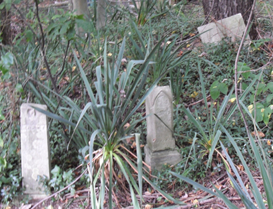
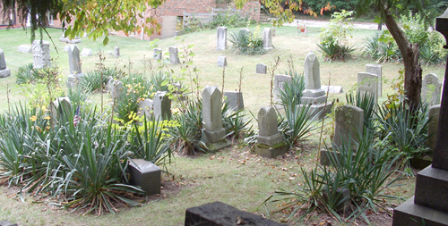
| Memorials | : | 10 |
| Location | : | Millheim, Summit County, USA |
| Coordinate | : | 41.0018005, -81.4345016 |
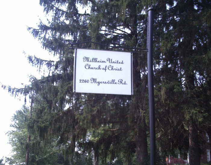
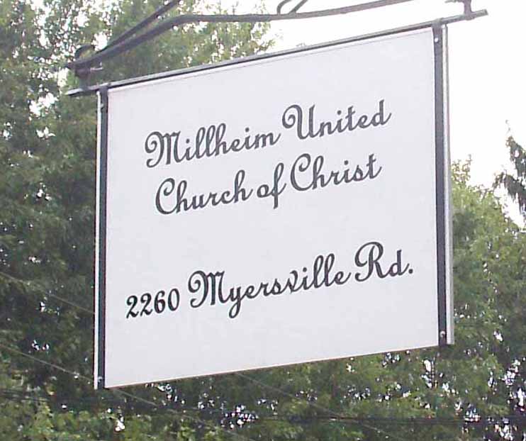
| Description | : | Located on the west Side of Myersville Road, south of Hayne Road, north of Rolling Meadows Lane. The cemetery is located in Springfield Township, Summit County, Ohio, and is # 11559 (Millheim Cemetery / Milheim Cemetery) in “Ohio Cemeteries 1803-2003”, compiled by the Ohio Genealogical Society. The U.S. Geological Survey (USGS) Geographic Names Information System (GNIS) feature ID for the cemetery is 1945612 (Milheim Cemetery). |
frequently asked questions (FAQ):
-
Where is Milheim Cemetery?
Milheim Cemetery is located at 2260 Myersville Road (County Road 180) Millheim, Summit County ,Ohio , 44312USA.
-
Milheim Cemetery cemetery's updated grave count on graveviews.com?
7 memorials
-
Where are the coordinates of the Milheim Cemetery?
Latitude: 41.0018005
Longitude: -81.4345016
Nearby Cemetories:
1. Edwin Shaw Sanitarium Cemetery
South Akron, Summit County, USA
Coordinate: 41.0162010, -81.4332962
2. Slovak Evangelical Cemetery
Krumroy, Summit County, USA
Coordinate: 41.0131989, -81.4675980
3. Greenlawn Cemetery
Uniontown, Stark County, USA
Coordinate: 40.9782982, -81.4103012
4. Tison Road Cemetery
Akron, Summit County, USA
Coordinate: 40.9995003, -81.3936996
5. Old Lutheran Cemetery
Uniontown, Stark County, USA
Coordinate: 40.9772290, -81.4081710
6. Grace Cathedral Cemetery
Akron, Summit County, USA
Coordinate: 41.0361958, -81.4297615
7. Woods Cemetery
Uniontown, Stark County, USA
Coordinate: 40.9757996, -81.4008026
8. Hillside Memorial Park
Akron, Summit County, USA
Coordinate: 41.0387001, -81.4255981
9. Ellet Cemetery
Akron, Summit County, USA
Coordinate: 41.0452995, -81.4360962
10. Pleasant Valley Cemetery
Akron, Summit County, USA
Coordinate: 41.0065002, -81.4931030
11. Kent Corners Cemetery
Suffield, Portage County, USA
Coordinate: 41.0250000, -81.3831000
12. Maple Hill Cemetery
Akron, Summit County, USA
Coordinate: 41.0416527, -81.4056473
13. Memory Lane Cemetery
Ellet, Summit County, USA
Coordinate: 41.0495140, -81.4416990
14. East Liberty Cemetery
Green, Summit County, USA
Coordinate: 40.9743004, -81.4962997
15. Old Springfield Cemetery
Akron, Summit County, USA
Coordinate: 41.0501780, -81.4722920
16. Greenwood Cemetery
Mogadore, Summit County, USA
Coordinate: 41.0518990, -81.3983002
17. Ahavas Zedek Cemetery
Akron, Summit County, USA
Coordinate: 41.0199880, -81.5133590
18. Walnut Grove Cemetery
Uniontown, Stark County, USA
Coordinate: 40.9682000, -81.3648100
19. Farband and Workmens Circle Cemetery
Akron, Summit County, USA
Coordinate: 41.0203840, -81.5146590
20. Anshe Sfard Cemetery
Akron, Summit County, USA
Coordinate: 41.0208570, -81.5153790
21. Boosinger Cemetery
Tallmadge, Summit County, USA
Coordinate: 41.0677700, -81.4250000
22. Saint Michaels Cemetery
Portage County, USA
Coordinate: 41.0518990, -81.3739014
23. East-Lawn Cemetery
Suffield, Portage County, USA
Coordinate: 41.0234200, -81.3453400
24. Watson Park Vietnam Memory Garden
Akron, Summit County, USA
Coordinate: 41.0695100, -81.4627300