
| Memorials | : | 1 |
| Location | : | Henderson County, USA |
| Coordinate | : | 35.3863860, -82.3652670 |
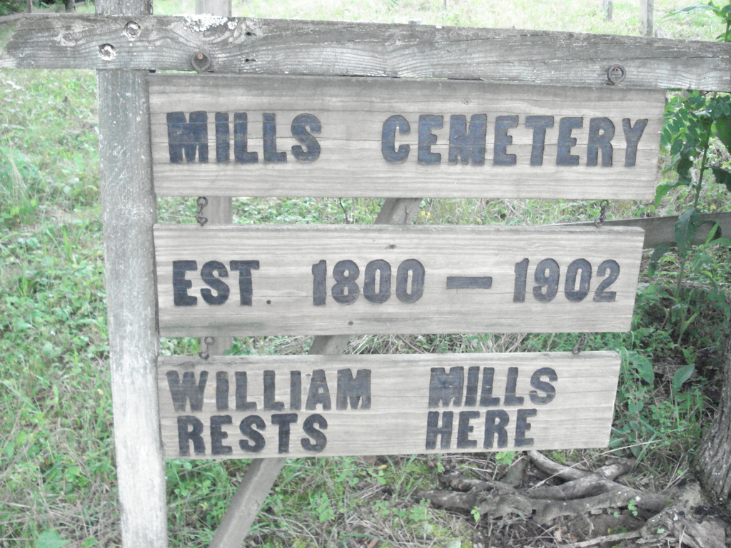
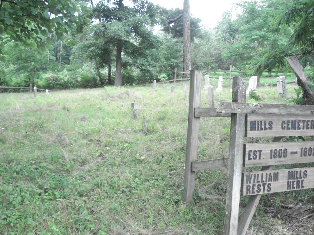
| Description | : | Mills Cemetery is the location of the graves of Maj. William Mills and Eleanor Morris Mills, each of whom lived into their 80's. Major William Mills is believed to have been the first white settler to move his family into the area that is now Henderson County, North Carolina. He was of English descent and remained loyal to the Crown during the Revolutionary War. He was wounded at the Battle of Kings Mountain on October 7, 1780, and avoided capture by the Patriots by pretending to be dead. He escaped to Sugar Loaf Mountain where he hid out... Read More |
frequently asked questions (FAQ):
-
Where is Mills Cemetery?
Mills Cemetery is located at 1528 S Mills Gap Rd, Henersonville, NC Henderson County ,North Carolina , 28792USA.
-
Mills Cemetery cemetery's updated grave count on graveviews.com?
1 memorials
-
Where are the coordinates of the Mills Cemetery?
Latitude: 35.3863860
Longitude: -82.3652670
Nearby Cemetories:
1. Asa Edney Family Cemetery
Edneyville, Henderson County, USA
Coordinate: 35.3928300, -82.3708000
2. Edney-Coston Cemetery
Edneyville, Henderson County, USA
Coordinate: 35.3895250, -82.3550190
3. Kings Grove Church Cemetery
Henderson County, USA
Coordinate: 35.3716740, -82.3685470
4. Edneyville United Methodist Church Cemetery
Edneyville, Henderson County, USA
Coordinate: 35.4043999, -82.3550034
5. Mount Moriah Baptist Church Cemetery
Edneyville, Henderson County, USA
Coordinate: 35.3911580, -82.3324770
6. Byers Family Cemetery
Edneyville, Henderson County, USA
Coordinate: 35.3810500, -82.3298310
7. Lanning-Pittillo Cemetery
Henderson County, USA
Coordinate: 35.3939018, -82.4002991
8. Fruitland Cemetery
Henderson County, USA
Coordinate: 35.3833008, -82.4019012
9. Rhodes-Lyda Family Cemetery
Edneyville, Henderson County, USA
Coordinate: 35.4135900, -82.3491700
10. Jones Cemetery at Sugarloaf
Henderson County, USA
Coordinate: 35.3669014, -82.3321991
11. Saint Paul Cemetery
Edneyville, Henderson County, USA
Coordinate: 35.4133210, -82.3366600
12. John Jackson Family Cemetery
Edneyville, Henderson County, USA
Coordinate: 35.3801861, -82.3202583
13. Union Hill Holiness Baptist Church Cemetery
Hendersonville, Henderson County, USA
Coordinate: 35.3522000, -82.3395000
14. Liberty Baptist Church Cemetery
Henderson County, USA
Coordinate: 35.4266700, -82.3563300
15. Hill Family Cemetery
Dana, Henderson County, USA
Coordinate: 35.3416300, -82.3652940
16. Hill Cemetery
Edneyville, Henderson County, USA
Coordinate: 35.4081750, -82.3169610
17. Indian Jack Cemetery
Edneyville, Henderson County, USA
Coordinate: 35.3762500, -82.3095556
18. Drake Cemetery
Fruitland, Henderson County, USA
Coordinate: 35.4301390, -82.3851940
19. Dana Baptist Church Cemetery
Dana, Henderson County, USA
Coordinate: 35.3395300, -82.3729300
20. Dana United Methodist Church Cemetery
Dana, Henderson County, USA
Coordinate: 35.3367271, -82.3744049
21. Stepp Round Hill Cemetery
Hendersonville, Henderson County, USA
Coordinate: 35.3367483, -82.3464429
22. Basiewicz Family Cemetery
Dana, Henderson County, USA
Coordinate: 35.3343700, -82.3603700
23. Stepp Cemetery
Hendersonville, Henderson County, USA
Coordinate: 35.3365000, -82.3464000
24. Love Cemetery
Henderson County, USA
Coordinate: 35.3731003, -82.4289017