
| Memorials | : | 0 |
| Location | : | Franklin County, USA |
| Coordinate | : | 35.6409900, -93.8676100 |
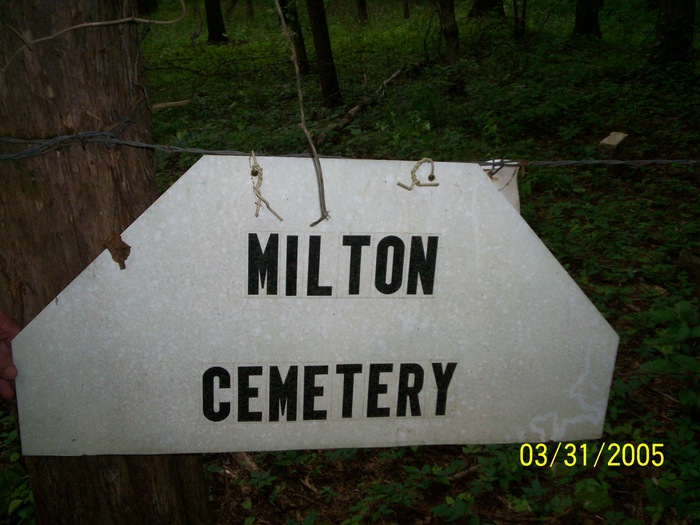
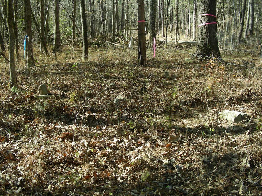
| Description | : | rom Ozark, Arkansas, take Highway 23 North to Turner’s Bend; continue on Highway 23 for ½ mile past Turner’s Bend. Turn left onto Forest Service Road #1501 (Jethro Road) and go 3 ½ miles Turn left (south) on Forest Service Road #1501D (Big Foot Road) and go 1/10th of a mile. The cemetery is located about 100 feet from the roadway on the left side of the road. All of the grave markers are low to the ground so the cemetery is difficult to see. Located in the Northeast Quarter of Section 9, Township 11... Read More |
frequently asked questions (FAQ):
-
Where is Milton Cemetery?
Milton Cemetery is located at Franklin County ,Arkansas ,USA.
-
Milton Cemetery cemetery's updated grave count on graveviews.com?
0 memorials
-
Where are the coordinates of the Milton Cemetery?
Latitude: 35.6409900
Longitude: -93.8676100
Nearby Cemetories:
1. Anton Peter Anderson Cemetery
White Oak, Franklin County, USA
Coordinate: 35.6178900, -93.8694300
2. Childers Cemetery
Franklin County, USA
Coordinate: 35.6347008, -93.8339005
3. Oak Ridge Cemetery
Ozark, Franklin County, USA
Coordinate: 35.6116982, -93.8927994
4. Turner Bend Cemetery
Cass, Franklin County, USA
Coordinate: 35.6613998, -93.8283005
5. Campbell Cemetery
Jethro, Franklin County, USA
Coordinate: 35.6244011, -93.9100037
6. McLaughlin Cemetery
Franklin County, USA
Coordinate: 35.6021996, -93.8741989
7. Plymale - Barnes Cemetery
Franklin County, USA
Coordinate: 35.6381980, -93.8190220
8. Plymale Cemetery
Franklin County, USA
Coordinate: 35.6391983, -93.8178024
9. Elias Turner Cemetery
Cass, Franklin County, USA
Coordinate: 35.6733017, -93.8356018
10. McIroy Cemetery
Franklin County, USA
Coordinate: 35.6805992, -93.8274994
11. Morgan Cemetery
Franklin County, USA
Coordinate: 35.6617012, -93.8097000
12. James Cemetery
Watalula, Franklin County, USA
Coordinate: 35.5983090, -93.8268967
13. Harris Cemetery
Franklin County, USA
Coordinate: 35.5946999, -93.8311005
14. West View Cemetery
Mountain Top, Franklin County, USA
Coordinate: 35.6007996, -93.8082962
15. Shores Cemetery
Cass, Franklin County, USA
Coordinate: 35.6399994, -93.9569016
16. Welton Cemetery
Ozark, Franklin County, USA
Coordinate: 35.6814630, -93.7881090
17. Handchew Cemetery
Franklin County, USA
Coordinate: 35.6021996, -93.7855988
18. Duncan Cemetery
Ozark, Franklin County, USA
Coordinate: 35.5588989, -93.8503036
19. Richard W. Dick Hill Cemetery
Franklin County, USA
Coordinate: 35.6782990, -93.7742004
20. Belt Cemetery
Ozark, Franklin County, USA
Coordinate: 35.5669370, -93.8097460
21. Phillips Cemetery
Franklin County, USA
Coordinate: 35.7281900, -93.8862500
22. McAnally Cemetery
Ozark, Franklin County, USA
Coordinate: 35.5578003, -93.8210983
23. Lessley Cemetery
Cravens, Franklin County, USA
Coordinate: 35.5575790, -93.9138030
24. Threadgill Cemetery
Franklin County, USA
Coordinate: 35.5527992, -93.8985977