
| Memorials | : | 0 |
| Location | : | Asheboro, Randolph County, USA |
| Coordinate | : | 35.6233300, -79.7910600 |
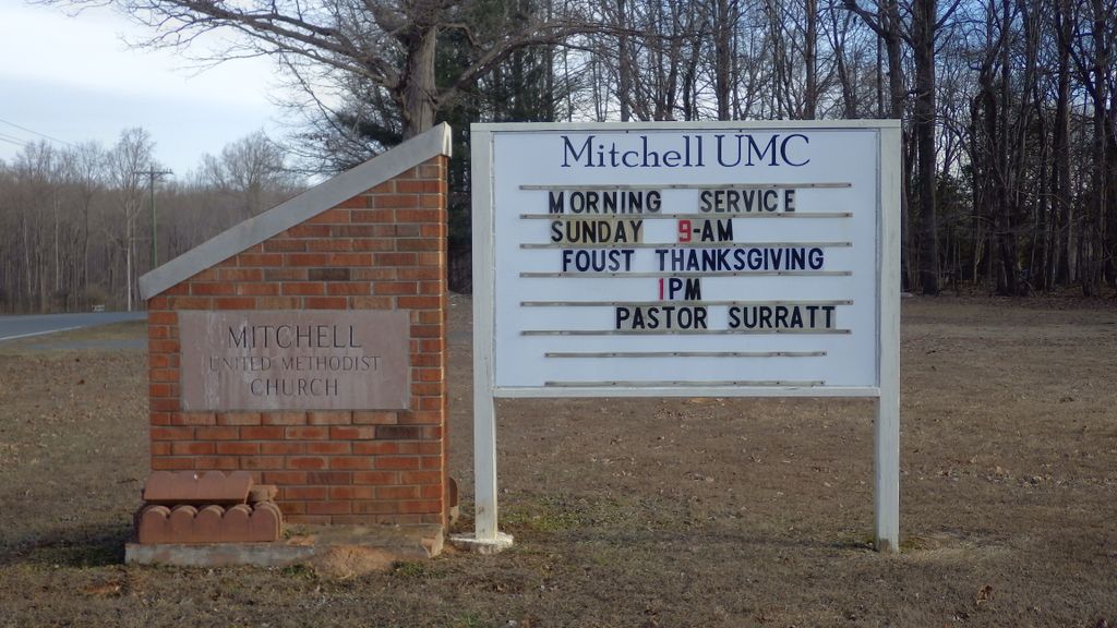
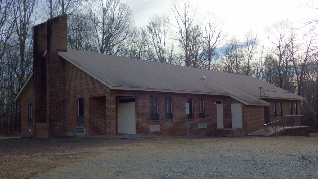
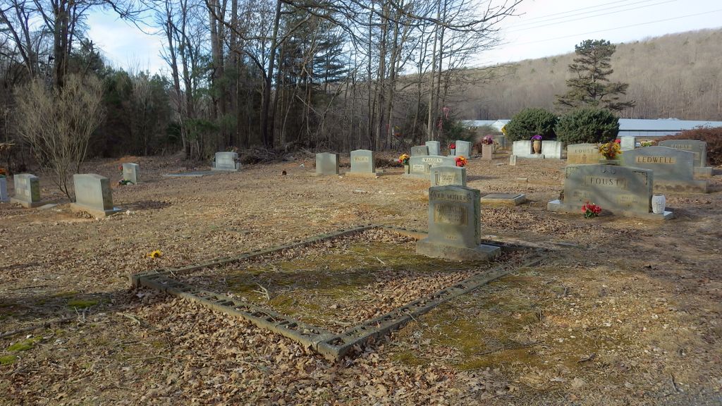
| Description | : | The Mitchell UMC has two cemetery locations, this is the first location used by the church. The cemetery sets in front of the church which is located on Zoo Parkway at the intersection of Ledwell Rd just south of the North Carolina Zoo. |
frequently asked questions (FAQ):
-
Where is Mitchell United Methodist Church Cemetery #1?
Mitchell United Methodist Church Cemetery #1 is located at 4899 Zoo Parkway Asheboro, Randolph County ,North Carolina , 27205USA.
-
Mitchell United Methodist Church Cemetery #1 cemetery's updated grave count on graveviews.com?
0 memorials
-
Where are the coordinates of the Mitchell United Methodist Church Cemetery #1?
Latitude: 35.6233300
Longitude: -79.7910600
Nearby Cemetories:
1. Mitchell United Methodist Church Cemetery #2
Asheboro, Randolph County, USA
Coordinate: 35.6221700, -79.7929700
2. Flag Springs United Methodist Church Cemetery
Asheboro, Randolph County, USA
Coordinate: 35.6102860, -79.8068910
3. Russells Grove Baptist Church Cemetery
Asheboro, Randolph County, USA
Coordinate: 35.6304300, -79.8266700
4. Antioch Missionary Baptist Church Cemetery
Asheboro, Randolph County, USA
Coordinate: 35.6014220, -79.8159830
5. New Hope Memorial Gardens
Asheboro, Randolph County, USA
Coordinate: 35.5975400, -79.8155130
6. Panther Creek Baptist Church Cemetery
Asheboro, Randolph County, USA
Coordinate: 35.6176300, -79.7437820
7. Grace Baptist Temple Cemetery
Asheboro, Randolph County, USA
Coordinate: 35.5843810, -79.8023330
8. Richland Baptist Church Cemetery
Asheboro, Randolph County, USA
Coordinate: 35.6543740, -79.7559120
9. Old New Hope Cemetery
Union Township, Randolph County, USA
Coordinate: 35.5842500, -79.8230000
10. Huldah Baptist Church Cemetery
Asheboro, Randolph County, USA
Coordinate: 35.5779360, -79.7753080
11. New Hope United Methodist Church Cemetery
Asheboro, Randolph County, USA
Coordinate: 35.5804900, -79.8197100
12. Browers Chapel UMC Cemetery
Asheboro, Randolph County, USA
Coordinate: 35.6747290, -79.7854000
13. Bethel Friends Cemetery
Asheboro, Randolph County, USA
Coordinate: 35.6645700, -79.7391200
14. Victory Baptist Church Cemetery
Asheboro, Randolph County, USA
Coordinate: 35.5604090, -79.7907740
15. Richard Graves Family Cemetery
Seagrove, Randolph County, USA
Coordinate: 35.5611100, -79.7679100
16. Union Grove Christian Church Cemetery
Asheboro, Randolph County, USA
Coordinate: 35.6235200, -79.7106600
17. Tucker Cemetery
Seagrove, Randolph County, USA
Coordinate: 35.5574900, -79.8091700
18. Goins Family Cemetery
Asheboro, Randolph County, USA
Coordinate: 35.6285300, -79.7079600
19. Spoons Chapel United Church of Christ Cemetery
Asheboro, Randolph County, USA
Coordinate: 35.6763150, -79.7345110
20. Oaklawn Cemetery
Asheboro, Randolph County, USA
Coordinate: 35.6885986, -79.8246994
21. Hopewell Friends Meeting Cemetery
Asheboro, Randolph County, USA
Coordinate: 35.6390840, -79.8765500
22. First Presbyterian Church Columbarium
Asheboro, Randolph County, USA
Coordinate: 35.6912790, -79.8196490
23. Pleasant Hill Primitive Baptist Cemetery
Asheboro, Randolph County, USA
Coordinate: 35.5570850, -79.8279590
24. West Bend United Methodist Church Cemetery
Asheboro, Randolph County, USA
Coordinate: 35.6872610, -79.8345780