| Memorials | : | 3 |
| Location | : | Asheboro, Randolph County, USA |
| Coordinate | : | 35.6176300, -79.7437820 |
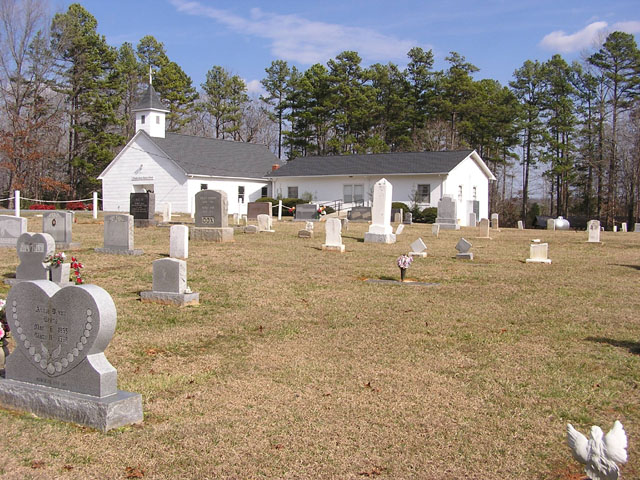
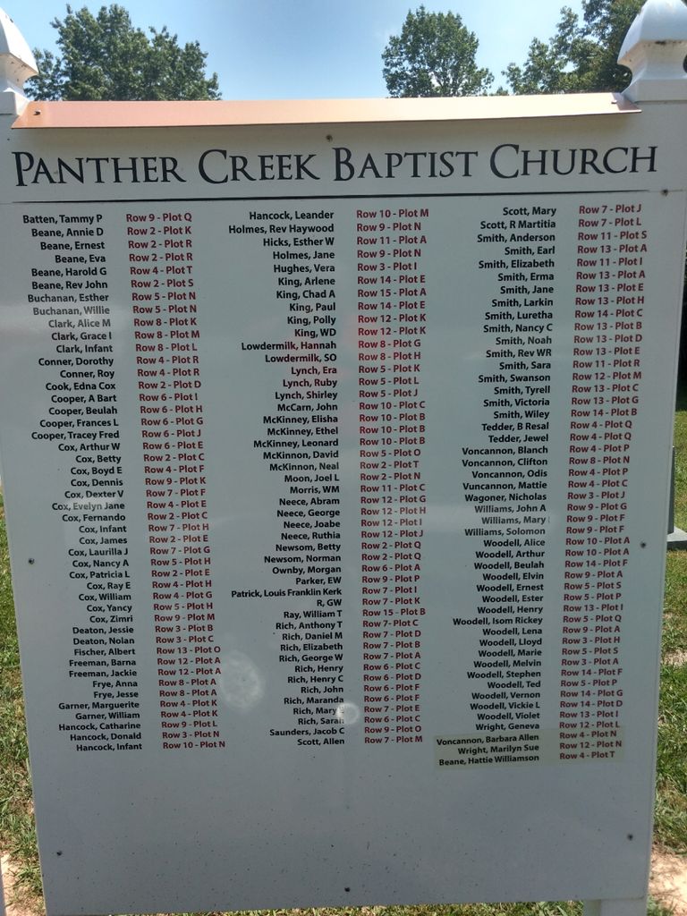
| Description | : | The cemetery is located at 2204 Panther Creek Rd, Asheboro, NC 27205. The land for the cemetery was donated by Anthony T. Rich, who is buried here and lived nearby. The original Quaker meeting house was a log structure that stood on the opposite side of the cemetery from the current Baptist church. Sunday school and worship were held there for a long time. However, an official congreation was not established and members brought business to Holly Spring Friends Meeting near Ramseur, NC. When the Rich and Cox families moved away, the remaining members tranferred to Holly Spring. |
frequently asked questions (FAQ):
-
Where is Panther Creek Baptist Church Cemetery?
Panther Creek Baptist Church Cemetery is located at Asheboro, Randolph County ,North Carolina ,USA.
-
Panther Creek Baptist Church Cemetery cemetery's updated grave count on graveviews.com?
3 memorials
-
Where are the coordinates of the Panther Creek Baptist Church Cemetery?
Latitude: 35.6176300
Longitude: -79.7437820
Nearby Cemetories:
1. Union Grove Christian Church Cemetery
Asheboro, Randolph County, USA
Coordinate: 35.6235200, -79.7106600
2. Goins Family Cemetery
Asheboro, Randolph County, USA
Coordinate: 35.6285300, -79.7079600
3. Richland Baptist Church Cemetery
Asheboro, Randolph County, USA
Coordinate: 35.6543740, -79.7559120
4. Mitchell United Methodist Church Cemetery #1
Asheboro, Randolph County, USA
Coordinate: 35.6233300, -79.7910600
5. Mitchell United Methodist Church Cemetery #2
Asheboro, Randolph County, USA
Coordinate: 35.6221700, -79.7929700
6. Bethel Friends Cemetery
Asheboro, Randolph County, USA
Coordinate: 35.6645700, -79.7391200
7. Huldah Baptist Church Cemetery
Asheboro, Randolph County, USA
Coordinate: 35.5779360, -79.7753080
8. Piney Ridge UMC Cemetery
Seagrove, Randolph County, USA
Coordinate: 35.5898720, -79.6944330
9. Flag Springs United Methodist Church Cemetery
Asheboro, Randolph County, USA
Coordinate: 35.6102860, -79.8068910
10. Pleasant Hill United Methodist Church
Seagrove, Randolph County, USA
Coordinate: 35.5732574, -79.7067261
11. Grace Baptist Temple Cemetery
Asheboro, Randolph County, USA
Coordinate: 35.5843810, -79.8023330
12. Spoons Chapel United Church of Christ Cemetery
Asheboro, Randolph County, USA
Coordinate: 35.6763150, -79.7345110
13. Richard Graves Family Cemetery
Seagrove, Randolph County, USA
Coordinate: 35.5611100, -79.7679100
14. Antioch Missionary Baptist Church Cemetery
Asheboro, Randolph County, USA
Coordinate: 35.6014220, -79.8159830
15. New Hope Memorial Gardens
Asheboro, Randolph County, USA
Coordinate: 35.5975400, -79.8155130
16. Mountain of Faith Christian Church Cemetery
Asheboro, Randolph County, USA
Coordinate: 35.6760930, -79.7129830
17. Spencer Family Cemetery
Seagrove, Randolph County, USA
Coordinate: 35.5528110, -79.7310880
18. Browers Chapel UMC Cemetery
Asheboro, Randolph County, USA
Coordinate: 35.6747290, -79.7854000
19. Russells Grove Baptist Church Cemetery
Asheboro, Randolph County, USA
Coordinate: 35.6304300, -79.8266700
20. Victory Baptist Church Cemetery
Asheboro, Randolph County, USA
Coordinate: 35.5604090, -79.7907740
21. Shiloh Baptist Church Cemetery
Ramseur, Randolph County, USA
Coordinate: 35.6115112, -79.6561737
22. New Hope United Methodist Church Cemetery
Asheboro, Randolph County, USA
Coordinate: 35.5804900, -79.8197100
23. Mount Tabor Community Church Cemetery
Asheboro, Randolph County, USA
Coordinate: 35.6892900, -79.7318400
24. Old New Hope Cemetery
Union Township, Randolph County, USA
Coordinate: 35.5842500, -79.8230000


