
| Memorials | : | 0 |
| Location | : | Bakerton, Jefferson County, USA |
| Coordinate | : | 39.3673700, -77.7496000 |
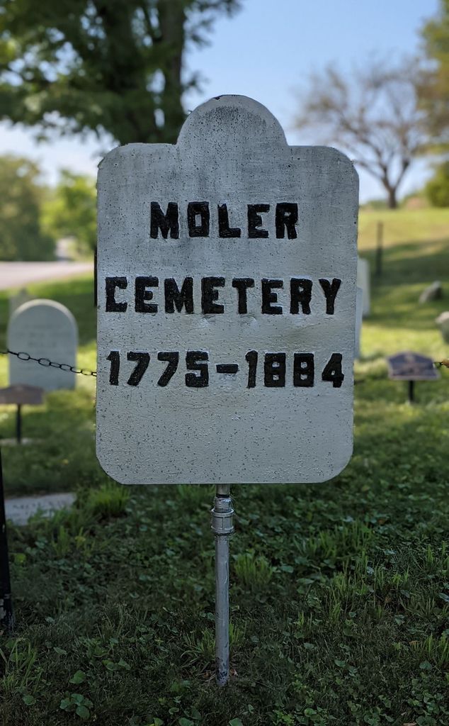
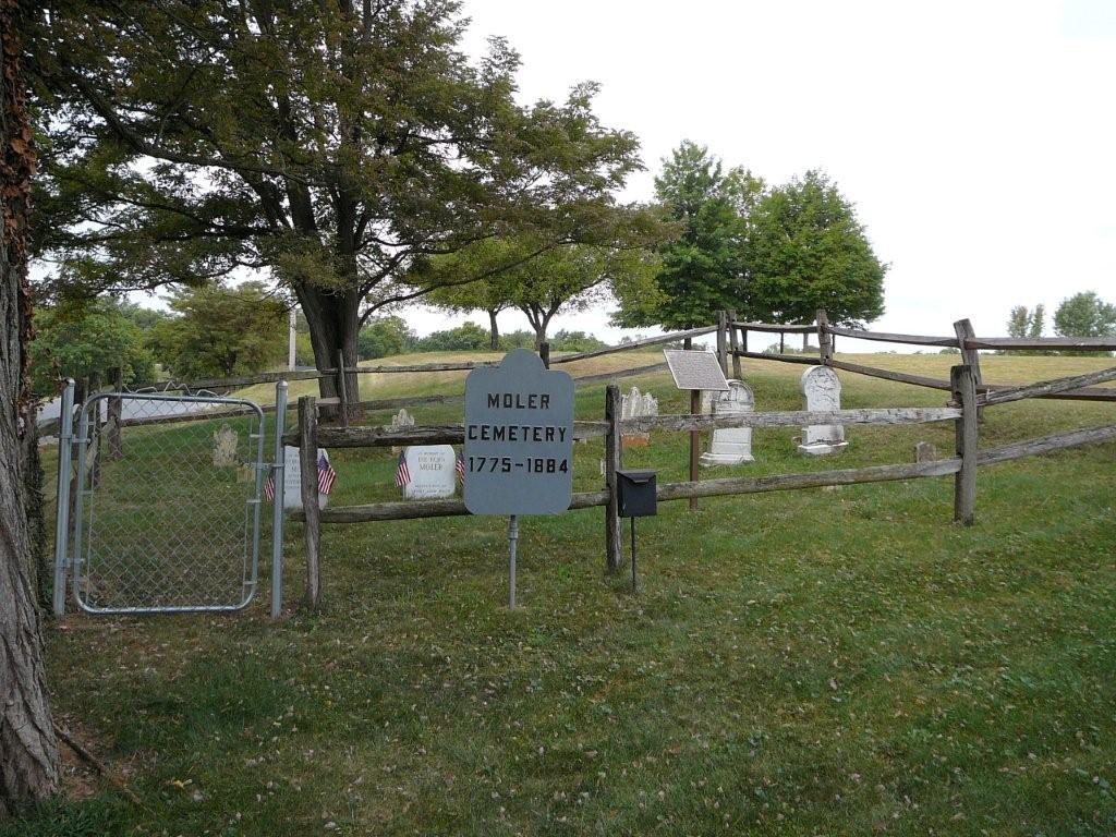
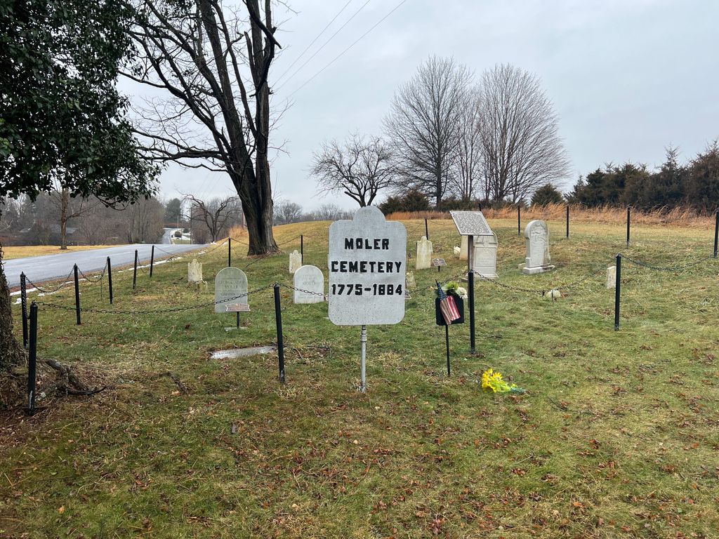
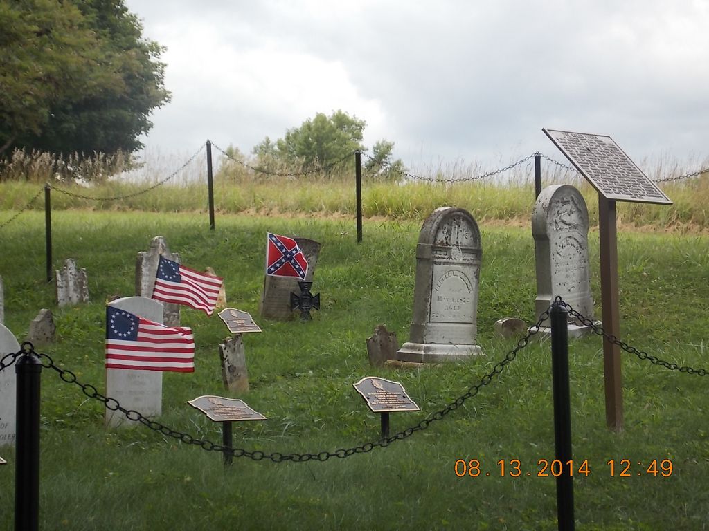
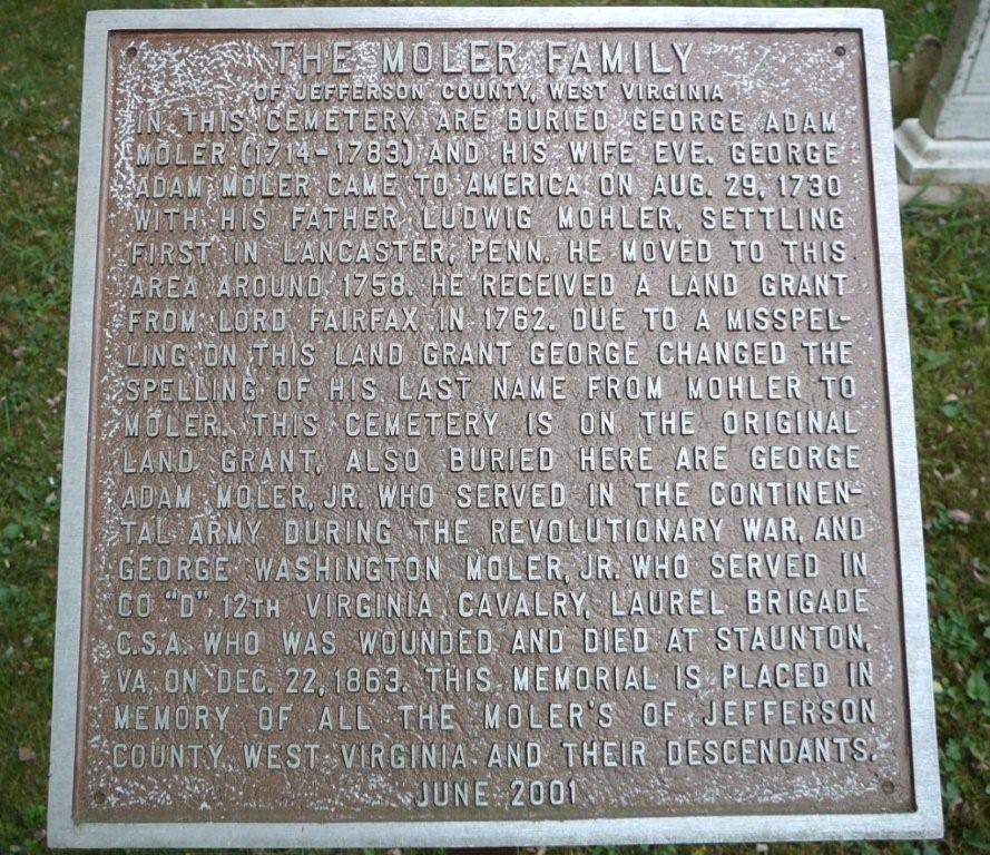
| Description | : | Located at the intersection of Bakerton Road and Morning Calm Lane (on the left-hand side of the road heading north), there are only twelve marked graves (one stone is broken off and is unreadable) in this old, but well-maintained, family cemetery. |
frequently asked questions (FAQ):
-
Where is Moler Cemetery?
Moler Cemetery is located at Bakerton, Jefferson County ,West Virginia ,USA.
-
Moler Cemetery cemetery's updated grave count on graveviews.com?
0 memorials
-
Where are the coordinates of the Moler Cemetery?
Latitude: 39.3673700
Longitude: -77.7496000
Nearby Cemetories:
1. Moler Cemetery
Moler Crossroads, Jefferson County, USA
Coordinate: 39.3672700, -77.7495100
2. Flanegan Cemetery
Bakerton, Jefferson County, USA
Coordinate: 39.3750000, -77.7620000
3. Hageley Cemetery
Bakerton, Jefferson County, USA
Coordinate: 39.3641838, -77.7730423
4. Samples Manor Cemetery
Samples Manor, Washington County, USA
Coordinate: 39.3732262, -77.7216568
5. Duffield Colored Cemetery
Uvilla, Jefferson County, USA
Coordinate: 39.3603900, -77.7985600
6. Saint James Lutheran Church Cemetery
Uvilla, Jefferson County, USA
Coordinate: 39.3686104, -77.7995300
7. Uvilla Methodist Church Cemetery
Jefferson County, USA
Coordinate: 39.3660040, -77.7998030
8. Cedar Hill Cemetery
Harpers Ferry, Jefferson County, USA
Coordinate: 39.3283520, -77.7524420
9. Mount Zion AME Church Cemetery
Reedson, Jefferson County, USA
Coordinate: 39.3492120, -77.8001050
10. Harper Cemetery
Harpers Ferry, Jefferson County, USA
Coordinate: 39.3236847, -77.7345352
11. Saint Peter's Cemetery
Harpers Ferry, Jefferson County, USA
Coordinate: 39.3213806, -77.7480927
12. Fairview Lutheran Cemetery
Bolivar, Jefferson County, USA
Coordinate: 39.3215700, -77.7567500
13. Mount Moriah Baptist Church Cemetery
Washington County, USA
Coordinate: 39.3535995, -77.6908035
14. Renaud Cemetery
Moler Crossroads, Jefferson County, USA
Coordinate: 39.3970846, -77.7986351
15. Garrett's Mill Assemblies of God Cemetery
Garretts Mill, Washington County, USA
Coordinate: 39.3527184, -77.6881485
16. Moler Graveyard
Halltown, Jefferson County, USA
Coordinate: 39.3188400, -77.7739900
17. Payne's Hill Cemetery
Halltown, Jefferson County, USA
Coordinate: 39.3190730, -77.7810570
18. McGolenick-Phillips Cemetery
Garretts Mill, Washington County, USA
Coordinate: 39.3612300, -77.6793900
19. Virts Farm Cemetery
Sandy Hook, Washington County, USA
Coordinate: 39.3299675, -77.6966705
20. Allstadt Graveyard
Halltown, Jefferson County, USA
Coordinate: 39.3145270, -77.7732030
21. Lucas Family Cemetery at Elmwood
Shepherdstown, Jefferson County, USA
Coordinate: 39.3957200, -77.8149300
22. Norris Cemetery
Garretts Mill, Washington County, USA
Coordinate: 39.3463968, -77.6781411
23. Elk Branch Presbyterian Church Cemetery
Duffields, Jefferson County, USA
Coordinate: 39.3647614, -77.8279190
24. Ridenour Cemetery
Duffields, Jefferson County, USA
Coordinate: 39.3644414, -77.8280193