
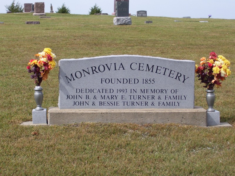
| Memorials | : | 23 |
| Location | : | Effingham, Atchison County, USA |
| Coordinate | : | 39.5150719, -95.3470993 |
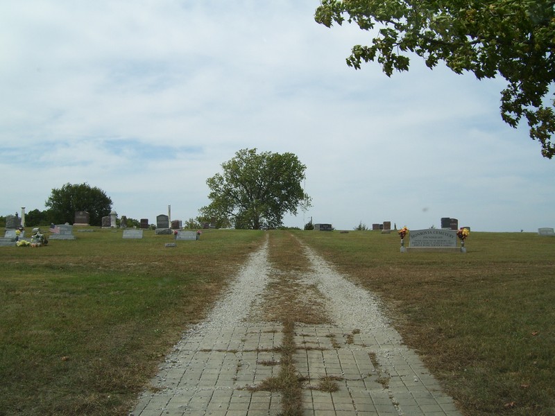
| Description | : | Located on 262nd Road, south of Monrovia, halfway between Monrovia and 254th Road. Benton N Twp., Sec 24 |
frequently asked questions (FAQ):
-
Where is Monrovia Cemetery?
Monrovia Cemetery is located at 262nd Road Effingham, Atchison County ,Kansas ,USA.
-
Monrovia Cemetery cemetery's updated grave count on graveviews.com?
23 memorials
-
Where are the coordinates of the Monrovia Cemetery?
Latitude: 39.5150719
Longitude: -95.3470993
Nearby Cemetories:
1. Campbell Cemetery
Farmington, Atchison County, USA
Coordinate: 39.5186900, -95.3145600
2. Noffsinger Cemetery
Effingham, Atchison County, USA
Coordinate: 39.4924011, -95.3652344
3. Robinson Family Cemetery
Atchison, Atchison County, USA
Coordinate: 39.4920100, -95.3114700
4. Maple Grove Cemetery
Atchison County, USA
Coordinate: 39.5505981, -95.3597031
5. Effingham Cemetery
Effingham, Atchison County, USA
Coordinate: 39.5152359, -95.3971558
6. Saint Anns Catholic Cemetery
Effingham, Atchison County, USA
Coordinate: 39.5186005, -95.4011002
7. Pleasant Grove Cemetery
Effingham, Atchison County, USA
Coordinate: 39.4786000, -95.3858000
8. Seventh Day Baptist Original Cemetery
Cummings, Atchison County, USA
Coordinate: 39.4706400, -95.3243400
9. Pardee Cemetery
Cummings, Atchison County, USA
Coordinate: 39.4914589, -95.2860489
10. Loomis Family Burial Site
Effingham, Atchison County, USA
Coordinate: 39.4762200, -95.4041600
11. Lancaster Cemetery
Lancaster, Atchison County, USA
Coordinate: 39.5666275, -95.3054123
12. Griffin Cemetery
Cummings, Atchison County, USA
Coordinate: 39.4629707, -95.3053207
13. Neill Cemetery
Atchison County, USA
Coordinate: 39.4497000, -95.3944200
14. Jackie Jones Cemetery
Cummings, Atchison County, USA
Coordinate: 39.4622000, -95.2631000
15. Forest Grove Cemetery
Effingham, Atchison County, USA
Coordinate: 39.5802689, -95.4171524
16. Camp Creek Cemetery
Parnell, Atchison County, USA
Coordinate: 39.5202789, -95.2346573
17. Huron Cemetery
Huron, Atchison County, USA
Coordinate: 39.6058006, -95.3585968
18. Saint Josephs Cemetery
Nortonville, Jefferson County, USA
Coordinate: 39.4193993, -95.3191986
19. Cummings District Cemetery
Cummings, Atchison County, USA
Coordinate: 39.4599609, -95.2416077
20. Nortonville Cemetery
Nortonville, Jefferson County, USA
Coordinate: 39.4140205, -95.3374023
21. Chain Family Cemetery
Huron, Atchison County, USA
Coordinate: 39.6238518, -95.3964767
22. Ernst Family Cemetery
Arrington, Atchison County, USA
Coordinate: 39.4533900, -95.4781800
23. Mormon Grove Historical Marker Memorial
Parnell, Atchison County, USA
Coordinate: 39.5572319, -95.1985931
24. Wills Cemetery
Muscotah, Atchison County, USA
Coordinate: 39.5596400, -95.5002800