
| Memorials | : | 1 |
| Location | : | Cummings, Atchison County, USA |
| Coordinate | : | 39.4706400, -95.3243400 |
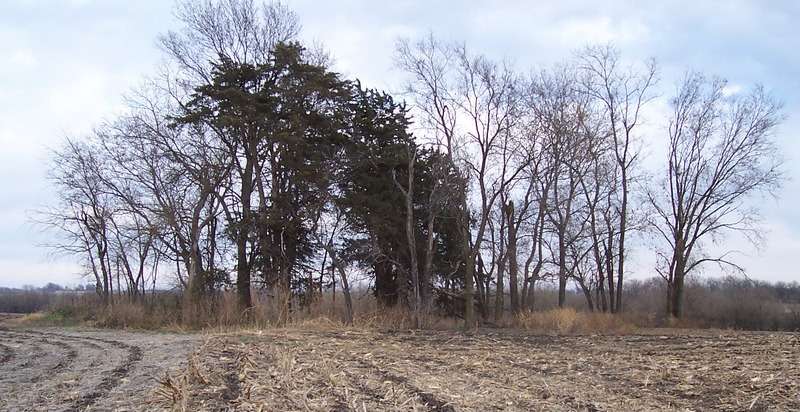
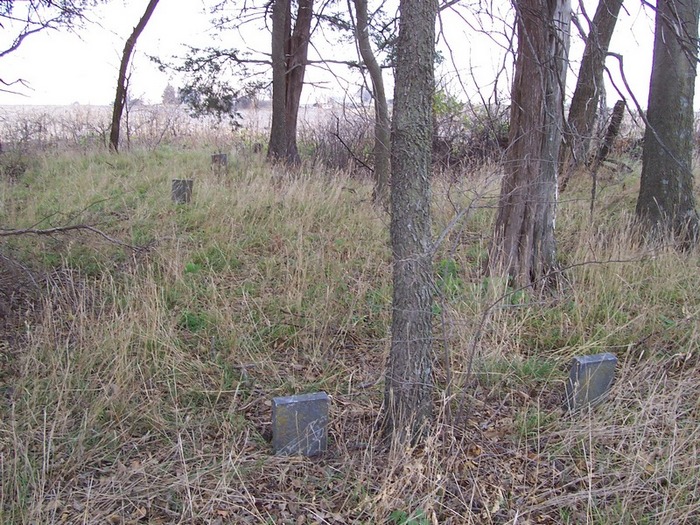
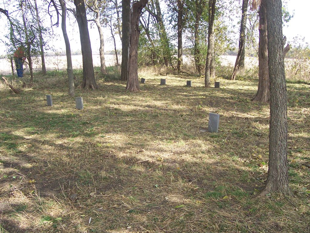
| Description | : | This cemetery is the final resting place of some of the Seventh Day Baptist pioneers who first settled in Kansas in October of 1857. This cemetery was the original SDB cemetery. It was used from 1860 to 1907. It is located on the original Issac Maris farm and then Fred Maris farm. It is currently on land owned by James Higley, Nortonville. The first person buried here was Anna Butin, in 1860. The cemetery is 4 miles north of Nortonville just off the intersection of Highway 159 and Hwy 116. At the junction of the highways the road curves... Read More |
frequently asked questions (FAQ):
-
Where is Seventh Day Baptist Original Cemetery?
Seventh Day Baptist Original Cemetery is located at Cummings, Atchison County ,Kansas , 66002USA.
-
Seventh Day Baptist Original Cemetery cemetery's updated grave count on graveviews.com?
1 memorials
-
Where are the coordinates of the Seventh Day Baptist Original Cemetery?
Latitude: 39.4706400
Longitude: -95.3243400
Nearby Cemetories:
1. Griffin Cemetery
Cummings, Atchison County, USA
Coordinate: 39.4629707, -95.3053207
2. Robinson Family Cemetery
Atchison, Atchison County, USA
Coordinate: 39.4920100, -95.3114700
3. Pardee Cemetery
Cummings, Atchison County, USA
Coordinate: 39.4914589, -95.2860489
4. Noffsinger Cemetery
Effingham, Atchison County, USA
Coordinate: 39.4924011, -95.3652344
5. Monrovia Cemetery
Effingham, Atchison County, USA
Coordinate: 39.5150719, -95.3470993
6. Jackie Jones Cemetery
Cummings, Atchison County, USA
Coordinate: 39.4622000, -95.2631000
7. Pleasant Grove Cemetery
Effingham, Atchison County, USA
Coordinate: 39.4786000, -95.3858000
8. Campbell Cemetery
Farmington, Atchison County, USA
Coordinate: 39.5186900, -95.3145600
9. Saint Josephs Cemetery
Nortonville, Jefferson County, USA
Coordinate: 39.4193993, -95.3191986
10. Nortonville Cemetery
Nortonville, Jefferson County, USA
Coordinate: 39.4140205, -95.3374023
11. Neill Cemetery
Atchison County, USA
Coordinate: 39.4497000, -95.3944200
12. Loomis Family Burial Site
Effingham, Atchison County, USA
Coordinate: 39.4762200, -95.4041600
13. Cummings District Cemetery
Cummings, Atchison County, USA
Coordinate: 39.4599609, -95.2416077
14. Effingham Cemetery
Effingham, Atchison County, USA
Coordinate: 39.5152359, -95.3971558
15. Saint Anns Catholic Cemetery
Effingham, Atchison County, USA
Coordinate: 39.5186005, -95.4011002
16. Maple Grove Cemetery
Atchison County, USA
Coordinate: 39.5505981, -95.3597031
17. Camp Creek Cemetery
Parnell, Atchison County, USA
Coordinate: 39.5202789, -95.2346573
18. Hart Cemetery
Boyle, Jefferson County, USA
Coordinate: 39.3770485, -95.3482819
19. Lancaster Cemetery
Lancaster, Atchison County, USA
Coordinate: 39.5666275, -95.3054123
20. Lamar-Rogers Cemetery
Jefferson County, USA
Coordinate: 39.3867400, -95.2604900
21. Springhill Cemetery
Potter, Atchison County, USA
Coordinate: 39.4303589, -95.2025375
22. Round Mound Cemetery
Cummings, Atchison County, USA
Coordinate: 39.4646988, -95.1908035
23. Corpus Christi Cemetery
Winchester, Jefferson County, USA
Coordinate: 39.3908005, -95.2394028
24. Smith Family Cemetery
Valley Falls, Jefferson County, USA
Coordinate: 39.4157295, -95.4602737