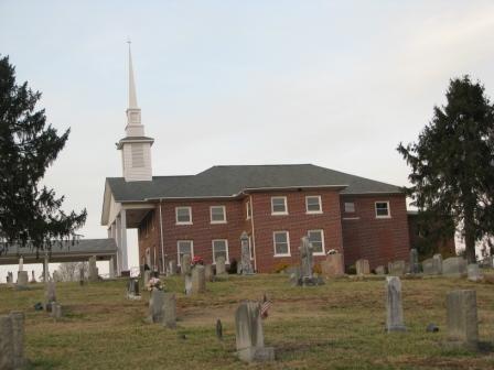
| Memorials | : | 210 |
| Location | : | Union Mills, Rutherford County, USA |
| Coordinate | : | 35.5244110, -82.0934540 |
frequently asked questions (FAQ):
-
Where is Montford Cove Baptist Church Cemetery?
Montford Cove Baptist Church Cemetery is located at 4920 Cove Road Union Mills, Rutherford County ,North Carolina , 28167-8644USA.
-
Montford Cove Baptist Church Cemetery cemetery's updated grave count on graveviews.com?
210 memorials
-
Where are the coordinates of the Montford Cove Baptist Church Cemetery?
Latitude: 35.5244110
Longitude: -82.0934540
Nearby Cemetories:
1. Hemphill Morgan Cemetery
Rutherford County, USA
Coordinate: 35.5197250, -82.0914320
2. Welcome Home Baptist Church Cemetery
Gilkey, Rutherford County, USA
Coordinate: 35.5118310, -82.0482780
3. Cedar Creek Holiness Church Cemetery
Bills Creek, Rutherford County, USA
Coordinate: 35.4855560, -82.1106620
4. Antioch Church Cemetery
Bills Creek, Rutherford County, USA
Coordinate: 35.4826780, -82.1201230
5. Dalton Family Cemetery
Bills Creek, Rutherford County, USA
Coordinate: 35.4826320, -82.1391050
6. Shingle Hollow Holiness Church Cemetery
Rutherfordton, Rutherford County, USA
Coordinate: 35.4700130, -82.0727290
7. Old Pleasant Grove Methodist Church Cemetery
McDowell County, USA
Coordinate: 35.5785060, -82.0515210
8. Noblitt Graveyard
McDowell County, USA
Coordinate: 35.5690890, -82.1534230
9. Piney Knob Baptist Church Cemetery
Rutherfordton, Rutherford County, USA
Coordinate: 35.4633100, -82.0551600
10. Davistown Cemetery
Old Fort, McDowell County, USA
Coordinate: 35.5661011, -82.1632996
11. Freedom Missionary Baptist Church Cemetery
McDowell County, USA
Coordinate: 35.5835400, -82.0412400
12. Pleasant Grove Cemetery
Marion, McDowell County, USA
Coordinate: 35.5830920, -82.0399750
13. Sugar Hill Baptist Church Cemetery
McDowell County, USA
Coordinate: 35.5803070, -82.0316050
14. Hillsdale Church Cemetery
Rutherfordton, Rutherford County, USA
Coordinate: 35.4849150, -82.0134380
15. Saint Johns Missionary Baptist Cemetery
Lake Lure, Rutherford County, USA
Coordinate: 35.4523926, -82.1266098
16. Lawing Cemetery
McDowell County, USA
Coordinate: 35.5628014, -82.0056000
17. Gossett Family Cemetery
Rutherfordton, Rutherford County, USA
Coordinate: 35.4439400, -82.0766300
18. Pine Ridge Mennonite Church Cemetery
Rutherfordton, Rutherford County, USA
Coordinate: 35.4568660, -82.0358090
19. Mountain Creek Independent Baptist Church Cemetery
Glenwood, McDowell County, USA
Coordinate: 35.5657700, -82.0057900
20. Bethlehem Community Cemetery
Old Fort, McDowell County, USA
Coordinate: 35.6009320, -82.1315530
21. Bills Creek Baptist Church Cemetery
Bills Creek, Rutherford County, USA
Coordinate: 35.4514980, -82.1411210
22. Pleasant Grove Baptist Church Cemetery
Rutherfordton, Rutherford County, USA
Coordinate: 35.4436000, -82.0646970
23. Sigmon - Laughter Family Cemetery
Oldfort, Polk County, USA
Coordinate: 35.6020486, -82.1359261
24. Mount Nebo Baptist Cemetery
Lake Lure, Rutherford County, USA
Coordinate: 35.4502700, -82.1500200

