
| Memorials | : | 0 |
| Location | : | McDowell County, USA |
| Coordinate | : | 35.5785060, -82.0515210 |
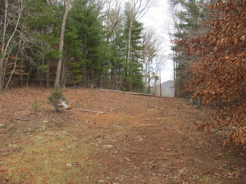
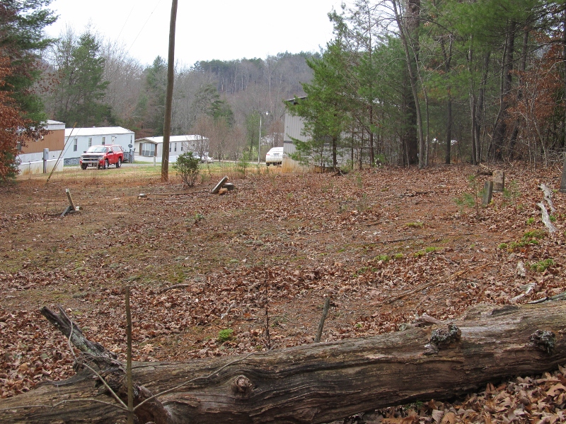
| Description | : | Directions: From Marion, take Sugar Hill Road approx. 10 miles. Turn right onto Sugar Hill Heights Drive. Go about .2 of a mile and turn right onto Ben View Drive. Go to the end of the block. Straight ahead you will see power lines. The cemetery is partially in the power lines right-of way, partially in the woods to the left. Several burials have been relocated from this cemetery. Pleasant Grove Methodist Church and Cemetery was originally located here. It was moved up the road, near the present Sugar Hill Fire Dept. about 1923. |
frequently asked questions (FAQ):
-
Where is Old Pleasant Grove Methodist Church Cemetery?
Old Pleasant Grove Methodist Church Cemetery is located at McDowell County ,North Carolina ,USA.
-
Old Pleasant Grove Methodist Church Cemetery cemetery's updated grave count on graveviews.com?
0 memorials
-
Where are the coordinates of the Old Pleasant Grove Methodist Church Cemetery?
Latitude: 35.5785060
Longitude: -82.0515210
Nearby Cemetories:
1. Freedom Missionary Baptist Church Cemetery
McDowell County, USA
Coordinate: 35.5835400, -82.0412400
2. Pleasant Grove Cemetery
Marion, McDowell County, USA
Coordinate: 35.5830920, -82.0399750
3. Sugar Hill Baptist Church Cemetery
McDowell County, USA
Coordinate: 35.5803070, -82.0316050
4. Mountain Creek Independent Baptist Church Cemetery
Glenwood, McDowell County, USA
Coordinate: 35.5657700, -82.0057900
5. Lawing Cemetery
McDowell County, USA
Coordinate: 35.5628014, -82.0056000
6. Mount Pleasant Baptist Church Cemetery
Marion, McDowell County, USA
Coordinate: 35.6174650, -82.0190030
7. Bethel Baptist Church Cemetery
Marion, McDowell County, USA
Coordinate: 35.5847890, -81.9929230
8. Nealsville Church Of God Cemetery
McDowell County, USA
Coordinate: 35.5885590, -81.9924240
9. Neal Cemetery
McDowell County, USA
Coordinate: 35.6068993, -81.9991989
10. Zion Hill Baptist Church Cemetery
Marion, McDowell County, USA
Coordinate: 35.6314011, -82.0686035
11. Glenwood Independent Baptist Church Cemetery
McDowell County, USA
Coordinate: 35.5884730, -81.9829800
12. Providence United Methodist Church Cemetery
Marion, McDowell County, USA
Coordinate: 35.6368860, -82.0503680
13. Montford Cove Baptist Church Cemetery
Union Mills, Rutherford County, USA
Coordinate: 35.5244110, -82.0934540
14. Glades Cemetery
McDowell County, USA
Coordinate: 35.6422005, -82.0669022
15. Welcome Home Baptist Church Cemetery
Gilkey, Rutherford County, USA
Coordinate: 35.5118310, -82.0482780
16. Hemphill Morgan Cemetery
Rutherford County, USA
Coordinate: 35.5197250, -82.0914320
17. Ridgeway Freewill Baptist Church Cemetery
McDowell County, USA
Coordinate: 35.6319070, -82.0010530
18. Arrowood Cemetery
Glenwood, McDowell County, USA
Coordinate: 35.5774970, -81.9669530
19. Bethlehem Community Cemetery
Old Fort, McDowell County, USA
Coordinate: 35.6009320, -82.1315530
20. Nix Creek Free Will Baptist Church
Marion, McDowell County, USA
Coordinate: 35.6461500, -82.0699590
21. Sigmon - Laughter Family Cemetery
Oldfort, Polk County, USA
Coordinate: 35.6020486, -82.1359261
22. Glenwood Cemetery
Marion, McDowell County, USA
Coordinate: 35.6117870, -81.9708270
23. Hensley Cemetery
McDowell County, USA
Coordinate: 35.6034370, -82.1420810
24. Noblitt Graveyard
McDowell County, USA
Coordinate: 35.5690890, -82.1534230