
| Memorials | : | 0 |
| Location | : | McDowell County, USA |
| Coordinate | : | 35.5628014, -82.0056000 |
frequently asked questions (FAQ):
-
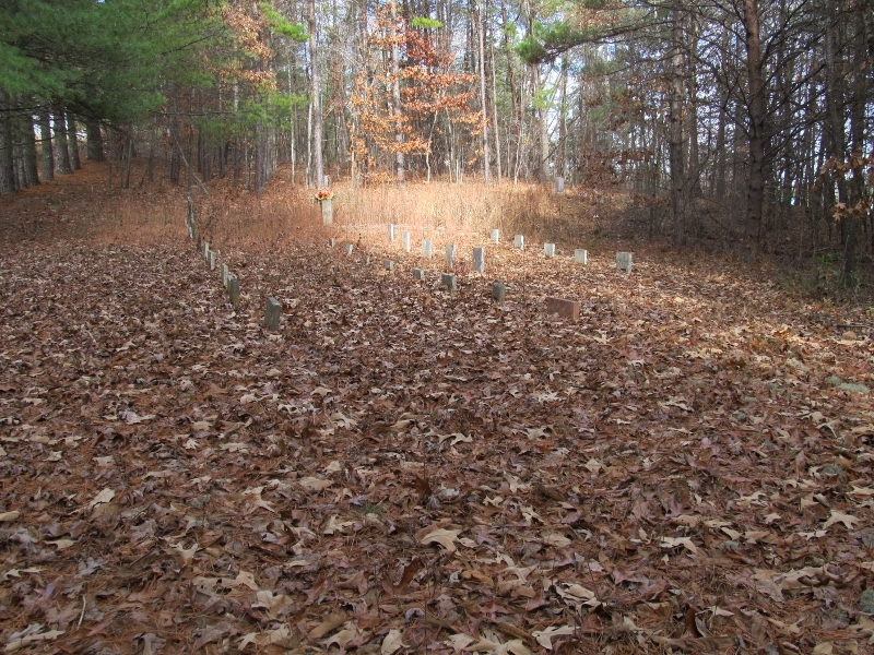
Where is Lawing Cemetery?
Lawing Cemetery is located at McDowell County ,North Carolina ,USA.
-
Lawing Cemetery cemetery's updated grave count on graveviews.com?
0 memorials
-
Where are the coordinates of the Lawing Cemetery?
Latitude: 35.5628014
Longitude: -82.0056000
Nearby Cemetories:
1. Mountain Creek Independent Baptist Church Cemetery
Glenwood, McDowell County, USA
Coordinate: 35.5657700, -82.0057900
2. Bethel Baptist Church Cemetery
Marion, McDowell County, USA
Coordinate: 35.5847890, -81.9929230
3. Sugar Hill Baptist Church Cemetery
McDowell County, USA
Coordinate: 35.5803070, -82.0316050
4. Nealsville Church Of God Cemetery
McDowell County, USA
Coordinate: 35.5885590, -81.9924240
5. Glenwood Independent Baptist Church Cemetery
McDowell County, USA
Coordinate: 35.5884730, -81.9829800
6. Pleasant Grove Cemetery
Marion, McDowell County, USA
Coordinate: 35.5830920, -82.0399750
7. Arrowood Cemetery
Glenwood, McDowell County, USA
Coordinate: 35.5774970, -81.9669530
8. Freedom Missionary Baptist Church Cemetery
McDowell County, USA
Coordinate: 35.5835400, -82.0412400
9. Old Pleasant Grove Methodist Church Cemetery
McDowell County, USA
Coordinate: 35.5785060, -82.0515210
10. Neal Cemetery
McDowell County, USA
Coordinate: 35.6068993, -81.9991989
11. Old Thermal City Church Cemetery
Thermal City, Rutherford County, USA
Coordinate: 35.5173120, -81.9706250
12. Mount Pleasant Baptist Church Cemetery
Marion, McDowell County, USA
Coordinate: 35.6174650, -82.0190030
13. Glenwood Cemetery
Marion, McDowell County, USA
Coordinate: 35.6117870, -81.9708270
14. Macedonia Baptist Church Cemetery
McDowell County, USA
Coordinate: 35.5770190, -81.9369820
15. Welcome Home Baptist Church Cemetery
Gilkey, Rutherford County, USA
Coordinate: 35.5118310, -82.0482780
16. Sprouse Cemetery
Dysartsville, McDowell County, USA
Coordinate: 35.5723570, -81.9297430
17. Ridgeway Freewill Baptist Church Cemetery
McDowell County, USA
Coordinate: 35.6319070, -82.0010530
18. Brackettown Cemetery
McDowell County, USA
Coordinate: 35.5532990, -81.9207993
19. Grace Tabernacle Cemetery
Union Mills, Rutherford County, USA
Coordinate: 35.4957850, -81.9777540
20. Round Hill Baptist Church Cemetery
Union Mills, Rutherford County, USA
Coordinate: 35.4934690, -81.9711200
21. Poteet Family Cemetery
McDowell County, USA
Coordinate: 35.5774040, -81.9125020
22. Hillsdale Church Cemetery
Rutherfordton, Rutherford County, USA
Coordinate: 35.4849150, -82.0134380
23. Pleasant Hill Cemetery
Rutherford County, USA
Coordinate: 35.5022011, -81.9441986
24. Montford Cove Baptist Church Cemetery
Union Mills, Rutherford County, USA
Coordinate: 35.5244110, -82.0934540