
| Memorials | : | 0 |
| Location | : | Upper Providence Township, Montgomery County, USA |
| Coordinate | : | 40.1640800, -75.5059000 |
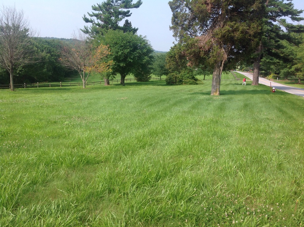
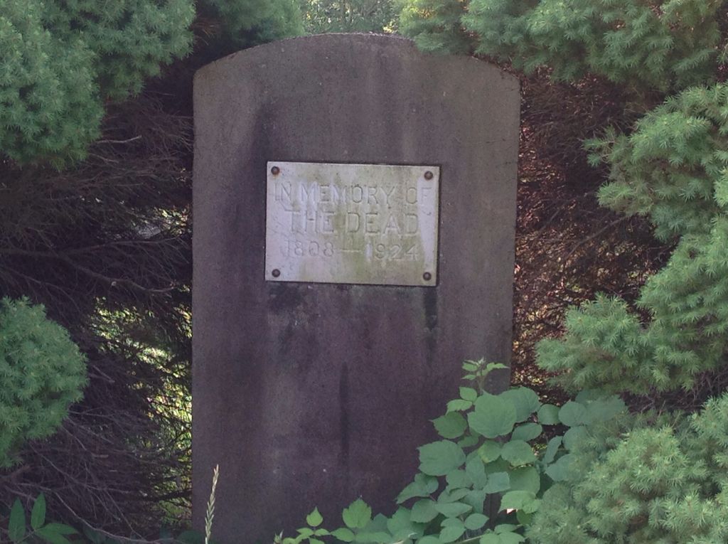
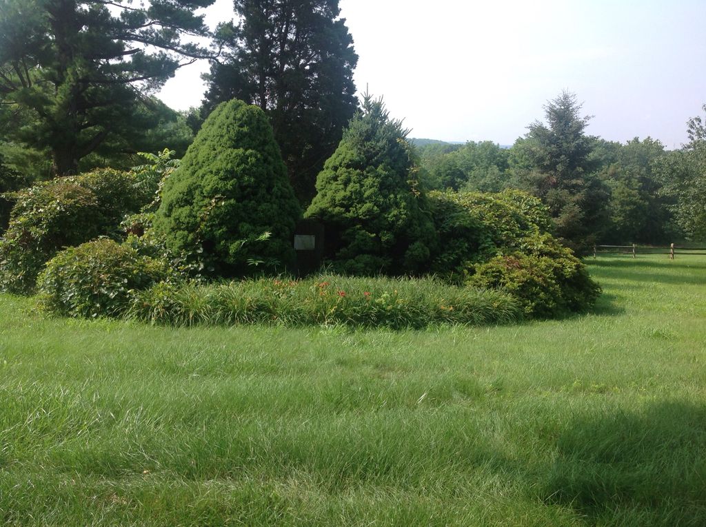
| Description | : | The question of establishing a county poor farm in Montgomery County was first considered in 1801. Despite this, it was not until 1806 that the county first passed an act establishing the county poor farm and authorizing its construction. By the fall of 1807, the construction was completed, and the farm was placed in operation. It was located in Upper Providence Township, two miles north of Phoenixville. By 1885, the almshouse property extended 298 acres, of which 245 were under cultivation, and four more under garden husbandry. On the property were several buildings used to house the county's indigent.... Read More |
frequently asked questions (FAQ):
-
Where is Montgomery County Almshouse Cemetery?
Montgomery County Almshouse Cemetery is located at South Side of Black Rock Road Upper Providence Township, Montgomery County ,Pennsylvania , 19426USA.
-
Montgomery County Almshouse Cemetery cemetery's updated grave count on graveviews.com?
0 memorials
-
Where are the coordinates of the Montgomery County Almshouse Cemetery?
Latitude: 40.1640800
Longitude: -75.5059000
Nearby Cemetories:
1. Black Rock Cemetery
Phoenixville, Chester County, USA
Coordinate: 40.1472015, -75.5168991
2. Holy Ghost Cemetery
Mont Clare, Montgomery County, USA
Coordinate: 40.1439018, -75.5010986
3. B'nai Jacob Cemetery
Mont Clare, Montgomery County, USA
Coordinate: 40.1425018, -75.5057983
4. Saint Michael's Greek Catholic Cemetery
Mont Clare, Montgomery County, USA
Coordinate: 40.1417999, -75.5053635
5. Dismant Cemetery
Upper Providence Township, Montgomery County, USA
Coordinate: 40.1791992, -75.5289001
6. Saint Mary of the Assumption Roman Catholic Cemetery
Phoenixville, Chester County, USA
Coordinate: 40.1397018, -75.5149994
7. Holy Trinity Polish Catholic Cemetery
Phoenixville, Chester County, USA
Coordinate: 40.1439018, -75.5289001
8. Sacred Heart Slavish Catholic Cemetery
Phoenixville, Chester County, USA
Coordinate: 40.1431007, -75.5280991
9. Providence Mennonite Church Cemetery
Collegeville, Montgomery County, USA
Coordinate: 40.1679400, -75.4705100
10. Upper Providence Friends Meeting Burial Ground
Oaks, Montgomery County, USA
Coordinate: 40.1489000, -75.4758000
11. Saints Peter And Paul Ukrainian Catholic Cemetery
Phoenixville, Chester County, USA
Coordinate: 40.1431007, -75.5302963
12. Phoenixville Mennonite Cemetery
Phoenixville, Chester County, USA
Coordinate: 40.1327000, -75.5161000
13. Fernwood Cemetery
Royersford, Montgomery County, USA
Coordinate: 40.1926270, -75.5259171
14. Zion Lutheran Church Cemetery
Spring City, Chester County, USA
Coordinate: 40.1594009, -75.5535965
15. Saint Ann Roman Catholic Church Crypt
Phoenixville, Chester County, USA
Coordinate: 40.1272874, -75.5145145
16. Mingo Cemetery
Upper Providence Township, Montgomery County, USA
Coordinate: 40.2016983, -75.5117035
17. Morris Cemetery
Phoenixville, Chester County, USA
Coordinate: 40.1258011, -75.5242004
18. Green Tree Church of the Brethren Cemetery
Oaks, Montgomery County, USA
Coordinate: 40.1351000, -75.4679000
19. Augustus Lutheran Church Cemetery
Trappe, Montgomery County, USA
Coordinate: 40.2013397, -75.4816742
20. Saint Luke's United Church of Christ Cemetery
Trappe, Montgomery County, USA
Coordinate: 40.1972313, -75.4711380
21. Schuylkill Friends Meeting Cemetery
Phoenixville, Chester County, USA
Coordinate: 40.1212000, -75.5018000
22. Trappe Evangelical Congregational Cemetery
Trappe, Montgomery County, USA
Coordinate: 40.2037888, -75.4785614
23. Trinity United Church of Christ Cemetery
Collegeville, Montgomery County, USA
Coordinate: 40.1898300, -75.4577600
24. Pennhurst Memorial Cemetery
Spring City, Chester County, USA
Coordinate: 40.1863190, -75.5579620