
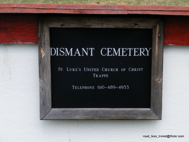
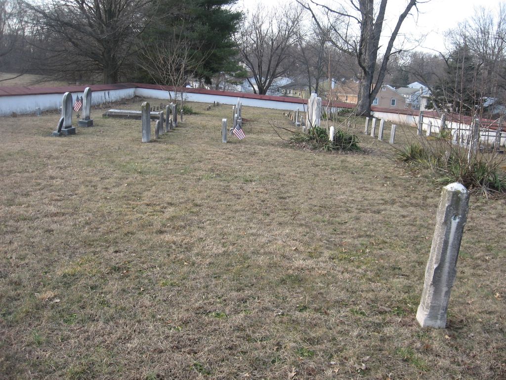
| Memorials | : | 0 |
| Location | : | Upper Providence Township, Montgomery County, USA |
| Coordinate | : | 40.1791992, -75.5289001 |
frequently asked questions (FAQ):
-
Where is Dismant Cemetery?
Dismant Cemetery is located at 4th Avenue and Vaughn Road Upper Providence Township, Montgomery County ,Pennsylvania , 19468USA.
-
Dismant Cemetery cemetery's updated grave count on graveviews.com?
0 memorials
-
Where are the coordinates of the Dismant Cemetery?
Latitude: 40.1791992
Longitude: -75.5289001
Nearby Cemetories:
1. Fernwood Cemetery
Royersford, Montgomery County, USA
Coordinate: 40.1926270, -75.5259171
2. Montgomery County Almshouse Cemetery
Upper Providence Township, Montgomery County, USA
Coordinate: 40.1640800, -75.5059000
3. Pennhurst Memorial Cemetery
Spring City, Chester County, USA
Coordinate: 40.1863190, -75.5579620
4. Mingo Cemetery
Upper Providence Township, Montgomery County, USA
Coordinate: 40.2016983, -75.5117035
5. Vincent Mennonite Church Cemetery
East Vincent Township, Chester County, USA
Coordinate: 40.1778221, -75.5638351
6. Zion Lutheran Church Cemetery
Spring City, Chester County, USA
Coordinate: 40.1594009, -75.5535965
7. Black Rock Cemetery
Phoenixville, Chester County, USA
Coordinate: 40.1472015, -75.5168991
8. Holy Trinity Polish Catholic Cemetery
Phoenixville, Chester County, USA
Coordinate: 40.1439018, -75.5289001
9. Sacred Heart Slavish Catholic Cemetery
Phoenixville, Chester County, USA
Coordinate: 40.1431007, -75.5280991
10. Saints Peter And Paul Ukrainian Catholic Cemetery
Phoenixville, Chester County, USA
Coordinate: 40.1431007, -75.5302963
11. East Vincent United Church of Christ Cemetery
Spring City, Chester County, USA
Coordinate: 40.1560173, -75.5674210
12. East Vincent Revolutionary War Soldiers' Cemetery
East Vincent Township, Chester County, USA
Coordinate: 40.1543999, -75.5671997
13. Saint Vincent United Church of Christ Cemetery
Spring City, Chester County, USA
Coordinate: 40.1561966, -75.5716553
14. B'nai Jacob Cemetery
Mont Clare, Montgomery County, USA
Coordinate: 40.1425018, -75.5057983
15. Saint Mary of the Assumption Roman Catholic Cemetery
Phoenixville, Chester County, USA
Coordinate: 40.1397018, -75.5149994
16. Holy Ghost Cemetery
Mont Clare, Montgomery County, USA
Coordinate: 40.1439018, -75.5010986
17. Saint Michael's Greek Catholic Cemetery
Mont Clare, Montgomery County, USA
Coordinate: 40.1417999, -75.5053635
18. Augustus Lutheran Church Cemetery
Trappe, Montgomery County, USA
Coordinate: 40.2013397, -75.4816742
19. Tyson Cemetery
Limerick, Montgomery County, USA
Coordinate: 40.2206001, -75.5111008
20. Trappe Evangelical Congregational Cemetery
Trappe, Montgomery County, USA
Coordinate: 40.2037888, -75.4785614
21. Providence Mennonite Church Cemetery
Collegeville, Montgomery County, USA
Coordinate: 40.1679400, -75.4705100
22. Phoenixville Mennonite Cemetery
Phoenixville, Chester County, USA
Coordinate: 40.1327000, -75.5161000
23. Saint Luke's United Church of Christ Cemetery
Trappe, Montgomery County, USA
Coordinate: 40.1972313, -75.4711380
24. Evangelical Cemetery
Limerick, Montgomery County, USA
Coordinate: 40.2289560, -75.5182170