| Memorials | : | 0 |
| Location | : | Monthalia, Gonzales County, USA |
| Coordinate | : | 29.4358200, -97.5877560 |
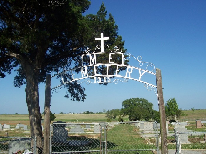
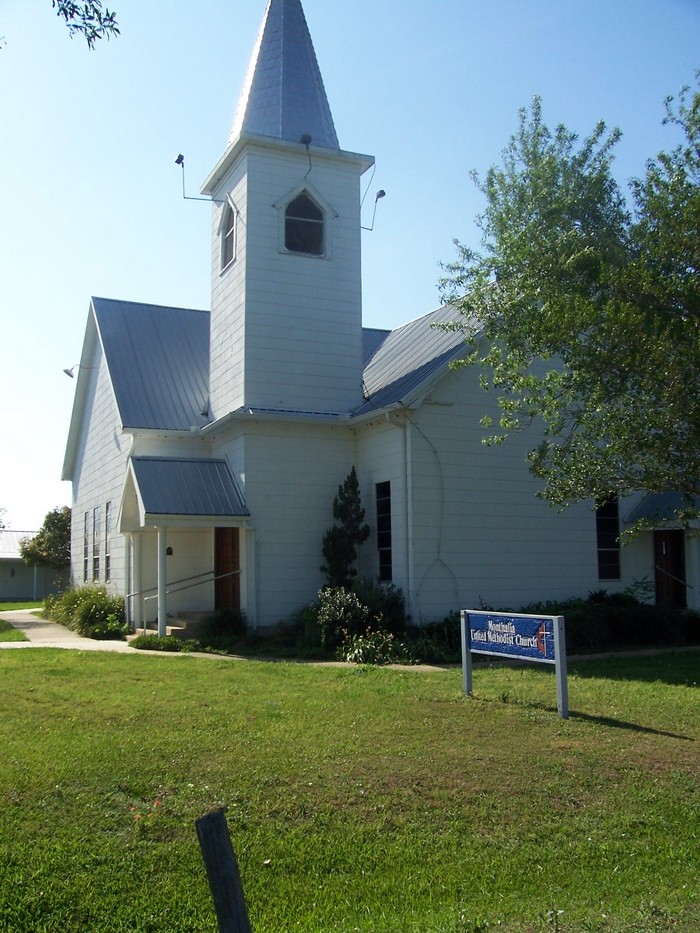
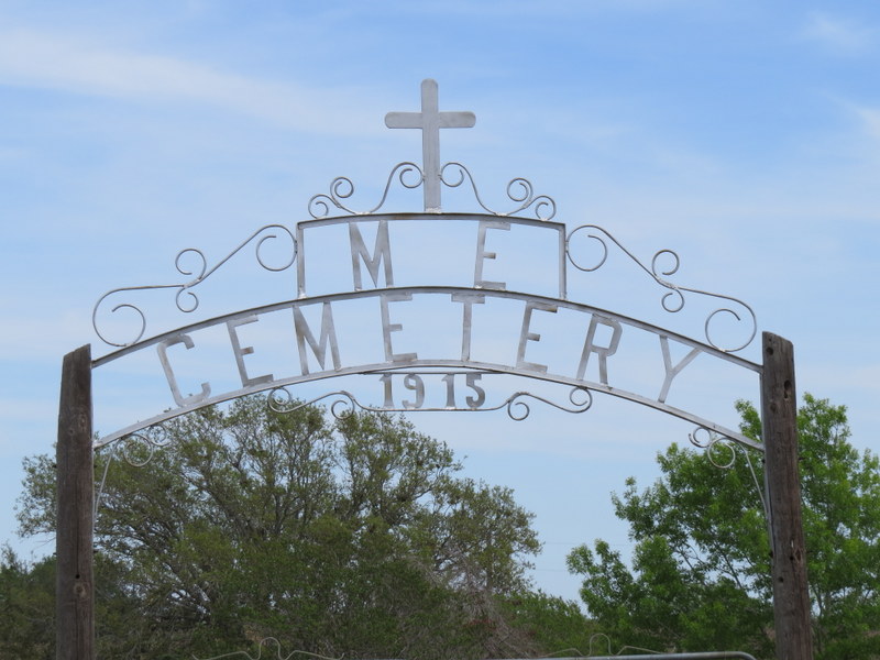
| Description | : | At the time that the cemetery was established in 1915, the church with which it is connected was the named the Monthalia Methodist Episcopal Church. The Methodist Episcopal denomination was often called by its abbreviation M. E., hence the M E Cemetery sign over the cemetery entrance. Mergers among similar denominations caused the church to become the Monthalia Methodist Church in 1939, then the Monthalia United Methodist Church in 1968. |
frequently asked questions (FAQ):
-
Where is Monthalia United Methodist Church Cemetery?
Monthalia United Methodist Church Cemetery is located at Church Road Monthalia, Gonzales County ,Texas ,USA.
-
Monthalia United Methodist Church Cemetery cemetery's updated grave count on graveviews.com?
0 memorials
-
Where are the coordinates of the Monthalia United Methodist Church Cemetery?
Latitude: 29.4358200
Longitude: -97.5877560
Nearby Cemetories:
1. Rossow Family Cemetery
Gonzales County, USA
Coordinate: 29.4209820, -97.5836710
2. Monthalia African American Cemetery
Monthalia, Gonzales County, USA
Coordinate: 29.4615840, -97.5849960
3. Monthalia Methodist Cemetery
Monthalia, Gonzales County, USA
Coordinate: 29.4640000, -97.5878200
4. Monthalia Catholic Cemetery, Mexican-American Side
Gonzales County, USA
Coordinate: 29.4638630, -97.5928890
5. Oso Cemetery
Gonzales County, USA
Coordinate: 29.4246998, -97.5569000
6. Monthalia Catholic Cemetery
Monthalia, Gonzales County, USA
Coordinate: 29.4648000, -97.5926430
7. Shuler Cemetery
Gonzales County, USA
Coordinate: 29.4675360, -97.5689110
8. Monthalia Lutheran Cemetery
Monthalia, Gonzales County, USA
Coordinate: 29.4683640, -97.6064700
9. Liberty Cemetery
Gonzales County, USA
Coordinate: 29.4316998, -97.6374969
10. Dikes Family Cemetery
Cost, Gonzales County, USA
Coordinate: 29.4436530, -97.5227330
11. Stroman Cemetery
Gonzales County, USA
Coordinate: 29.4547005, -97.6603012
12. King Cemetery
Oak Forest, Gonzales County, USA
Coordinate: 29.5044003, -97.5971985
13. Wrightsboro Latin American Cemetery
Wrightsboro, Gonzales County, USA
Coordinate: 29.3680030, -97.5664140
14. Wrightsboro Cemetery
Wrightsboro, Gonzales County, USA
Coordinate: 29.3675560, -97.5667530
15. Pecan Branch - Smith Cemetery
Gonzales, Gonzales County, USA
Coordinate: 29.4841995, -97.5252991
16. Holmes Cemetery
Gonzales County, USA
Coordinate: 29.4293995, -97.6746979
17. Hodge Cemetery
Gonzales County, USA
Coordinate: 29.5083008, -97.5578003
18. Floyd Chapel Cemetery
Wrightsboro, Gonzales County, USA
Coordinate: 29.3941708, -97.5086136
19. Foster Cemetery
Gonzales County, USA
Coordinate: 29.5160999, -97.6102982
20. Dickinson Cemetery
Gonzales County, USA
Coordinate: 29.5096380, -97.6348330
21. Askey Cemetery
Gonzales, Gonzales County, USA
Coordinate: 29.4477760, -97.4847550
22. Ellis-Nance Cemetery
Gonzales County, USA
Coordinate: 29.4652996, -97.6868973
23. Randle Cemetery
Oak Forest, Gonzales County, USA
Coordinate: 29.5293999, -97.5742035
24. Allen Family Cemetery
Belmont, Gonzales County, USA
Coordinate: 29.5104340, -97.6599060

