
| Memorials | : | 0 |
| Location | : | Gonzales, Gonzales County, USA |
| Coordinate | : | 29.4841995, -97.5252991 |
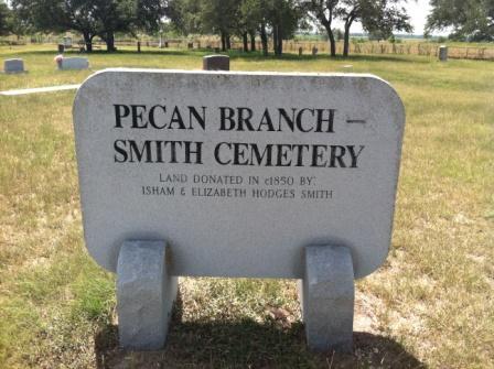
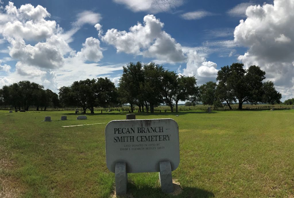
| Description | : | This small cemetery is located about 5.5 miles WSW of the City of Gonzales on the west side of Pecan Branch (stream). The cemetery sign states that the land for the cemetery was donated in 1850 by Isham and Elizabeth Hodges Smith. |
frequently asked questions (FAQ):
-
Where is Pecan Branch - Smith Cemetery?
Pecan Branch - Smith Cemetery is located at Gonzales, Gonzales County ,Texas ,USA.
-
Pecan Branch - Smith Cemetery cemetery's updated grave count on graveviews.com?
0 memorials
-
Where are the coordinates of the Pecan Branch - Smith Cemetery?
Latitude: 29.4841995
Longitude: -97.5252991
Nearby Cemetories:
1. Hodge Cemetery
Gonzales County, USA
Coordinate: 29.5083008, -97.5578003
2. Hodges Family Cemetery
Gonzales, Gonzales County, USA
Coordinate: 29.4820080, -97.4801450
3. Dikes Family Cemetery
Cost, Gonzales County, USA
Coordinate: 29.4436530, -97.5227330
4. Shuler Cemetery
Gonzales County, USA
Coordinate: 29.4675360, -97.5689110
5. Greenwood Cemetery
Gonzales, Gonzales County, USA
Coordinate: 29.5317001, -97.5302963
6. Askey Cemetery
Gonzales, Gonzales County, USA
Coordinate: 29.4477760, -97.4847550
7. Monthalia African American Cemetery
Monthalia, Gonzales County, USA
Coordinate: 29.4615840, -97.5849960
8. Monthalia Methodist Cemetery
Monthalia, Gonzales County, USA
Coordinate: 29.4640000, -97.5878200
9. Princeville Cemetery
Gonzales County, USA
Coordinate: 29.5442009, -97.5361023
10. Gonzales Jewish Cemetery
Gonzales, Gonzales County, USA
Coordinate: 29.5110540, -97.4614160
11. Monthalia Catholic Cemetery
Monthalia, Gonzales County, USA
Coordinate: 29.4648000, -97.5926430
12. Randle Cemetery
Oak Forest, Gonzales County, USA
Coordinate: 29.5293999, -97.5742035
13. Monthalia Catholic Cemetery, Mexican-American Side
Gonzales County, USA
Coordinate: 29.4638630, -97.5928890
14. Odd Fellows Cemetery
Gonzales, Gonzales County, USA
Coordinate: 29.5106201, -97.4592209
15. Gonzales Masonic Cemetery
Gonzales, Gonzales County, USA
Coordinate: 29.5088700, -97.4582600
16. Oso Cemetery
Gonzales County, USA
Coordinate: 29.4246998, -97.5569000
17. King Cemetery
Oak Forest, Gonzales County, USA
Coordinate: 29.5044003, -97.5971985
18. DeWitt Cemetery
Gonzales County, USA
Coordinate: 29.4743996, -97.4475021
19. Gonzales City Cemetery
Gonzales, Gonzales County, USA
Coordinate: 29.5100900, -97.4512202
20. Old 1825 Cemetery Square
Gonzales County, USA
Coordinate: 29.5020510, -97.4478870
21. Gonzales City Cemetery Church St Section
Gonzales, Gonzales County, USA
Coordinate: 29.5104000, -97.4485000
22. Monthalia Lutheran Cemetery
Monthalia, Gonzales County, USA
Coordinate: 29.4683640, -97.6064700
23. Monthalia United Methodist Church Cemetery
Monthalia, Gonzales County, USA
Coordinate: 29.4358200, -97.5877560
24. Hood Point Negro Cemetery
Gonzales, Gonzales County, USA
Coordinate: 29.5392140, -97.5814860