
| Memorials | : | 0 |
| Location | : | Carey, Greene County, USA |
| Phone | : | (706) 453-7668 |
| Coordinate | : | 33.5339600, -83.2522600 |
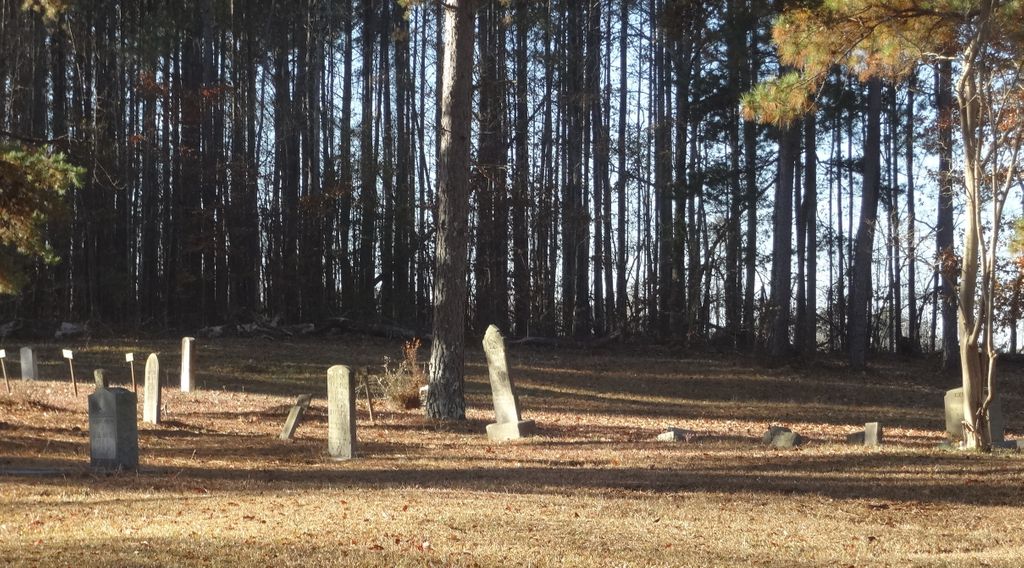
| Description | : | At the intersection of GA-44, and Carey Station Road, travel north northwest on Carey Station Road for 3.9 miles. Church on the left with cemetery to the front left of the church. As of Dec 2014, all headstones, markers, and monuments have been photographed. At that time there were, at a minimum, 50 unmarked graves indicated by either a slab, field stone, or sunken ground and another three no longer readable. |
frequently asked questions (FAQ):
-
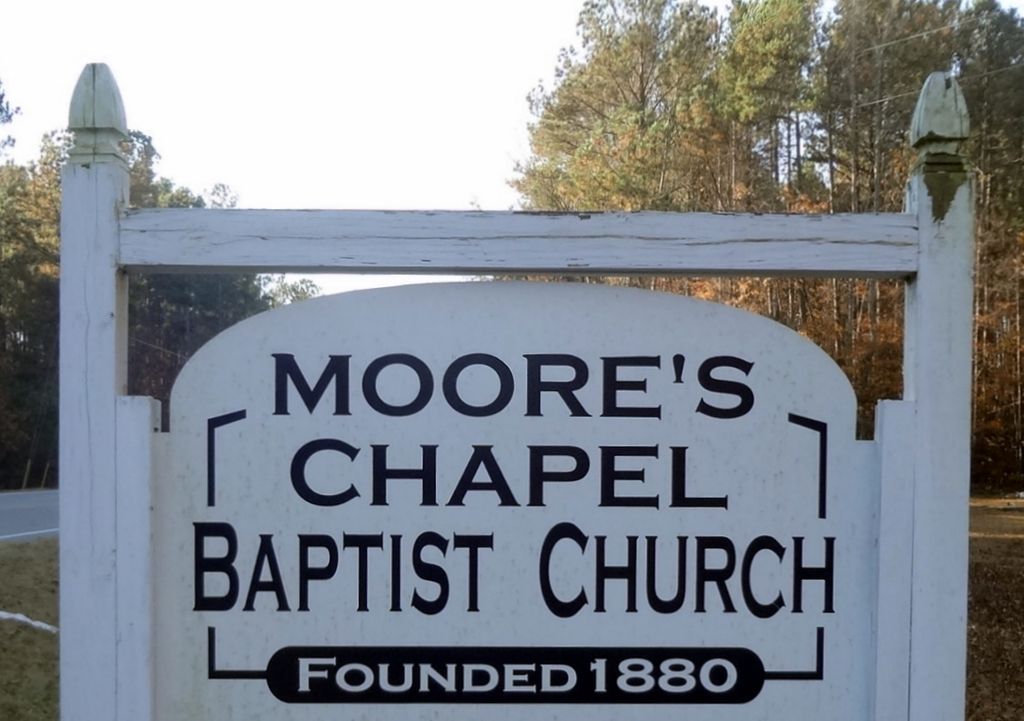
Where is Moore's Chapel Baptist Church Cemetery?
Moore's Chapel Baptist Church Cemetery is located at 3171 Carey Station Road Carey, Greene County ,Georgia , 30642USA.
-
Moore's Chapel Baptist Church Cemetery cemetery's updated grave count on graveviews.com?
0 memorials
-
Where are the coordinates of the Moore's Chapel Baptist Church Cemetery?
Latitude: 33.5339600
Longitude: -83.2522600

Nearby Cemetories:
1. Perdue-Cary Family Cemetery
Carey, Greene County, USA
Coordinate: 33.5327000, -83.2520800
2. Ridge Grove Cemetery
Greensboro, Greene County, USA
Coordinate: 33.5062900, -83.2478100
3. Ayers Cemetery
Greene County, USA
Coordinate: 33.5056000, -83.2481003
4. Park Cemetery
Carey, Greene County, USA
Coordinate: 33.4990150, -83.2761310
5. Zion Wrightsville Baptist Church Cemetery
Greensboro, Greene County, USA
Coordinate: 33.5011900, -83.2195700
6. Mount Calvary Baptist Church Cemetery
Greensboro, Greene County, USA
Coordinate: 33.4754074, -83.2462711
7. Walker United Methodist Church Cemetery
Veazey, Greene County, USA
Coordinate: 33.5084627, -83.1868244
8. Hutchinson Grove AME Church Cemetery
Veazey, Greene County, USA
Coordinate: 33.5043900, -83.1874800
9. Antioch Baptist Church Cemetery
Greensboro, Greene County, USA
Coordinate: 33.5967400, -83.2454700
10. Canaan Cemetery
Greensboro, Greene County, USA
Coordinate: 33.5686603, -83.1760200
11. Episcopal Church of the Redeemer
Greensboro, Greene County, USA
Coordinate: 33.5785570, -83.1821790
12. Rock Chapel Cemetery
Greensboro, Greene County, USA
Coordinate: 33.5804051, -83.1818232
13. Greenview Cemetery
Greensboro, Greene County, USA
Coordinate: 33.5829300, -83.1826400
14. Greensboro City Cemetery
Greensboro, Greene County, USA
Coordinate: 33.5814110, -83.1808380
15. Oliver Bryan Family Cemetery
Greensboro, Greene County, USA
Coordinate: 33.4591100, -83.1886400
16. New Bethel Church at Leslie Mill Cemetery
Veazey, Greene County, USA
Coordinate: 33.5055400, -83.1472000
17. Fork Chapel United Methodist Church Cemetery
Greshamville, Greene County, USA
Coordinate: 33.6116700, -83.3169400
18. Ward Cemetery
Greensboro, Greene County, USA
Coordinate: 33.4417800, -83.2264600
19. Old Salem Cemetery
Greene County, USA
Coordinate: 33.4415000, -83.2260600
20. Riley Shoals Cemetery
Greensboro, Greene County, USA
Coordinate: 33.4413200, -83.2254600
21. Chambers Cemetery
Greensboro, Greene County, USA
Coordinate: 33.4408400, -83.2267500
22. Rowland Family Cemetery
Mosquito Crossing, Greene County, USA
Coordinate: 33.4786100, -83.1501800
23. McWhorter Cemetery
Greene County, USA
Coordinate: 33.6296997, -83.3086014
24. Wesley Chapel Cemetery
Greensboro, Greene County, USA
Coordinate: 33.5601840, -83.1247840