
| Memorials | : | 0 |
| Location | : | Greensboro, Greene County, USA |
| Coordinate | : | 33.4754074, -83.2462711 |
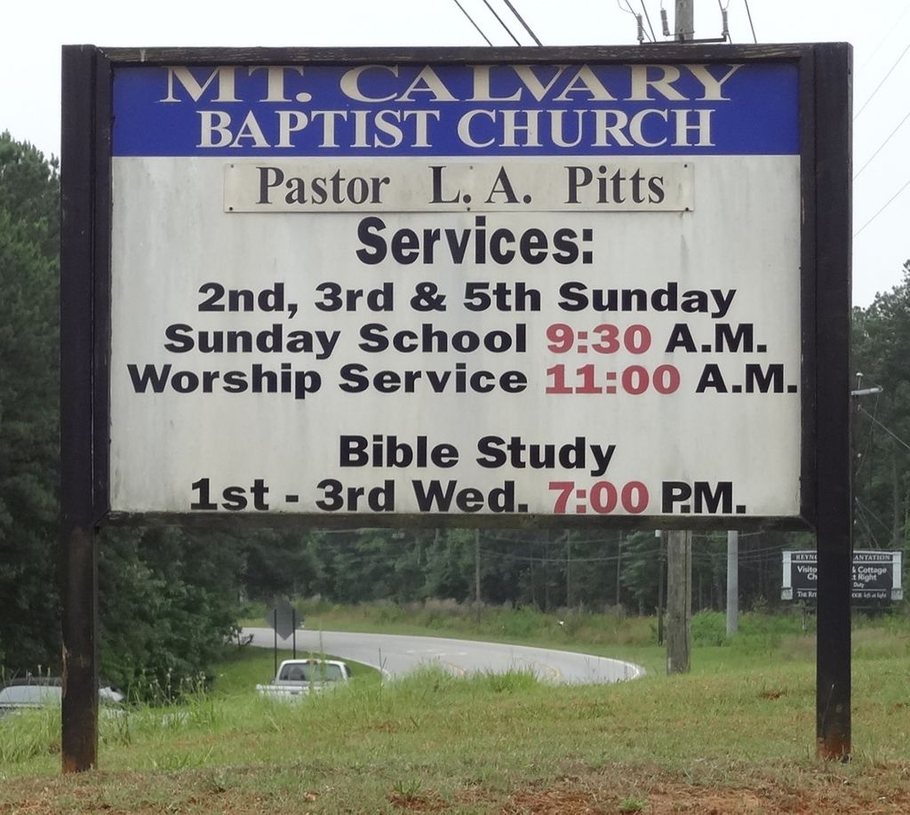
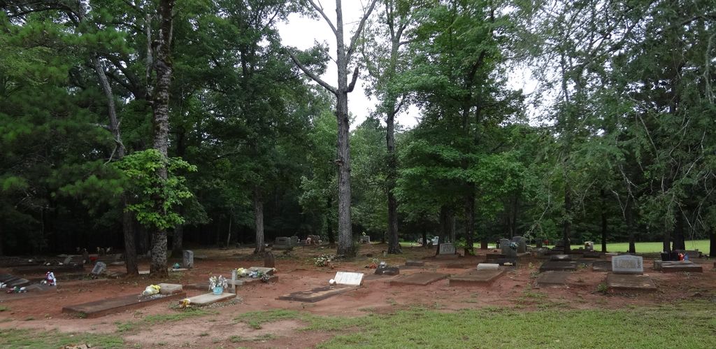
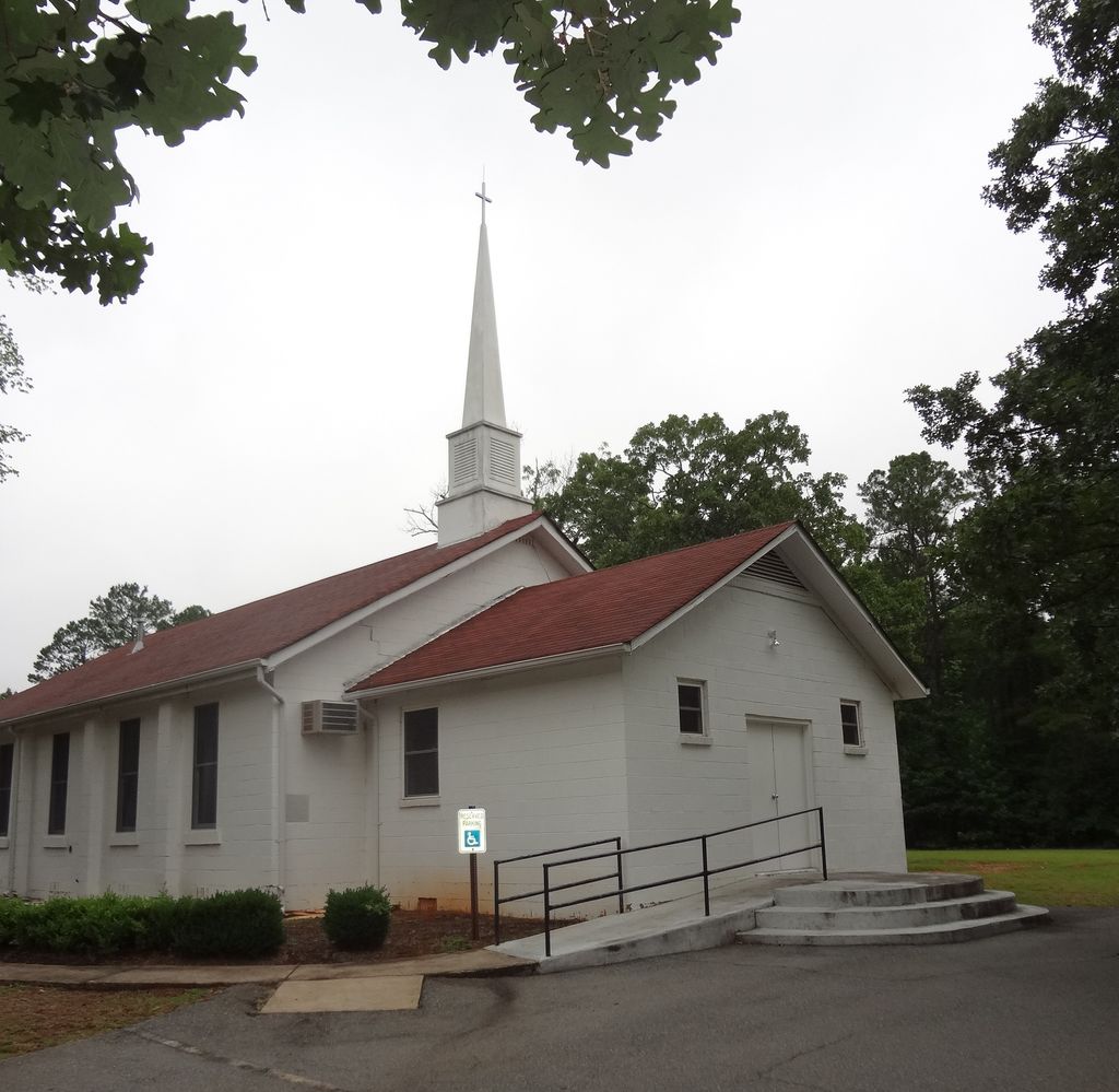
| Description | : | At the intersection of I-20 and GA-44, travel southwest on GA-44 for 5.9 miles. Turn right into church driveway. Cemetery to left rear of church. As of Jun 2013, all headstones, markers, and monuments have been photographed. At that time there were, at a minimum, 23 unmarked graves by either a slab, field stone, or sunken ground and another three that are no longer readable. |
frequently asked questions (FAQ):
-
Where is Mount Calvary Baptist Church Cemetery?
Mount Calvary Baptist Church Cemetery is located at Greensboro, Greene County ,Georgia ,USA.
-
Mount Calvary Baptist Church Cemetery cemetery's updated grave count on graveviews.com?
0 memorials
-
Where are the coordinates of the Mount Calvary Baptist Church Cemetery?
Latitude: 33.4754074
Longitude: -83.2462711
Nearby Cemetories:
1. Ayers Cemetery
Greene County, USA
Coordinate: 33.5056000, -83.2481003
2. Ridge Grove Cemetery
Greensboro, Greene County, USA
Coordinate: 33.5062900, -83.2478100
3. Zion Wrightsville Baptist Church Cemetery
Greensboro, Greene County, USA
Coordinate: 33.5011900, -83.2195700
4. Park Cemetery
Carey, Greene County, USA
Coordinate: 33.4990150, -83.2761310
5. Ward Cemetery
Greensboro, Greene County, USA
Coordinate: 33.4417800, -83.2264600
6. Old Salem Cemetery
Greene County, USA
Coordinate: 33.4415000, -83.2260600
7. Chambers Cemetery
Greensboro, Greene County, USA
Coordinate: 33.4408400, -83.2267500
8. Riley Shoals Cemetery
Greensboro, Greene County, USA
Coordinate: 33.4413200, -83.2254600
9. Oliver Bryan Family Cemetery
Greensboro, Greene County, USA
Coordinate: 33.4591100, -83.1886400
10. Hutchinson Grove AME Church Cemetery
Veazey, Greene County, USA
Coordinate: 33.5043900, -83.1874800
11. Perdue-Cary Family Cemetery
Carey, Greene County, USA
Coordinate: 33.5327000, -83.2520800
12. Moore's Chapel Baptist Church Cemetery
Carey, Greene County, USA
Coordinate: 33.5339600, -83.2522600
13. Walker United Methodist Church Cemetery
Veazey, Greene County, USA
Coordinate: 33.5084627, -83.1868244
14. Hendricks Cemetery
Greene County, USA
Coordinate: 33.4216995, -83.2108002
15. Cimitero Comunale di Armea
San Remo, Provincia di Imperia, Italy
Coordinate: 33.4048639, -83.2892222
16. Rowland Family Cemetery
Mosquito Crossing, Greene County, USA
Coordinate: 33.4786100, -83.1501800
17. Flat Rock Baptist Church Cemetery
White Plains, Greene County, USA
Coordinate: 33.4212445, -83.1668226
18. New Bethel Church at Leslie Mill Cemetery
Veazey, Greene County, USA
Coordinate: 33.5055400, -83.1472000
19. Smith Credille Cemetery
Liberty, Greene County, USA
Coordinate: 33.4606000, -83.1381000
20. Lawrence Family Cemetery
Mosquito Crossing, Greene County, USA
Coordinate: 33.4606700, -83.1379700
21. Kimbrough Family Cemetery
Liberty, Greene County, USA
Coordinate: 33.4143600, -83.1629100
22. Liberty United Methodist Church Cemetery
White Plains, Greene County, USA
Coordinate: 33.4357810, -83.1413080
23. Copelan-Credille Family Cemetery
Mosquito Crossing, Greene County, USA
Coordinate: 33.4520000, -83.1339700
24. Liberty Chapel Cemetery
White Plains, Greene County, USA
Coordinate: 33.4358000, -83.1407000