
| Memorials | : | 0 |
| Location | : | Greensboro, Greene County, USA |
| Coordinate | : | 33.5011900, -83.2195700 |
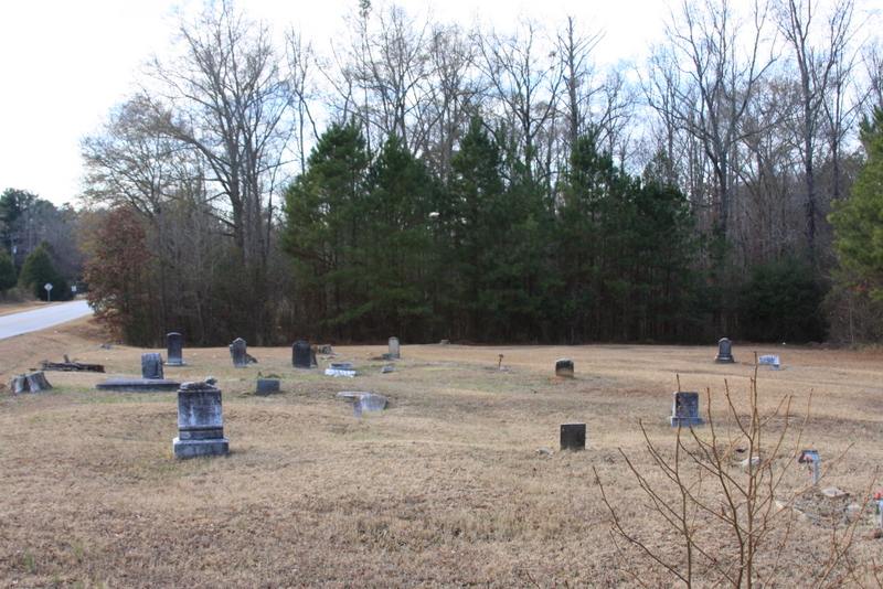
| Description | : | At the intersection of GA-44 and Richland Connector, travel east on Richland Connector for .3 miles. Turn left on Wrightsville Church Road and travel north for .2 miles. Turn left on the old Wrightsville Church Road and travel 85 yards. Cemetery on both left and right side of road. As of Jun 2013, all headstones, markers, and monuments have been photographed. At that time there were, at a minimum, 39 unmarked graves by either a slab, field stone, or sunken ground and another six that are no longer readable. |
frequently asked questions (FAQ):
-
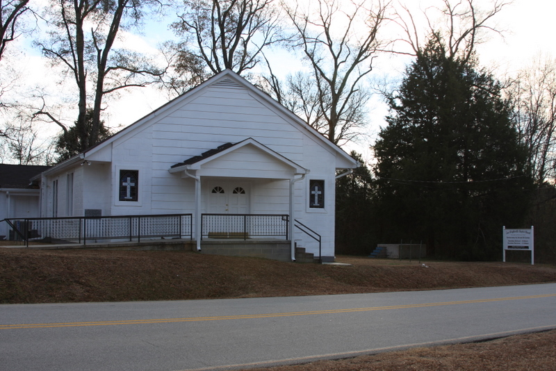
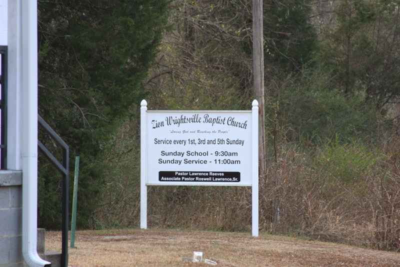
Where is Zion Wrightsville Baptist Church Cemetery?
Zion Wrightsville Baptist Church Cemetery is located at Greensboro, Greene County ,Georgia ,USA.
-
Zion Wrightsville Baptist Church Cemetery cemetery's updated grave count on graveviews.com?
0 memorials
-
Where are the coordinates of the Zion Wrightsville Baptist Church Cemetery?
Latitude: 33.5011900
Longitude: -83.2195700
Nearby Cemetories:
1. Ridge Grove Cemetery
Greensboro, Greene County, USA
Coordinate: 33.5062900, -83.2478100
2. Ayers Cemetery
Greene County, USA
Coordinate: 33.5056000, -83.2481003
3. Hutchinson Grove AME Church Cemetery
Veazey, Greene County, USA
Coordinate: 33.5043900, -83.1874800
4. Walker United Methodist Church Cemetery
Veazey, Greene County, USA
Coordinate: 33.5084627, -83.1868244
5. Mount Calvary Baptist Church Cemetery
Greensboro, Greene County, USA
Coordinate: 33.4754074, -83.2462711
6. Perdue-Cary Family Cemetery
Carey, Greene County, USA
Coordinate: 33.5327000, -83.2520800
7. Moore's Chapel Baptist Church Cemetery
Carey, Greene County, USA
Coordinate: 33.5339600, -83.2522600
8. Park Cemetery
Carey, Greene County, USA
Coordinate: 33.4990150, -83.2761310
9. Oliver Bryan Family Cemetery
Greensboro, Greene County, USA
Coordinate: 33.4591100, -83.1886400
10. Ward Cemetery
Greensboro, Greene County, USA
Coordinate: 33.4417800, -83.2264600
11. Old Salem Cemetery
Greene County, USA
Coordinate: 33.4415000, -83.2260600
12. Riley Shoals Cemetery
Greensboro, Greene County, USA
Coordinate: 33.4413200, -83.2254600
13. New Bethel Church at Leslie Mill Cemetery
Veazey, Greene County, USA
Coordinate: 33.5055400, -83.1472000
14. Chambers Cemetery
Greensboro, Greene County, USA
Coordinate: 33.4408400, -83.2267500
15. Rowland Family Cemetery
Mosquito Crossing, Greene County, USA
Coordinate: 33.4786100, -83.1501800
16. Canaan Cemetery
Greensboro, Greene County, USA
Coordinate: 33.5686603, -83.1760200
17. Smith Credille Cemetery
Liberty, Greene County, USA
Coordinate: 33.4606000, -83.1381000
18. Lawrence Family Cemetery
Mosquito Crossing, Greene County, USA
Coordinate: 33.4606700, -83.1379700
19. Hendricks Cemetery
Greene County, USA
Coordinate: 33.4216995, -83.2108002
20. Episcopal Church of the Redeemer
Greensboro, Greene County, USA
Coordinate: 33.5785570, -83.1821790
21. O'Neal Cemetery
Siloam, Greene County, USA
Coordinate: 33.5203018, -83.1213989
22. Rock Chapel Cemetery
Greensboro, Greene County, USA
Coordinate: 33.5804051, -83.1818232
23. Greensboro City Cemetery
Greensboro, Greene County, USA
Coordinate: 33.5814110, -83.1808380
24. Copelan-Credille Family Cemetery
Mosquito Crossing, Greene County, USA
Coordinate: 33.4520000, -83.1339700