
| Memorials | : | 7 |
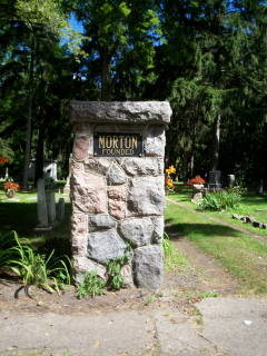
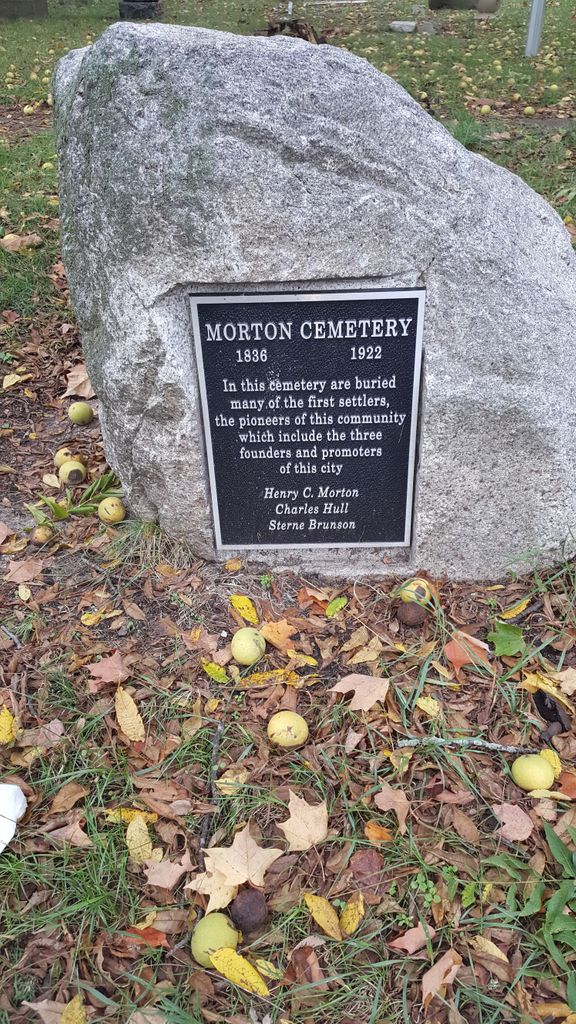
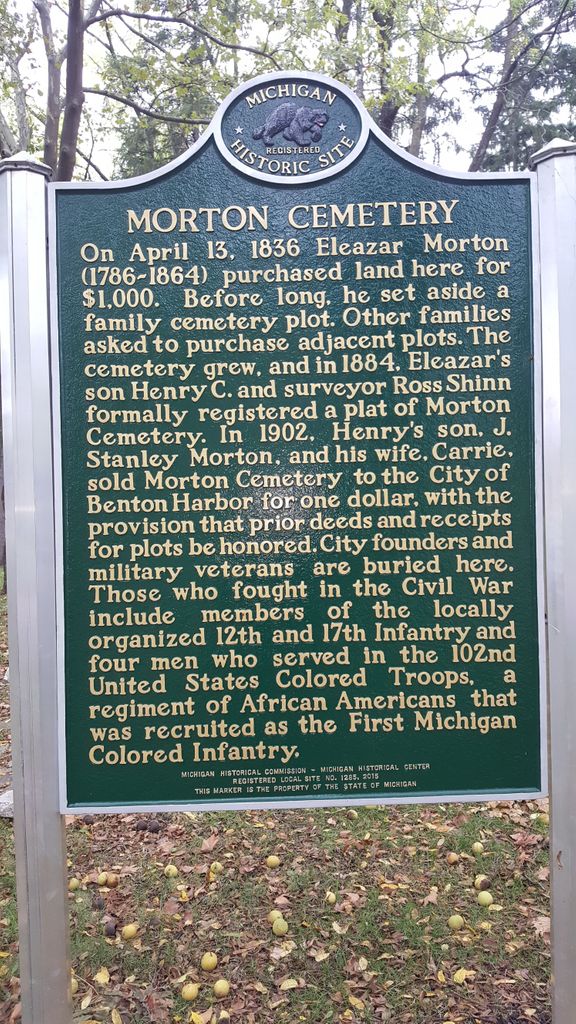
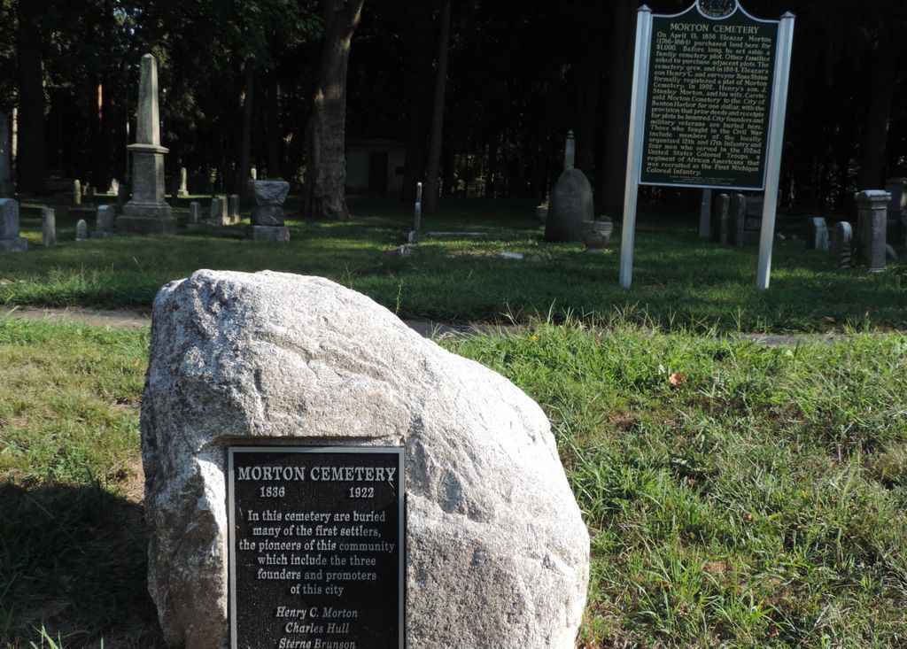
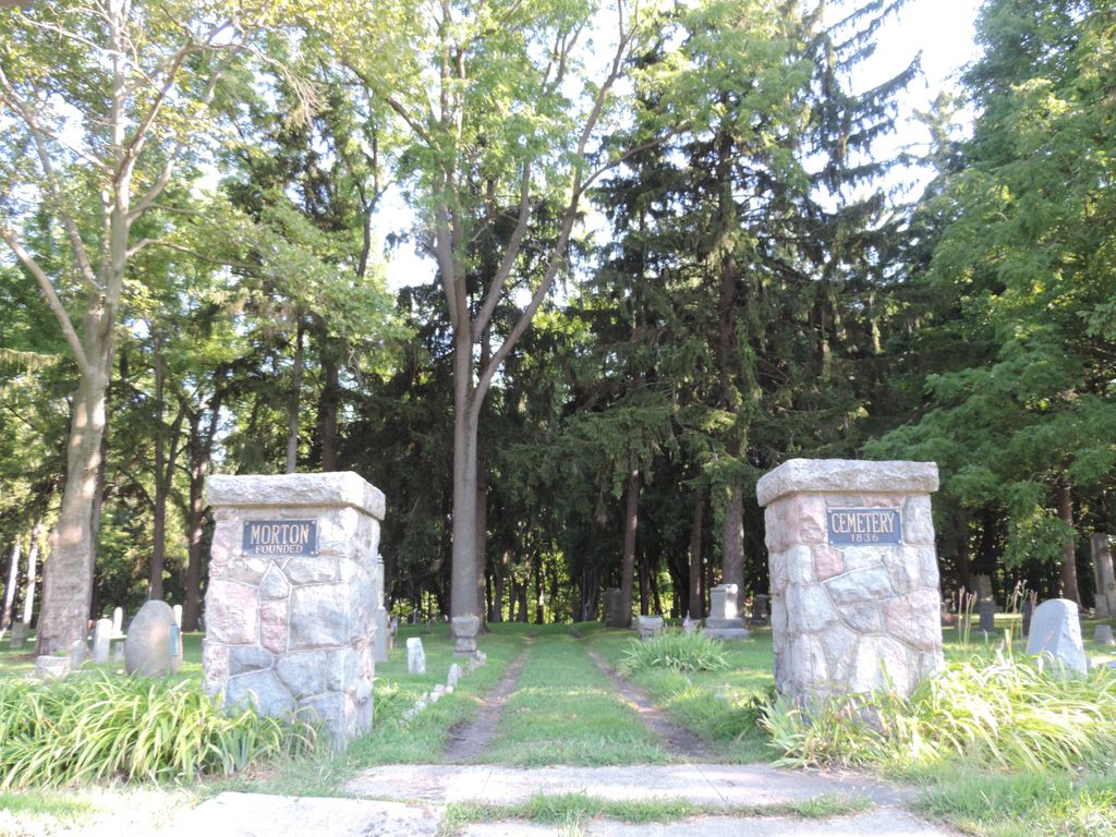
| Location | : | Benton Harbor, Berrien County, USA |
| Coordinate | : | 42.1194000, -86.4417038 |
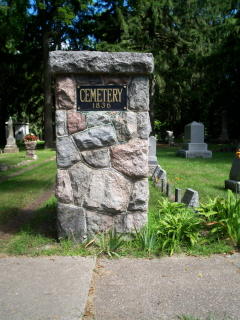
| Description | : | The U.S. Geological Survey (USGS) Geographic Names Information System (GNIS) feature ID for the cemetery is 632738 (Morton Cemetery / Morton Hill Cemetery). |
frequently asked questions (FAQ):
-
Where is Morton Hill Cemetery?
Morton Hill Cemetery is located at Territorial Road Benton Harbor, Berrien County ,Michigan , 49022USA.
-
Morton Hill Cemetery cemetery's updated grave count on graveviews.com?
7 memorials
-
Where are the coordinates of the Morton Hill Cemetery?
Latitude: 42.1194000
Longitude: -86.4417038
Nearby Cemetories:
1. B'nai Sholom Cemetery
Fair Plain, Berrien County, USA
Coordinate: 42.0938988, -86.4163971
2. Calvary Cemetery
Benton Harbor, Berrien County, USA
Coordinate: 42.0901820, -86.4196160
3. Crystal Springs Cemetery
Benton Harbor, Berrien County, USA
Coordinate: 42.0918999, -86.4150009
4. Temple Beth El Memorial Park
Berrien County, USA
Coordinate: 42.0908660, -86.4154530
5. First Congregational Church UCC Memorial Garden
Saint Joseph, Berrien County, USA
Coordinate: 42.0949790, -86.4842940
6. Saint Joseph City Cemetery
Saint Joseph, Berrien County, USA
Coordinate: 42.0960090, -86.4905980
7. Resurrection Cemetery
Saint Joseph, Berrien County, USA
Coordinate: 42.0975800, -86.4920883
8. Lake Shore Cemetery
Riverside, Berrien County, USA
Coordinate: 42.1669388, -86.4177780
9. Saint Joseph First UMC Memorial Garden
Saint Joseph, Berrien County, USA
Coordinate: 42.0810930, -86.4909620
10. Riverview Cemetery
Saint Joseph, Berrien County, USA
Coordinate: 42.0657997, -86.4657974
11. Bethel Cemetery
Sodus, Berrien County, USA
Coordinate: 42.0652770, -86.4013880
12. Pearl Cemetery
Benton Township, Berrien County, USA
Coordinate: 42.0905991, -86.3641968
13. Highland Cemetery
Saint Joseph, Berrien County, USA
Coordinate: 42.0650980, -86.4987150
14. Millburg Cemetery
Millburg, Berrien County, USA
Coordinate: 42.1264000, -86.3486023
15. Spring Run Cemetery
Scottdale, Berrien County, USA
Coordinate: 42.0407600, -86.4348526
16. Hickory Bluff Cemetery
Stevensville, Berrien County, USA
Coordinate: 42.0398670, -86.4952000
17. Boyer Cemetery
Bainbridge Center, Berrien County, USA
Coordinate: 42.1572222, -86.3305556
18. North Shore Memory Gardens
Coloma, Berrien County, USA
Coordinate: 42.2024994, -86.3908005
19. Curtis Cemetery
Hagar Township, Berrien County, USA
Coordinate: 42.1856003, -86.3544006
20. Jerome Cemetery
Saint Joseph, Berrien County, USA
Coordinate: 42.0302699, -86.4758279
21. Brant Cemetery
Bainbridge Township, Berrien County, USA
Coordinate: 42.0866000, -86.3197000
22. Kniebes Cemetery
Coloma, Berrien County, USA
Coordinate: 42.1511002, -86.3071976
23. Lincoln Charter Township Cemetery
Stevensville, Berrien County, USA
Coordinate: 42.0271490, -86.5139110
24. Royalton Cemetery
Saint Joseph, Berrien County, USA
Coordinate: 42.0094365, -86.4249946