
| Memorials | : | 187 |
| Location | : | Riverside, Berrien County, USA |
| Coordinate | : | 42.1669388, -86.4177780 |
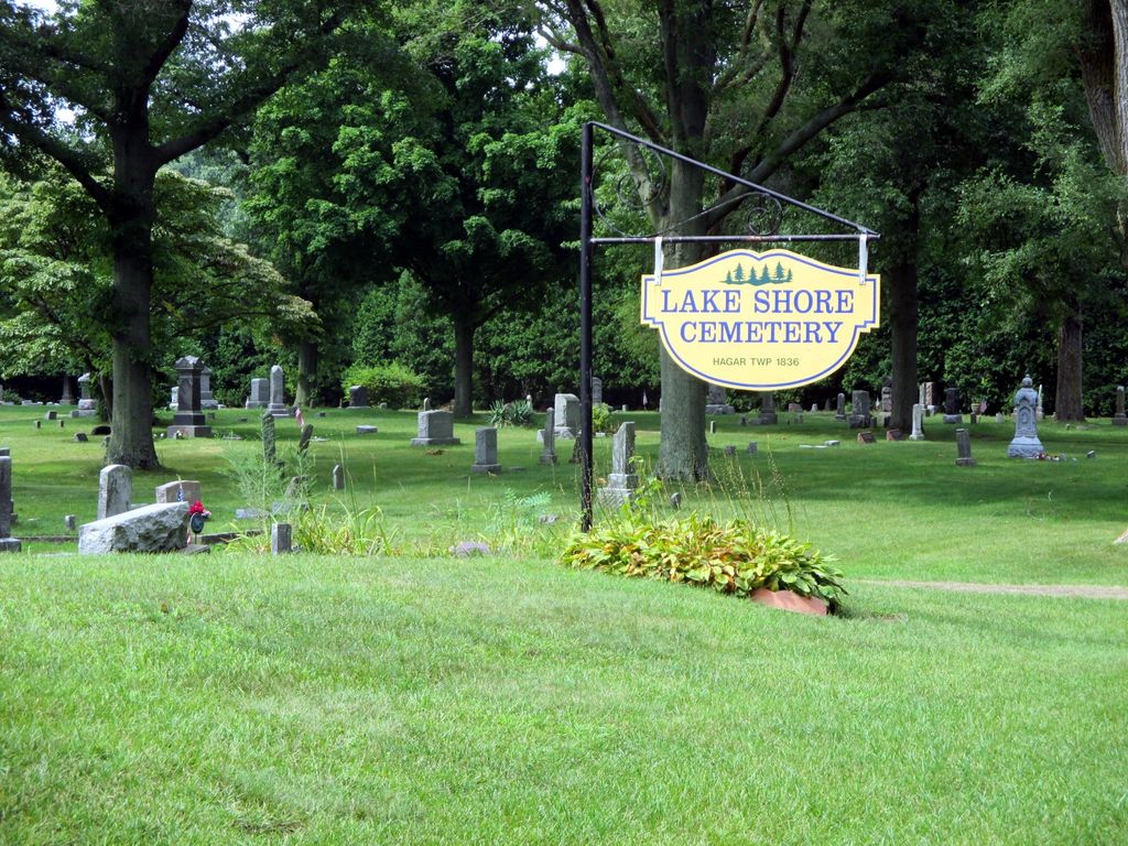
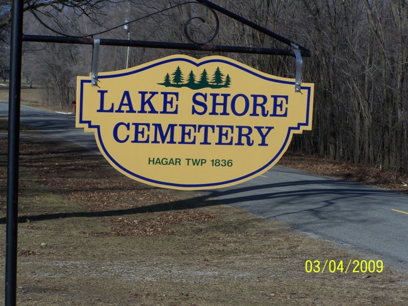
| Description | : | The cemetery is located on the east side of Eaman Road about 0.2 miles north of its intersection with Maple Lane. The U.S. Geological Survey (USGS) Geographic Names Information System (GNIS) feature ID for the cemetery is 1852395 (Lake Shore Cemetery / Hagar Township Cemetery / Lakeshore Cemetery). |
frequently asked questions (FAQ):
-
Where is Lake Shore Cemetery?
Lake Shore Cemetery is located at Eaman Road Riverside, Berrien County ,Michigan , 49022USA.
-
Lake Shore Cemetery cemetery's updated grave count on graveviews.com?
184 memorials
-
Where are the coordinates of the Lake Shore Cemetery?
Latitude: 42.1669388
Longitude: -86.4177780
Nearby Cemetories:
1. North Shore Memory Gardens
Coloma, Berrien County, USA
Coordinate: 42.2024994, -86.3908005
2. Curtis Cemetery
Hagar Township, Berrien County, USA
Coordinate: 42.1856003, -86.3544006
3. Morton Hill Cemetery
Benton Harbor, Berrien County, USA
Coordinate: 42.1194000, -86.4417038
4. Millburg Cemetery
Millburg, Berrien County, USA
Coordinate: 42.1264000, -86.3486023
5. Boyer Cemetery
Bainbridge Center, Berrien County, USA
Coordinate: 42.1572222, -86.3305556
6. Harris Cemetery
Lake Michigan Beach, Berrien County, USA
Coordinate: 42.2144012, -86.3482971
7. B'nai Sholom Cemetery
Fair Plain, Berrien County, USA
Coordinate: 42.0938988, -86.4163971
8. Crystal Springs Cemetery
Benton Harbor, Berrien County, USA
Coordinate: 42.0918999, -86.4150009
9. Temple Beth El Memorial Park
Berrien County, USA
Coordinate: 42.0908660, -86.4154530
10. Calvary Cemetery
Benton Harbor, Berrien County, USA
Coordinate: 42.0901820, -86.4196160
11. Coloma Cemetery
Coloma, Berrien County, USA
Coordinate: 42.1860008, -86.3119965
12. Kniebes Cemetery
Coloma, Berrien County, USA
Coordinate: 42.1511002, -86.3071976
13. Pearl Cemetery
Benton Township, Berrien County, USA
Coordinate: 42.0905991, -86.3641968
14. First Congregational Church UCC Memorial Garden
Saint Joseph, Berrien County, USA
Coordinate: 42.0949790, -86.4842940
15. Resurrection Cemetery
Saint Joseph, Berrien County, USA
Coordinate: 42.0975800, -86.4920883
16. Saint Joseph City Cemetery
Saint Joseph, Berrien County, USA
Coordinate: 42.0960090, -86.4905980
17. Baptist Cemetery
Bainbridge Center, Berrien County, USA
Coordinate: 42.1455600, -86.2947300
18. Saint Marys Catholic Church Cemetery
Watervliet, Berrien County, USA
Coordinate: 42.1450000, -86.2916670
19. Saint Joseph First UMC Memorial Garden
Saint Joseph, Berrien County, USA
Coordinate: 42.0810930, -86.4909620
20. Bethel Cemetery
Sodus, Berrien County, USA
Coordinate: 42.0652770, -86.4013880
21. Saint Pauls United Church of Christ Cemetery
Watervliet, Berrien County, USA
Coordinate: 42.1447222, -86.2819444
22. New Hope United Methodist Church Cemetery
Bainbridge Center, Berrien County, USA
Coordinate: 42.1380530, -86.2812620
23. Riverview Cemetery
Saint Joseph, Berrien County, USA
Coordinate: 42.0657997, -86.4657974
24. Brant Cemetery
Bainbridge Township, Berrien County, USA
Coordinate: 42.0866000, -86.3197000