
| Memorials | : | 0 |
| Location | : | Cedar County, USA |
| Coordinate | : | 37.6076813, -93.7407074 |
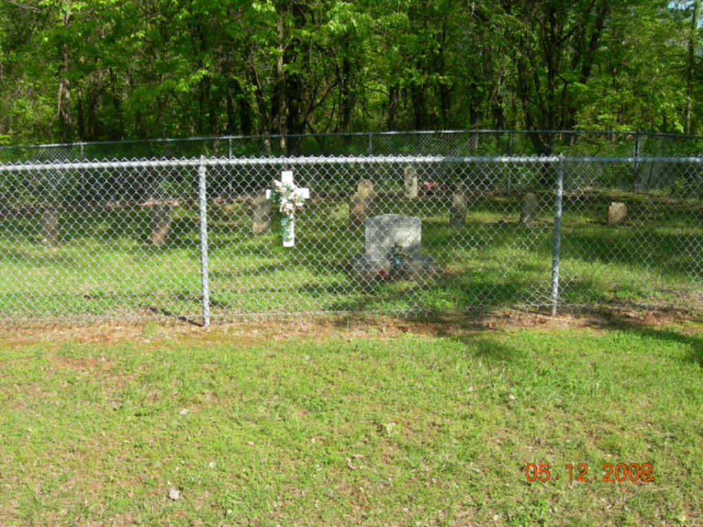
| Description | : | This cemetery has been relocated into the Stockton Lake State Park. There are nine old tombstones without names or dates. |
frequently asked questions (FAQ):
-
Where is Mount Carmel-OBryant Cemetery?
Mount Carmel-OBryant Cemetery is located at Cedar County ,Missouri ,USA.
-
Mount Carmel-OBryant Cemetery cemetery's updated grave count on graveviews.com?
0 memorials
-
Where are the coordinates of the Mount Carmel-OBryant Cemetery?
Latitude: 37.6076813
Longitude: -93.7407074
Nearby Cemetories:
1. Kington Family Cemetery
Umber, Cedar County, USA
Coordinate: 37.6125470, -93.7478150
2. Prebellum Cemetery
Cane Hill, Cedar County, USA
Coordinate: 37.5993090, -93.7541490
3. Montgomery Cemetery
Cane Hill, Cedar County, USA
Coordinate: 37.5964200, -93.7595000
4. Gordon Cemetery
Cedar County, USA
Coordinate: 37.6253014, -93.7556000
5. Dale Cemetery
Cane Hill, Cedar County, USA
Coordinate: 37.5881740, -93.7293770
6. Gothard Cemetery
Needmore, Cedar County, USA
Coordinate: 37.6242294, -93.7081375
7. Ross Cemetery
Umber View Heights, Cedar County, USA
Coordinate: 37.6105995, -93.7866974
8. Flint Hill Cemetery
Bona, Dade County, USA
Coordinate: 37.5695200, -93.7272300
9. Fullington Cemetery
Dade County, USA
Coordinate: 37.5661011, -93.7482986
10. Butler Cemetery
Cedar County, USA
Coordinate: 37.6482530, -93.7247510
11. Liberty Cemetery
Cedar County, USA
Coordinate: 37.6013985, -93.7938995
12. Thornton Cemetery (Re-Located)
Umber View Heights, Cedar County, USA
Coordinate: 37.6508390, -93.7477110
13. Crisp Cemetery
Dade County, USA
Coordinate: 37.5677986, -93.7746964
14. Hartley Cemetery
Masters, Cedar County, USA
Coordinate: 37.5993970, -93.6678040
15. Miller Cemetery (Re-Located)
Stockton, Cedar County, USA
Coordinate: 37.6581770, -93.7786820
16. Perkins Homestead Cemetery
Cedar County, USA
Coordinate: 37.5743904, -93.6745605
17. Toliver Cemetery
Cedar County, USA
Coordinate: 37.6713715, -93.7378845
18. Mount Gilead Cemetery
Cedar County, USA
Coordinate: 37.6697578, -93.7211914
19. Fox Cemetery (Re-Located)
Crisp, Dade County, USA
Coordinate: 37.5549540, -93.7887880
20. Bald Mound Cemetery
Seybert, Dade County, USA
Coordinate: 37.5456009, -93.7656021
21. Mullen-Cooper Cemetery (Re-Located)
Stockton, Cedar County, USA
Coordinate: 37.6710410, -93.7685440
22. Lindley Family Cemetery
Bona, Dade County, USA
Coordinate: 37.5670620, -93.6703890
23. Lindley Prairie Cemetery
Bearcreek, Cedar County, USA
Coordinate: 37.6540200, -93.6740000
24. Long Cemetery
Bona, Dade County, USA
Coordinate: 37.5502586, -93.6891785