
| Memorials | : | 0 |
| Location | : | North Sandwich, Carroll County, USA |
| Coordinate | : | 43.8385671, -71.5158940 |
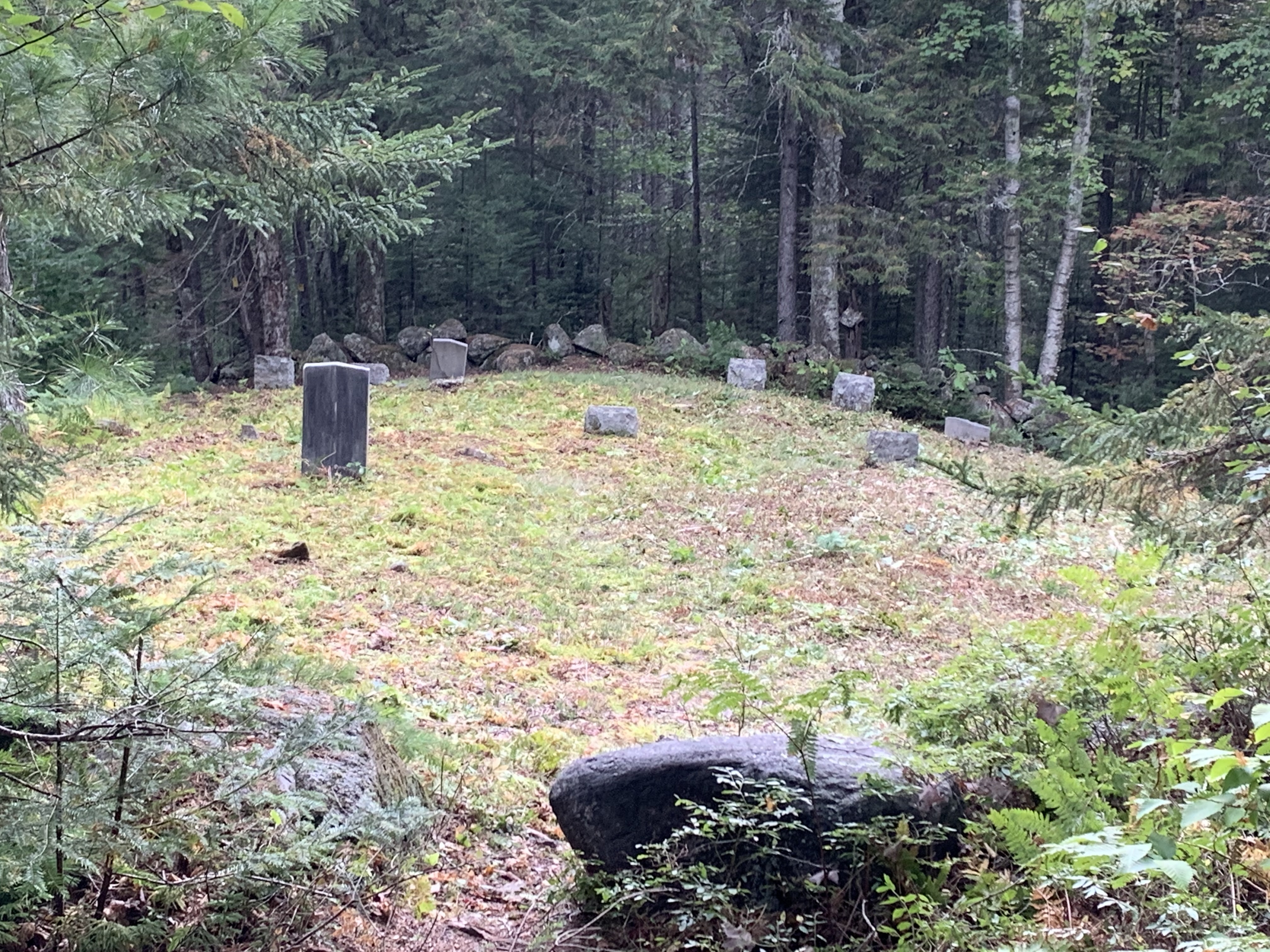
| Description | : | Small overgrown Graveyard off Sandwich Notch Road. 3.8 Miles up the road. On the left side (heading toward Waterville) 75 Yards off the road behind the clearing with the small circular turnout. |
frequently asked questions (FAQ):
-
Where is Mount Delight Burying Ground?
Mount Delight Burying Ground is located at Sandwich Notch Road North Sandwich, Carroll County ,New Hampshire ,USA.
-
Mount Delight Burying Ground cemetery's updated grave count on graveviews.com?
0 memorials
-
Where are the coordinates of the Mount Delight Burying Ground?
Latitude: 43.8385671
Longitude: -71.5158940
Nearby Cemetories:
1. Israel Gilman Cemetery
Sandwich Landing, Carroll County, USA
Coordinate: 43.8268727, -71.4757671
2. Thompson Cemetery
Sandwich, Carroll County, USA
Coordinate: 43.8014000, -71.5025000
3. Eastman Cemetery
Sandwich, Carroll County, USA
Coordinate: 43.7930300, -71.5263500
4. Chicks Corner Cemetery
Sandwich, Carroll County, USA
Coordinate: 43.8041000, -71.4728900
5. George Cemetery
Sandwich, Carroll County, USA
Coordinate: 43.7880560, -71.5338890
6. Mason Cemetery
North Sandwich, Carroll County, USA
Coordinate: 43.8542000, -71.4426000
7. Ladd Cemetery
Holderness, Grafton County, USA
Coordinate: 43.7873700, -71.5506400
8. Grove Cemetery
Sandwich, Carroll County, USA
Coordinate: 43.8101100, -71.4445200
9. True Cemetery
Holderness, Grafton County, USA
Coordinate: 43.7819440, -71.5538890
10. Baptist Burial Ground
Center Sandwich, Carroll County, USA
Coordinate: 43.8079900, -71.4392600
11. Elm Hill Cemetery
Sandwich, Carroll County, USA
Coordinate: 43.8158330, -71.4338890
12. Elm Hill Cemetery
Center Sandwich, Carroll County, USA
Coordinate: 43.8158000, -71.4336000
13. Eastern Corner Road Cemetery
Campton, Grafton County, USA
Coordinate: 43.8177540, -71.6045920
14. Burbank Foss Cemetery
Campton Lower Village, Grafton County, USA
Coordinate: 43.8955730, -71.5667000
15. Morse Cemetery
Center Sandwich, Carroll County, USA
Coordinate: 43.8534300, -71.4241600
16. Quinby Cemetery
North Sandwich, Carroll County, USA
Coordinate: 43.8433000, -71.4148000
17. Cemetery of the Religious Society of Friends
Sandwich, Carroll County, USA
Coordinate: 43.7994400, -71.4266700
18. Packard Graveyard
Thornton, Grafton County, USA
Coordinate: 43.8971540, -71.5845930
19. Mad River Cemetery
Thornton, Grafton County, USA
Coordinate: 43.8833670, -71.6077500
20. Beede Cemetery
Sandwich, Carroll County, USA
Coordinate: 43.8013890, -71.4166670
21. Mason Cemetery
Center Sandwich, Carroll County, USA
Coordinate: 43.7858000, -71.4258000
22. North Sandwich Cemetery
North Sandwich, Carroll County, USA
Coordinate: 43.8410750, -71.3953610
23. Smith-Morse Cemetery
Sandwich, Carroll County, USA
Coordinate: 43.7768000, -71.4301000
24. Moulton-Beede Cemetery
Sandwich, Carroll County, USA
Coordinate: 43.7774000, -71.4276000