
| Memorials | : | 0 |
| Location | : | Campton Lower Village, Grafton County, USA |
| Coordinate | : | 43.8955730, -71.5667000 |
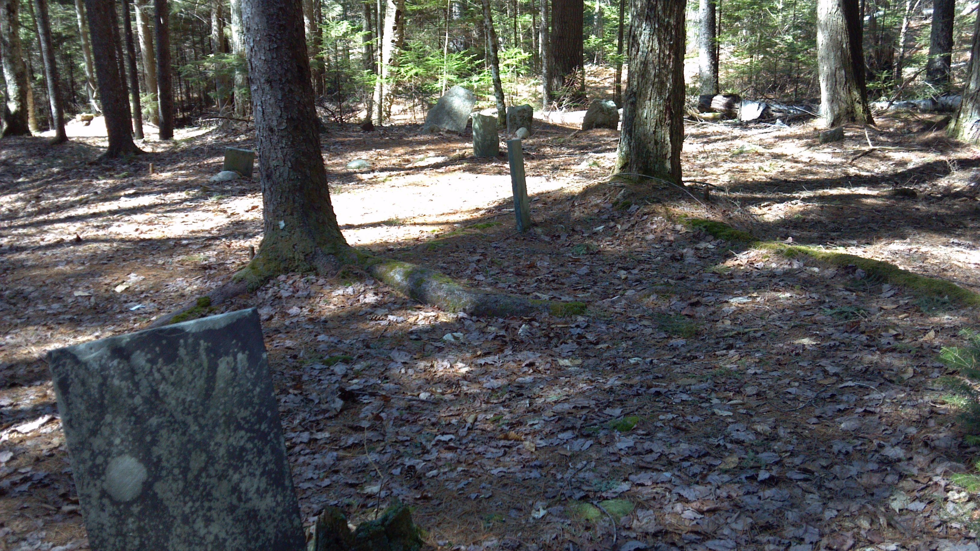
| Description | : | Burbank Foss Cemetery is located on a dirt road in Campton, NH, with no vehicular access. It is approximately a one mile hike from Route 49. There are only 4 inscribed headstones in this plot. In addition, there are 5 graves marked by fieldtones at the head and foot with no inscriptions. The cemetery is accessed from Route 49 between Campton and Waterville Valley, just east of Sandwich Notch Road. Park at the White Mountain National Forest trailhead for the Smarts Brook Trail. Walk the Pine Flats cross country ski trail appoximately 0.7 miles until reaching the... Read More |
frequently asked questions (FAQ):
-
Where is Burbank Foss Cemetery?
Burbank Foss Cemetery is located at Campton Lower Village, Grafton County ,New Hampshire ,USA.
-
Burbank Foss Cemetery cemetery's updated grave count on graveviews.com?
0 memorials
-
Where are the coordinates of the Burbank Foss Cemetery?
Latitude: 43.8955730
Longitude: -71.5667000
Nearby Cemetories:
1. Packard Graveyard
Thornton, Grafton County, USA
Coordinate: 43.8971540, -71.5845930
2. Mad River Cemetery
Thornton, Grafton County, USA
Coordinate: 43.8833670, -71.6077500
3. Campton Village Cemetery
Campton, Grafton County, USA
Coordinate: 43.8654440, -71.6364380
4. Mount Delight Burying Ground
North Sandwich, Carroll County, USA
Coordinate: 43.8385671, -71.5158940
5. Pine Grove Cemetery
Thornton, Grafton County, USA
Coordinate: 43.9060100, -71.6689000
6. Waterville Valley Cemetery
Waterville Valley, Grafton County, USA
Coordinate: 43.9634670, -71.5087000
7. Town Line Cemetery
Campton, Grafton County, USA
Coordinate: 43.8614570, -71.6678870
8. Blake Mountain Cemetery
Thornton, Grafton County, USA
Coordinate: 43.8963600, -71.6794200
9. Yeaton Cemetery
Thornton, Grafton County, USA
Coordinate: 43.8963800, -71.6794500
10. West Thornton Cemetery
Thornton, Grafton County, USA
Coordinate: 43.8997200, -71.6805600
11. Eastern Corner Road Cemetery
Campton, Grafton County, USA
Coordinate: 43.8177540, -71.6045920
12. Campton Hollow Cemetery
Campton Hollow, Grafton County, USA
Coordinate: 43.8238150, -71.6409440
13. Israel Gilman Cemetery
Sandwich Landing, Carroll County, USA
Coordinate: 43.8268727, -71.4757671
14. Mason Cemetery
North Sandwich, Carroll County, USA
Coordinate: 43.8542000, -71.4426000
15. Blaisdell Cemetery
Campton, Grafton County, USA
Coordinate: 43.8169440, -71.6555560
16. Thompson Cemetery
Sandwich, Carroll County, USA
Coordinate: 43.8014000, -71.5025000
17. West Campton Cemetery
Grafton County, USA
Coordinate: 43.8622220, -71.7052780
18. Eastman Cemetery
Sandwich, Carroll County, USA
Coordinate: 43.7930300, -71.5263500
19. Bog Road Cemetery
Campton, Grafton County, USA
Coordinate: 43.8152149, -71.6666793
20. Blair Cemetery
Campton, Grafton County, USA
Coordinate: 43.8111000, -71.6603012
21. Wildcat Cemetery
Thornton, Grafton County, USA
Coordinate: 43.9909710, -71.6391440
22. Ladd Cemetery
Holderness, Grafton County, USA
Coordinate: 43.7873700, -71.5506400
23. George Cemetery
Sandwich, Carroll County, USA
Coordinate: 43.7880560, -71.5338890
24. Morse Cemetery
Center Sandwich, Carroll County, USA
Coordinate: 43.8534300, -71.4241600