
| Memorials | : | 5 |
| Location | : | Scottown, Lawrence County, USA |
| Coordinate | : | 38.6638260, -82.4147780 |
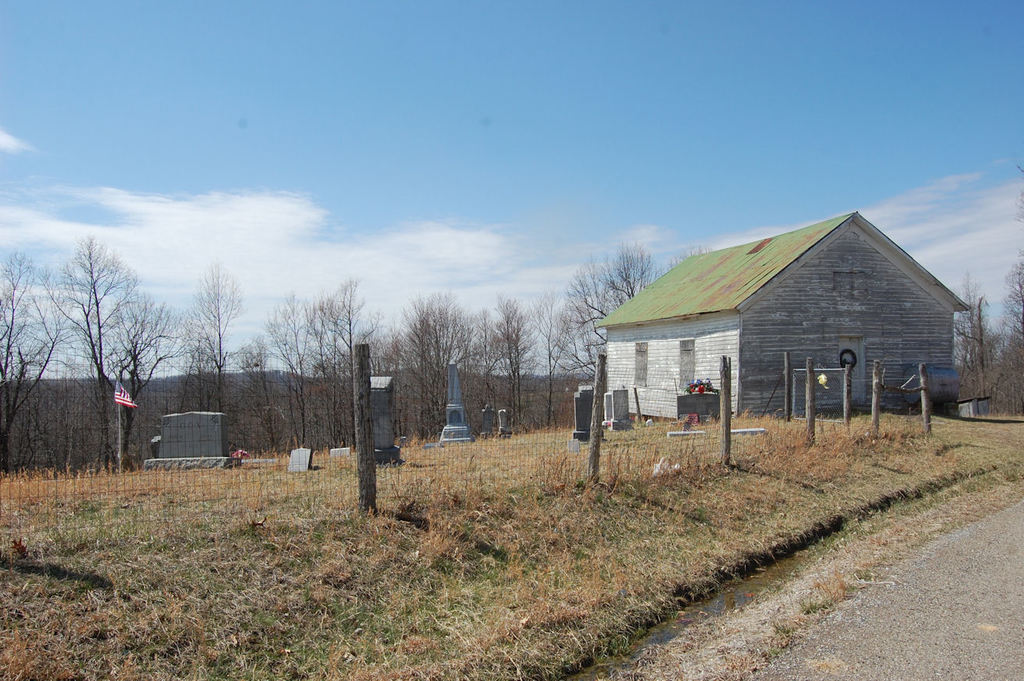
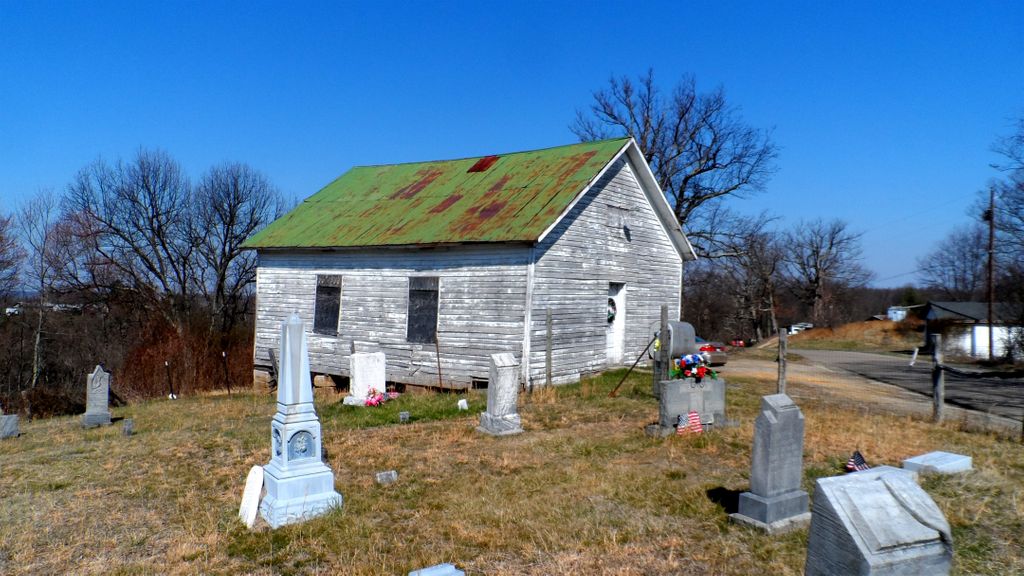
| Description | : | The cemetery is located on the west side of Buck Creek Road (County Road 62) about 250 feet west of its junction with Ohio State Route 775. The cemetery was established in 1891 and is 0.11 acres in size. The cemetery is located in Mason Township, Lawrence County, Ohio, and is # 6481 (Mount Hermon Cemetery) in “Ohio Cemeteries 1803-2003”, compiled by the Ohio Genealogical Society. |
frequently asked questions (FAQ):
-
Where is Mount Hermon UB Church Cemetery?
Mount Hermon UB Church Cemetery is located at 2742 – 3484 Buck Creek Road (County Road 62) Scottown, Lawrence County ,Ohio , 45696USA.
-
Mount Hermon UB Church Cemetery cemetery's updated grave count on graveviews.com?
4 memorials
-
Where are the coordinates of the Mount Hermon UB Church Cemetery?
Latitude: 38.6638260
Longitude: -82.4147780
Nearby Cemetories:
1. Brumfield Cemetery
Mason Township, Lawrence County, USA
Coordinate: 38.6653600, -82.4021000
2. Mount Pleasant Cemetery
Mason Township, Lawrence County, USA
Coordinate: 38.6513100, -82.4204300
3. Fox-Fairview Cemetery
Walnut Township, Gallia County, USA
Coordinate: 38.6834800, -82.4227400
4. Allen Cemetery
Mason Township, Lawrence County, USA
Coordinate: 38.6443310, -82.4417590
5. Okey Christian Chapel Cemetery
Mason Township, Lawrence County, USA
Coordinate: 38.6550800, -82.3784900
6. Grube Cemetery
Lecta, Lawrence County, USA
Coordinate: 38.6548800, -82.3785600
7. Carnes Cemetery
Mason Township, Lawrence County, USA
Coordinate: 38.6346200, -82.4065600
8. Walnut Ridge Cemetery
Walnut Township, Gallia County, USA
Coordinate: 38.6790400, -82.3798500
9. Mount Zion Cemetery
Walnut Township, Gallia County, USA
Coordinate: 38.6953011, -82.4203033
10. Palestine Cemetery
Scottown, Lawrence County, USA
Coordinate: 38.6334143, -82.4026537
11. Rucker Cemetery
Aid, Lawrence County, USA
Coordinate: 38.6311310, -82.4151310
12. Haskins Cemetery
Scottown, Lawrence County, USA
Coordinate: 38.6357994, -82.3858032
13. Backley Family Cemetery
Walnut Township, Gallia County, USA
Coordinate: 38.7028000, -82.3903000
14. Clark Cemetery
Walnut Township, Gallia County, USA
Coordinate: 38.7028008, -82.3902969
15. Rapp Cemetery
Rappsburg, Lawrence County, USA
Coordinate: 38.6197014, -82.4064026
16. J H Saunders Cemetery
Saundersville, Lawrence County, USA
Coordinate: 38.6613900, -82.3575100
17. Sanders Cemetery #2
Lawrence County, USA
Coordinate: 38.6555970, -82.3577540
18. Old Walnut Ridge Cemetery
Walnut Township, Gallia County, USA
Coordinate: 38.6856003, -82.3636017
19. Wiseman Cemetery
Walnut Township, Gallia County, USA
Coordinate: 38.6875000, -82.4682999
20. Notter Cemetery
Guyan Township, Gallia County, USA
Coordinate: 38.6610985, -82.3527985
21. Rose Cemetery
Lawrence County, USA
Coordinate: 38.6218987, -82.3806000
22. Vermillion Cemetery
Arabia, Lawrence County, USA
Coordinate: 38.6677130, -82.4801330
23. Neal Cemetery
Walnut Township, Gallia County, USA
Coordinate: 38.7121000, -82.3890200
24. Drummond-Folden Cemetery
Walnut Township, Gallia County, USA
Coordinate: 38.7092900, -82.3814100