| Memorials | : | 0 |
| Location | : | Arabia, Lawrence County, USA |
| Coordinate | : | 38.6677130, -82.4801330 |
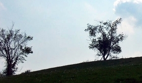
| Description | : | The cemetery is located in Aid Township (NW quadrant of the SE quadrant of Section 1) about 0.25 miles west of the intersection of Ohio State Route 141 and Coffee and Tea Creek about 750 feet north of Myrtle Tree Cemetery at the end of a ridge that crosses Coffee and Tea Creek. This is cemetery A-37 (Vermillion Cemetery) in Cemeteries of Aid Township, Lawrence County, Ohio, published by the Gallia County Historical Society, recorded by James C. & Mary L. Myers, 1983. The cemetery is located in Aid Township, Lawrence County, Ohio, and is # 13774 (Vermillion... Read More |
frequently asked questions (FAQ):
-
Where is Vermillion Cemetery?
Vermillion Cemetery is located at Ohio State Route 141 Arabia, Lawrence County ,Ohio , 45659USA.
-
Vermillion Cemetery cemetery's updated grave count on graveviews.com?
0 memorials
-
Where are the coordinates of the Vermillion Cemetery?
Latitude: 38.6677130
Longitude: -82.4801330
Nearby Cemetories:
1. Bradshaw Cemetery
Arabia, Lawrence County, USA
Coordinate: 38.6568370, -82.4854510
2. Bradshaw Cemetery #2
Arabia, Lawrence County, USA
Coordinate: 38.6550970, -82.4887380
3. Payton Family Cemetery
Aid Township, Lawrence County, USA
Coordinate: 38.6663500, -82.4996000
4. Lambert Cemetery
Aid Township, Lawrence County, USA
Coordinate: 38.6525230, -82.4913240
5. Wiseman Cemetery
Walnut Township, Gallia County, USA
Coordinate: 38.6875000, -82.4682999
6. Rankin Cemetery
Aid Township, Lawrence County, USA
Coordinate: 38.6380997, -82.4918976
7. Wiseman Cemetery
Sherritts, Lawrence County, USA
Coordinate: 38.6966600, -82.5073700
8. Nelson Cemetery
Arabia, Lawrence County, USA
Coordinate: 38.6377983, -82.5061035
9. Waterloo Cemetery
Walnut Township, Gallia County, USA
Coordinate: 38.7030983, -82.4653015
10. Allen Cemetery
Mason Township, Lawrence County, USA
Coordinate: 38.6443310, -82.4417590
11. Boggs Cemetery
Aid Township, Lawrence County, USA
Coordinate: 38.6464005, -82.5261002
12. Dennin Cemetery
Aid Township, Lawrence County, USA
Coordinate: 38.6761017, -82.5372009
13. Fox-Fairview Cemetery
Walnut Township, Gallia County, USA
Coordinate: 38.6834800, -82.4227400
14. Robinson Cemetery
Lawrence County, USA
Coordinate: 38.6711006, -82.5417023
15. Mount Pleasant Cemetery
Mason Township, Lawrence County, USA
Coordinate: 38.6513100, -82.4204300
16. Mount Hermon UB Church Cemetery
Scottown, Lawrence County, USA
Coordinate: 38.6638260, -82.4147780
17. Webster Cemetery
Walnut Township, Gallia County, USA
Coordinate: 38.7188500, -82.4586580
18. Mount Zion Cemetery
Walnut Township, Gallia County, USA
Coordinate: 38.6953011, -82.4203033
19. Aid Cemetery
Aid, Lawrence County, USA
Coordinate: 38.6086006, -82.4886017
20. Flag Springs Cemetery
Walnut Township, Gallia County, USA
Coordinate: 38.7230600, -82.4513100
21. Brumfield Cemetery
Mason Township, Lawrence County, USA
Coordinate: 38.6653600, -82.4021000
22. Russell Cemetery
Lawrence County, USA
Coordinate: 38.6128006, -82.5175018
23. Rucker Cemetery
Aid, Lawrence County, USA
Coordinate: 38.6311310, -82.4151310
24. John Neal Cemetery
Aid Township, Lawrence County, USA
Coordinate: 38.6519012, -82.5588989

