
| Memorials | : | 4 |
| Location | : | Wetaug, Pulaski County, USA |
| Coordinate | : | 37.3343240, -89.1781460 |
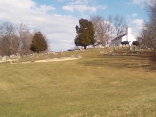
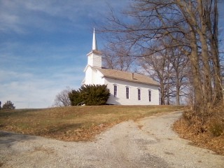
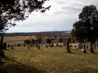
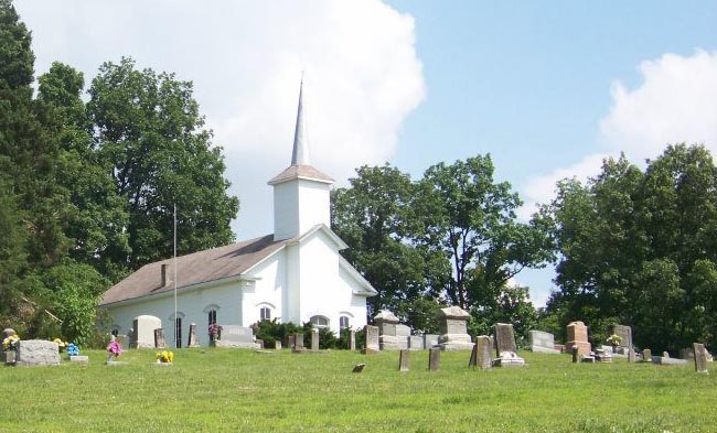
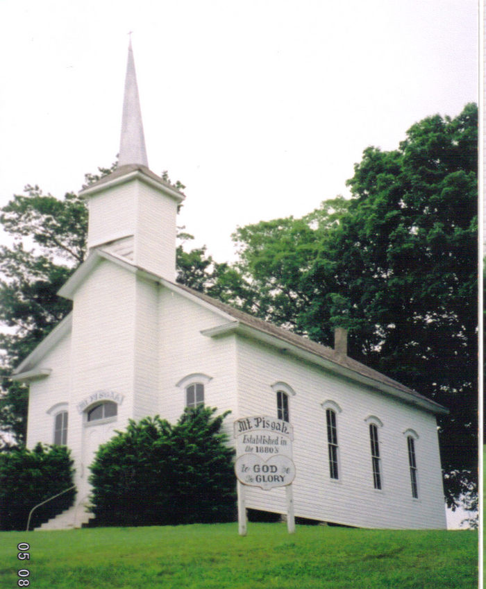
| Description | : | The cemetery is located on the Union County / Pulaski County line, the north half being in Union County and the south half being in Pulaski County. The cemetery is listed in Pulaski County since the USGS GNIS list it as a feature in Pulaski County. The cemetery is located on the east side of Mount Pisgah Road and is the cemetery of the former Mount Pisgah Lutheran Church, which was dissolved in 1963. The U.S. Geological Survey (USGS) Geographic Names Information System (GNIS) feature ID for the cemetery is 1820622 (Mount Pisgal Cemetery). |
frequently asked questions (FAQ):
-
Where is Mount Pisgah Church Cemetery?
Mount Pisgah Church Cemetery is located at Mount Pisgah Road Wetaug, Pulaski County ,Illinois , 62926USA.
-
Mount Pisgah Church Cemetery cemetery's updated grave count on graveviews.com?
4 memorials
-
Where are the coordinates of the Mount Pisgah Church Cemetery?
Latitude: 37.3343240
Longitude: -89.1781460


Nearby Cemetories:
1. German Reformed Cemetery
Wetaug, Pulaski County, USA
Coordinate: 37.3225037, -89.1674994
2. American Legion Cemetery
Dongola, Union County, USA
Coordinate: 37.3689003, -89.1671982
3. Sheffer Cemetery
Dongola, Union County, USA
Coordinate: 37.3492012, -89.1296997
4. Butter Ridge Cemetery
Ullin, Pulaski County, USA
Coordinate: 37.2891998, -89.1619034
5. Mount Zion Cumberland Presbyterian Cemetery
Dongola, Union County, USA
Coordinate: 37.3407280, -89.1189400
6. Union Cemetery
Dongola, Union County, USA
Coordinate: 37.3899994, -89.2071991
7. Hinkle Cemetery
Dongola, Union County, USA
Coordinate: 37.3807983, -89.1294022
8. Ullin Cemetery
Ullin, Pulaski County, USA
Coordinate: 37.2717171, -89.1939674
9. West Side Cemetery
Ullin, Pulaski County, USA
Coordinate: 37.2716030, -89.1952400
10. Bankston Cemetery
Mill Creek, Union County, USA
Coordinate: 37.3458800, -89.2588800
11. Christian Chapel Cemetery
Dongola, Union County, USA
Coordinate: 37.3881760, -89.1310960
12. Sims Cemetery
Tamms, Alexander County, USA
Coordinate: 37.3157997, -89.2596970
13. Mount Olive Cemetery
Dongola, Union County, USA
Coordinate: 37.3507250, -89.0950330
14. Leyerle Cemetery
Dongola, Union County, USA
Coordinate: 37.4035060, -89.1825910
15. Mission Chapel Cemetery
Balcom, Union County, USA
Coordinate: 37.3883018, -89.2331009
16. Saint John's Cemetery
Dongola, Union County, USA
Coordinate: 37.3884600, -89.2433300
17. Hazelwood Cemetery
Elco, Alexander County, USA
Coordinate: 37.2791640, -89.2456894
18. Free Trinity Pentecost Cemetery
Elco, Alexander County, USA
Coordinate: 37.2985610, -89.2651860
19. Cache Chapel Cemetery
Ullin, Pulaski County, USA
Coordinate: 37.2747340, -89.1113110
20. Cypress Grove Cemetery
Perks, Pulaski County, USA
Coordinate: 37.3096730, -89.0812990
21. Kimmel Cemetery
Jonesboro, Union County, USA
Coordinate: 37.4016650, -89.2395940
22. Big Creek Cemetery
Dongola, Union County, USA
Coordinate: 37.4195640, -89.1938950
23. New Hope Cemetery
Pulaski County, USA
Coordinate: 37.2557983, -89.1324997
24. Friendship Cemetery
Dongola, Union County, USA
Coordinate: 37.3842300, -89.0891600