
| Memorials | : | 8 |
| Location | : | Dongola, Union County, USA |
| Coordinate | : | 37.3689003, -89.1671982 |
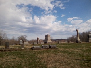
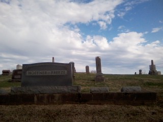
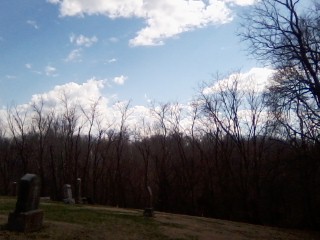
| Description | : | The cemetery is located on the west side of Old US Highway 51 S. The U.S. Geological Survey (USGS) Geographic Names Information System (GNIS) feature ID for the cemetery is 403482 (American Legion Cemetery / Dongola Cemetery). |
frequently asked questions (FAQ):
-
Where is American Legion Cemetery?
American Legion Cemetery is located at Old US Highway 51 S Dongola, Union County ,Illinois , 62926USA.
-
American Legion Cemetery cemetery's updated grave count on graveviews.com?
7 memorials
-
Where are the coordinates of the American Legion Cemetery?
Latitude: 37.3689003
Longitude: -89.1671982
Nearby Cemetories:
1. Hinkle Cemetery
Dongola, Union County, USA
Coordinate: 37.3807983, -89.1294022
2. Christian Chapel Cemetery
Dongola, Union County, USA
Coordinate: 37.3881760, -89.1310960
3. Mount Pisgah Church Cemetery
Wetaug, Pulaski County, USA
Coordinate: 37.3343240, -89.1781460
4. Sheffer Cemetery
Dongola, Union County, USA
Coordinate: 37.3492012, -89.1296997
5. Leyerle Cemetery
Dongola, Union County, USA
Coordinate: 37.4035060, -89.1825910
6. Union Cemetery
Dongola, Union County, USA
Coordinate: 37.3899994, -89.2071991
7. German Reformed Cemetery
Wetaug, Pulaski County, USA
Coordinate: 37.3225037, -89.1674994
8. Mount Zion Cumberland Presbyterian Cemetery
Dongola, Union County, USA
Coordinate: 37.3407280, -89.1189400
9. Big Creek Cemetery
Dongola, Union County, USA
Coordinate: 37.4195640, -89.1938950
10. Mission Chapel Cemetery
Balcom, Union County, USA
Coordinate: 37.3883018, -89.2331009
11. Mount Olive Cemetery
Dongola, Union County, USA
Coordinate: 37.3507250, -89.0950330
12. Saint John's Cemetery
Dongola, Union County, USA
Coordinate: 37.3884600, -89.2433300
13. Friendship Cemetery
Dongola, Union County, USA
Coordinate: 37.3842300, -89.0891600
14. Kimmel Cemetery
Jonesboro, Union County, USA
Coordinate: 37.4016650, -89.2395940
15. Bankston Cemetery
Mill Creek, Union County, USA
Coordinate: 37.3458800, -89.2588800
16. Butter Ridge Cemetery
Ullin, Pulaski County, USA
Coordinate: 37.2891998, -89.1619034
17. Ebenezer German Cemetery
Jonesboro, Union County, USA
Coordinate: 37.4086670, -89.2550670
18. Knupp Cemetery
Union County, USA
Coordinate: 37.4341030, -89.2375120
19. Cypress Grove Cemetery
Perks, Pulaski County, USA
Coordinate: 37.3096730, -89.0812990
20. Sims Cemetery
Tamms, Alexander County, USA
Coordinate: 37.3157997, -89.2596970
21. Mount Zion Cemetery
Union County, USA
Coordinate: 37.4110985, -89.0653000
22. McGinnis Cemetery
Anna, Union County, USA
Coordinate: 37.4435997, -89.0986023
23. Camp Ground Cemetery
Anna, Union County, USA
Coordinate: 37.4605000, -89.1389000
24. Grieb Cemetery
Jonesboro, Union County, USA
Coordinate: 37.4206009, -89.2694016