
| Memorials | : | 9 |
| Location | : | Licking County, USA |
| Coordinate | : | 40.2044200, -82.1871500 |
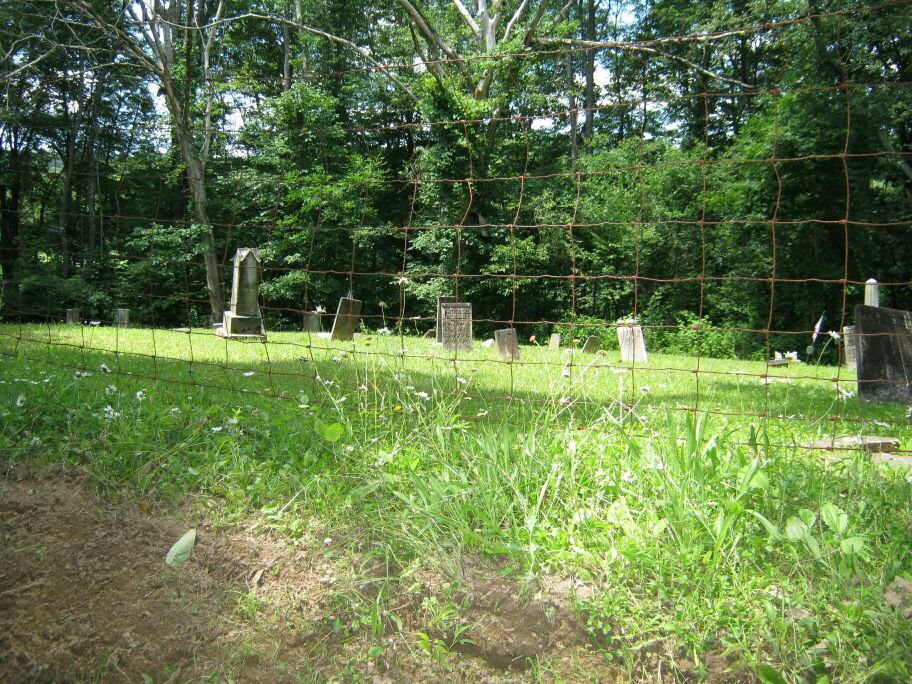
| Description | : | Mount Pleasant Cemetery is located on Township Rd.12/Church Rd., about .5 mile east of the intersection of County Rd.668/Licking Valley Rd. with State Route 79/Fallsburg Rd. Mt. Pleasant Church is on the east side of the road, within sight—about a quarter mile to the north—of the cemetery, which is on the west side of the road. This cemetery is in the northeast part of Section 11 in the Northeast Quarter of Township 4 in Range 10 of the U.S. Military Tract, very near the Coshocton County line. 43 hundredths of an acre was deeded over to the Fallsbury Township Trustees... Read More |
frequently asked questions (FAQ):
-
Where is Mount Pleasant Cemetery?
Mount Pleasant Cemetery is located at Church Road (County Road 12) Licking County ,Ohio , 43822USA.
-
Mount Pleasant Cemetery cemetery's updated grave count on graveviews.com?
9 memorials
-
Where are the coordinates of the Mount Pleasant Cemetery?
Latitude: 40.2044200
Longitude: -82.1871500


Nearby Cemetories:
1. Robinson Cemetery
West Carlisle, Coshocton County, USA
Coordinate: 40.1941480, -82.1676420
2. Proffit Family Farm Cemetery
Frazeysburg, Muskingum County, USA
Coordinate: 40.2131530, -82.2101100
3. Varner Cemetery
Licking County, USA
Coordinate: 40.2011720, -82.2182280
4. Wilson Cemetery
Frampton, Licking County, USA
Coordinate: 40.2262390, -82.2059550
5. VanWinkle Cemetery
Licking County, USA
Coordinate: 40.2329140, -82.1921640
6. Gardner Family Cemetery
West Carlisle, Coshocton County, USA
Coordinate: 40.2176510, -82.1512130
7. Frampton Family Cemetery
Licking County, USA
Coordinate: 40.1803820, -82.2291900
8. Anderson Cemetery
Coshocton County, USA
Coordinate: 40.1664009, -82.1694031
9. Fallsburg Cemetery
Fallsburg, Licking County, USA
Coordinate: 40.2034600, -82.2412900
10. Perry Chapel Baptist Cemetery
West Carlisle, Coshocton County, USA
Coordinate: 40.2470200, -82.1899500
11. Norris Cemetery
Coshocton County, USA
Coordinate: 40.1888470, -82.1295000
12. McKee Cemetery
Coshocton County, USA
Coordinate: 40.1698240, -82.1277770
13. Winding Fork Evangelical Lutheran Church Cemetery
Coshocton County, USA
Coordinate: 40.2589240, -82.1589090
14. Broomstick Cemetery
Coshocton County, USA
Coordinate: 40.2002983, -82.1100006
15. Perryton Cemetery
Perryton, Licking County, USA
Coordinate: 40.1467018, -82.2039032
16. West Carlisle Cemetery
Coshocton, Coshocton County, USA
Coordinate: 40.2308100, -82.1177700
17. Evans Fairall Cemetery
Frazeysburg, Muskingum County, USA
Coordinate: 40.1491455, -82.1541740
18. Horner Cemetery
Frazeysburg, Muskingum County, USA
Coordinate: 40.1562100, -82.1346300
19. Pleasant Hills Baptist Church Cemetery
Licking County, USA
Coordinate: 40.1547980, -82.2423040
20. Mount Zion Cemetery
Bladensburg, Knox County, USA
Coordinate: 40.2543800, -82.2475300
21. Rine Family Cemetery
Jackson Township, Knox County, USA
Coordinate: 40.2728050, -82.2224780
22. Arnold Cemetery
Perry Township, Licking County, USA
Coordinate: 40.1402000, -82.2366000
23. Miller Cemetery
Wakatomika, Coshocton County, USA
Coordinate: 40.1976260, -82.0849510
24. Mount Zion Christian Church Cemetery
Frazeysburg, Muskingum County, USA
Coordinate: 40.1447910, -82.1156960