
| Memorials | : | 5 |
| Location | : | Licking County, USA |
| Coordinate | : | 40.2329140, -82.1921640 |
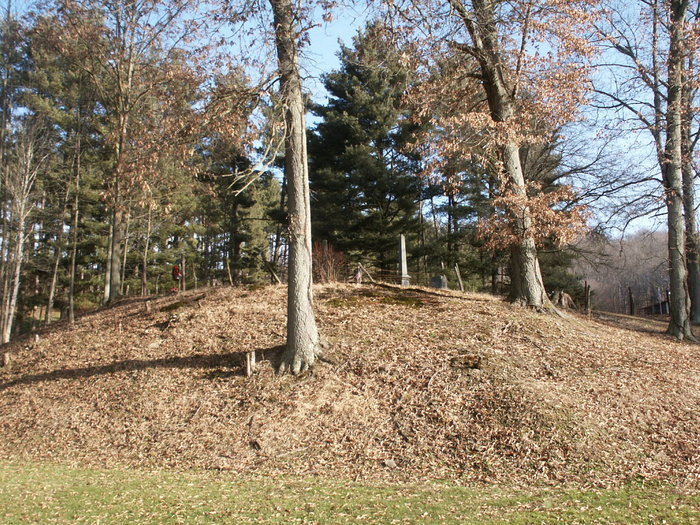
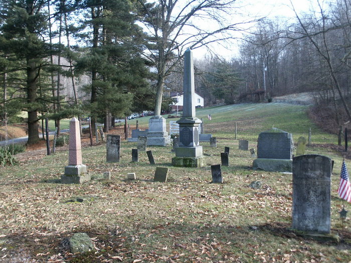
| Description | : | The cemetery is located on the east side of Jug Run Road (Township Road 184) about 1500 feet north of its intersection with Frampton Road (County Road 201). The cemetery is located in Fallsbury Township, Licking County, Ohio, and is # 6647 (Van Winkle Cemetery) in “Ohio Cemeteries 1803-2003”, compiled by the Ohio Genealogical Society. The cemetery is registered with the Ohio Division of Real Estate and Professional Licensing (ODRE) as Vanwinkle Cemetery with registration license number CGR.0000981139. |
frequently asked questions (FAQ):
-
Where is VanWinkle Cemetery?
VanWinkle Cemetery is located at 12666 Jug Run Road (Township Road 184) Licking County ,Ohio , 43822USA.
-
VanWinkle Cemetery cemetery's updated grave count on graveviews.com?
4 memorials
-
Where are the coordinates of the VanWinkle Cemetery?
Latitude: 40.2329140
Longitude: -82.1921640

Nearby Cemetories:
1. Wilson Cemetery
Frampton, Licking County, USA
Coordinate: 40.2262390, -82.2059550
2. Perry Chapel Baptist Cemetery
West Carlisle, Coshocton County, USA
Coordinate: 40.2470200, -82.1899500
3. Proffit Family Farm Cemetery
Frazeysburg, Muskingum County, USA
Coordinate: 40.2131530, -82.2101100
4. Mount Pleasant Cemetery
Licking County, USA
Coordinate: 40.2044200, -82.1871500
5. Gardner Family Cemetery
West Carlisle, Coshocton County, USA
Coordinate: 40.2176510, -82.1512130
6. Winding Fork Evangelical Lutheran Church Cemetery
Coshocton County, USA
Coordinate: 40.2589240, -82.1589090
7. Varner Cemetery
Licking County, USA
Coordinate: 40.2011720, -82.2182280
8. Robinson Cemetery
West Carlisle, Coshocton County, USA
Coordinate: 40.1941480, -82.1676420
9. Rine Family Cemetery
Jackson Township, Knox County, USA
Coordinate: 40.2728050, -82.2224780
10. Mount Zion Cemetery
Bladensburg, Knox County, USA
Coordinate: 40.2543800, -82.2475300
11. Fallsburg Cemetery
Fallsburg, Licking County, USA
Coordinate: 40.2034600, -82.2412900
12. West Carlisle Cemetery
Coshocton, Coshocton County, USA
Coordinate: 40.2308100, -82.1177700
13. New Guilford Cemetery
Coshocton County, USA
Coordinate: 40.2896996, -82.1699982
14. Frampton Family Cemetery
Licking County, USA
Coordinate: 40.1803820, -82.2291900
15. Scott Cemetery
Walhonding, Coshocton County, USA
Coordinate: 40.2964569, -82.1829250
16. Saint Matthews Episcopal Church Cemetery
New Guilford, Coshocton County, USA
Coordinate: 40.2964170, -82.1820690
17. Norris Cemetery
Coshocton County, USA
Coordinate: 40.1888470, -82.1295000
18. Goshen Cemetery
Warsaw, Coshocton County, USA
Coordinate: 40.2728004, -82.1193008
19. Anderson Cemetery
Coshocton County, USA
Coordinate: 40.1664009, -82.1694031
20. Stricker Cemetery
Bladensburg, Knox County, USA
Coordinate: 40.2978800, -82.2227900
21. Broomstick Cemetery
Coshocton County, USA
Coordinate: 40.2002983, -82.1100006
22. Mount Airy Cemetery
Coshocton County, USA
Coordinate: 40.3107310, -82.1854160
23. Dennis Cemetery
Knox County, USA
Coordinate: 40.3055200, -82.2334200
24. McKee Cemetery
Coshocton County, USA
Coordinate: 40.1698240, -82.1277770