
| Memorials | : | 6 |
| Location | : | Jackson Creek, Randolph County, USA |
| Coordinate | : | 35.6954230, -80.0124970 |
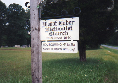
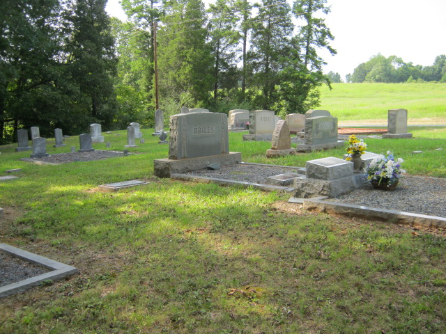
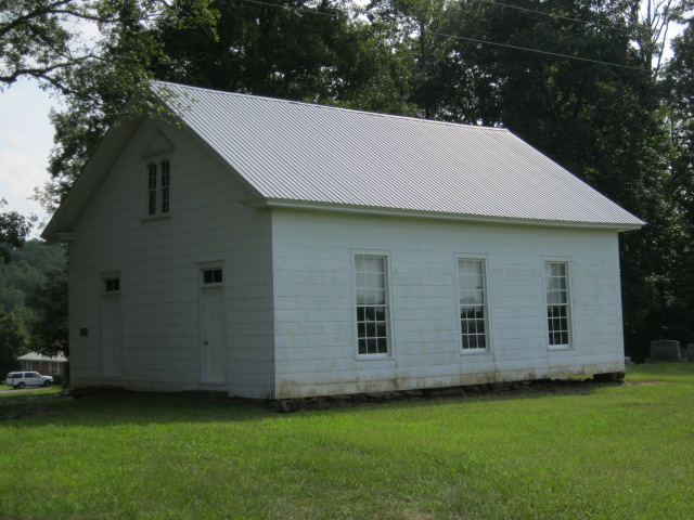
| Description | : | Located at the intersection of Jackson Creek Road and Bescher Chapel Road, the church was established in 1840 when land was donated by the NANCE family "for the purpose of building a church and cemetery". It has been inactive for many years, but the building and cemetery are maintained by the Mount Tabor Methodist Church Association. It is used for weddings, receptions, homecomings and the annual NANCE family reunion. |
frequently asked questions (FAQ):
-
Where is Mount Tabor Methodist Church Cemetery?
Mount Tabor Methodist Church Cemetery is located at Jackson Creek, Randolph County ,North Carolina ,USA.
-
Mount Tabor Methodist Church Cemetery cemetery's updated grave count on graveviews.com?
6 memorials
-
Where are the coordinates of the Mount Tabor Methodist Church Cemetery?
Latitude: 35.6954230
Longitude: -80.0124970
Nearby Cemetories:
1. Piney Grove Methodist Church
Jackson Creek, Randolph County, USA
Coordinate: 35.6920000, -80.0340000
2. Pierces Chapel Primitive Baptist Church Cemetery
Trinity, Randolph County, USA
Coordinate: 35.7141953, -80.0097046
3. Pleasant Union Community Church Cemetery
Randolph County, USA
Coordinate: 35.6922910, -79.9885640
4. North Bend Cemetery
Jackson Creek, Randolph County, USA
Coordinate: 35.6730000, -80.0213000
5. Hoover Cemetery
Jackson Creek, Randolph County, USA
Coordinate: 35.6836200, -79.9812800
6. Hoovers Grove Wesleyan Church Cemetery
Randolph County, USA
Coordinate: 35.6829870, -79.9796830
7. Walters Grove Baptist Church Cemetery
Lexington, Davidson County, USA
Coordinate: 35.6988260, -80.0673240
8. Canaan United Methodist Church Cemetery
Denton, Davidson County, USA
Coordinate: 35.6690000, -80.0630000
9. Pleasant Grove Methodist Church
Asheboro, Randolph County, USA
Coordinate: 35.7344704, -80.0565033
10. Tabernacle United Methodist Church Cemetery
Randolph County, USA
Coordinate: 35.7485500, -80.0042000
11. Farmer United Methodist Church Cemetery
Farmer, Randolph County, USA
Coordinate: 35.6500330, -79.9767170
12. Farmer Baptist Church Cemetery
Farmer, Randolph County, USA
Coordinate: 35.6527300, -79.9716300
13. Old Fashion Baptist Church Cemetery
Randolph County, USA
Coordinate: 35.6408790, -80.0238300
14. Bethel Baptist Church Cemetery
Asheboro, Randolph County, USA
Coordinate: 35.7357530, -79.9619270
15. Garner Family Cemetery
Denton, Davidson County, USA
Coordinate: 35.6575800, -80.0717900
16. Mount Shepherd Primitive Baptist Church Cemetery
Asheboro, Randolph County, USA
Coordinate: 35.7422130, -79.9531370
17. Mount Shepherd United Methodist Church Cemetery
Asheboro, Randolph County, USA
Coordinate: 35.7417068, -79.9512863
18. Stout Cemetery
Denton, Davidson County, USA
Coordinate: 35.6439100, -80.0689600
19. Westfield Baptist Church Cemetery
Trinity, Randolph County, USA
Coordinate: 35.7630539, -80.0314102
20. Cedar Springs Cemetery
Cid, Davidson County, USA
Coordinate: 35.6803017, -80.0960999
21. Snider Cemetery
Denton, Davidson County, USA
Coordinate: 35.6614000, -80.0879500
22. Salem Fellowship Church Cemetery
Denton, Davidson County, USA
Coordinate: 35.6268190, -80.0306790
23. Fairview United Methodist Church
Denton, Davidson County, USA
Coordinate: 35.6870000, -80.1000000
24. Salem United Methodist Church Cemetery
Martha, Randolph County, USA
Coordinate: 35.6255170, -80.0315170