
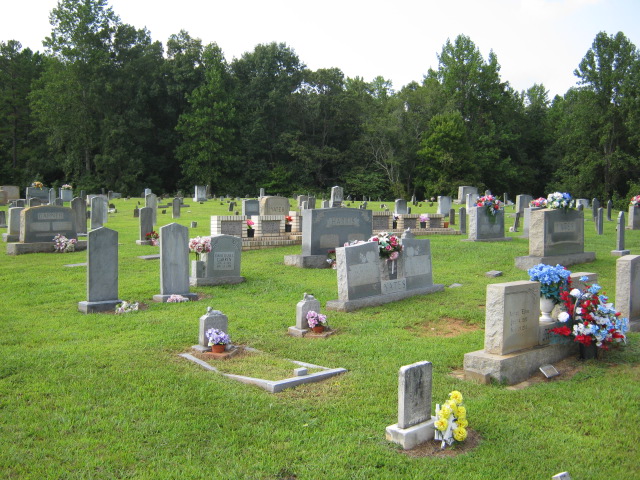
| Memorials | : | 11 |
| Location | : | Randolph County, USA |
| Coordinate | : | 35.6922910, -79.9885640 |
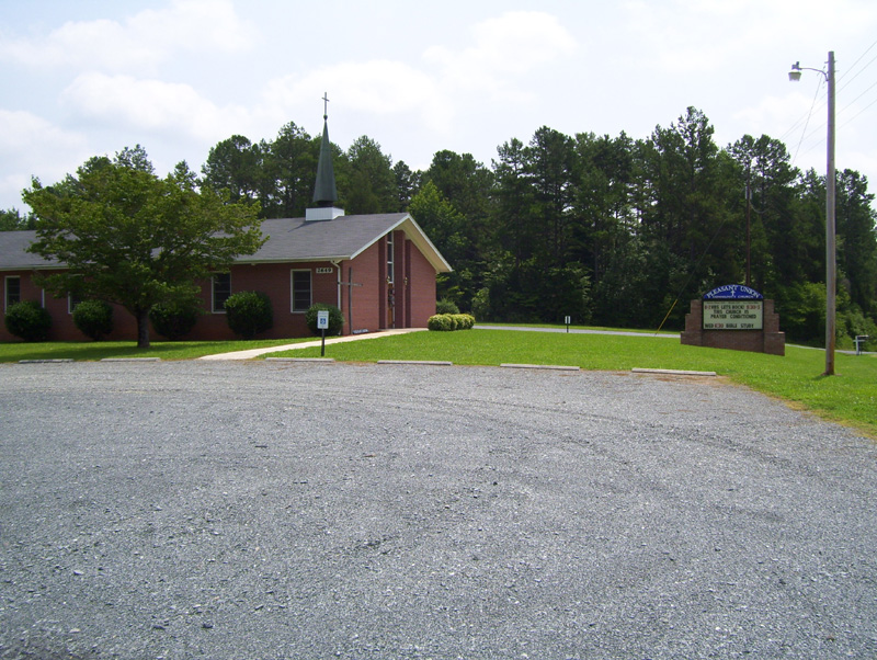
| Description | : | This church, Pleasant Union Community Church, was formerly known as Pleasant Union United Church of Christ, and before that was known as Pleasant Union Methodist Episcopal Church. Its physical location is in Randolph County, but its mailing address is Denton, Davidson County. |
frequently asked questions (FAQ):
-
Where is Pleasant Union Community Church Cemetery?
Pleasant Union Community Church Cemetery is located at Randolph County ,North Carolina ,USA.
-
Pleasant Union Community Church Cemetery cemetery's updated grave count on graveviews.com?
11 memorials
-
Where are the coordinates of the Pleasant Union Community Church Cemetery?
Latitude: 35.6922910
Longitude: -79.9885640


Nearby Cemetories:
1. Hoover Cemetery
Jackson Creek, Randolph County, USA
Coordinate: 35.6836200, -79.9812800
2. Hoovers Grove Wesleyan Church Cemetery
Randolph County, USA
Coordinate: 35.6829870, -79.9796830
3. Mount Tabor Methodist Church Cemetery
Jackson Creek, Randolph County, USA
Coordinate: 35.6954230, -80.0124970
4. Pierces Chapel Primitive Baptist Church Cemetery
Trinity, Randolph County, USA
Coordinate: 35.7141953, -80.0097046
5. North Bend Cemetery
Jackson Creek, Randolph County, USA
Coordinate: 35.6730000, -80.0213000
6. Piney Grove Methodist Church
Jackson Creek, Randolph County, USA
Coordinate: 35.6920000, -80.0340000
7. Farmer Baptist Church Cemetery
Farmer, Randolph County, USA
Coordinate: 35.6527300, -79.9716300
8. Farmer United Methodist Church Cemetery
Farmer, Randolph County, USA
Coordinate: 35.6500330, -79.9767170
9. Bethel Baptist Church Cemetery
Asheboro, Randolph County, USA
Coordinate: 35.7357530, -79.9619270
10. Saint Mark's United Methodist Church
Cedar Grove, Randolph County, USA
Coordinate: 35.6454300, -79.9484300
11. Mount Shepherd Primitive Baptist Church Cemetery
Asheboro, Randolph County, USA
Coordinate: 35.7422130, -79.9531370
12. Tabernacle United Methodist Church Cemetery
Randolph County, USA
Coordinate: 35.7485500, -80.0042000
13. Mount Shepherd United Methodist Church Cemetery
Asheboro, Randolph County, USA
Coordinate: 35.7417068, -79.9512863
14. Old Fashion Baptist Church Cemetery
Randolph County, USA
Coordinate: 35.6408790, -80.0238300
15. Science Hill Friends Meeting Cemetery
Asheboro, Randolph County, USA
Coordinate: 35.6554090, -79.9310680
16. Walters Grove Baptist Church Cemetery
Lexington, Davidson County, USA
Coordinate: 35.6988260, -80.0673240
17. Canaan United Methodist Church Cemetery
Denton, Davidson County, USA
Coordinate: 35.6690000, -80.0630000
18. Sawyersville Wesleyan Church Cemetery
Asheboro, Randolph County, USA
Coordinate: 35.7155790, -79.9107290
19. Pleasant Grove Methodist Church
Asheboro, Randolph County, USA
Coordinate: 35.7344704, -80.0565033
20. Salem Fellowship Church Cemetery
Denton, Davidson County, USA
Coordinate: 35.6268190, -80.0306790
21. Salem United Methodist Church Cemetery
Martha, Randolph County, USA
Coordinate: 35.6255170, -80.0315170
22. Garner Family Cemetery
Denton, Davidson County, USA
Coordinate: 35.6575800, -80.0717900
23. Westfield Baptist Church Cemetery
Trinity, Randolph County, USA
Coordinate: 35.7630539, -80.0314102
24. Back Creek Friends Meeting Cemetery
Asheboro, Randolph County, USA
Coordinate: 35.7065063, -79.8921153