
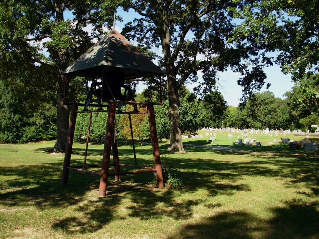
| Memorials | : | 1 |
| Location | : | Stantonville, McNairy County, USA |
| Coordinate | : | 35.1890270, -88.3966700 |
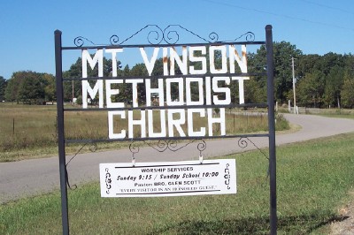
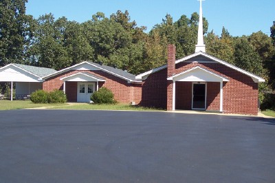
| Description | : | From the intersection of Mt Vinson Rd. & TN-117 S, 3 mi. SW of Adamsville, travel 0.2 mi. on Mt Vinson Rd. passing the cemetery on the west (right); turning west (right) onto Tommy Sanders Rd., then immediately onto the driveway of the cemetery, adjacent to St. Vinson U.M. Church. |
frequently asked questions (FAQ):
-
Where is Mount Vinson Methodist Church Cemetery?
Mount Vinson Methodist Church Cemetery is located at 2381 Mt Vinson Road Stantonville, McNairy County ,Tennessee , 38379USA.
-
Mount Vinson Methodist Church Cemetery cemetery's updated grave count on graveviews.com?
1 memorials
-
Where are the coordinates of the Mount Vinson Methodist Church Cemetery?
Latitude: 35.1890270
Longitude: -88.3966700
Nearby Cemetories:
1. Meeks Grove Church Cemetery
Stantonville, McNairy County, USA
Coordinate: 35.1836930, -88.4138630
2. Smith Cemetery #2
Stantonville, McNairy County, USA
Coordinate: 35.1721010, -88.3894940
3. Emmanuel Tabernacle Church Cemetery
Stantonville, McNairy County, USA
Coordinate: 35.1843910, -88.4190730
4. Sanders Cemetery #1
Adamsville, McNairy County, USA
Coordinate: 35.2060110, -88.4220870
5. Clear Creek Cemetery
Stantonville, McNairy County, USA
Coordinate: 35.1609250, -88.4066740
6. Gilchrist Cemetery
Adamsville, McNairy County, USA
Coordinate: 35.2110200, -88.4221320
7. McWhirter Cemetery
Adamsville, McNairy County, USA
Coordinate: 35.2170830, -88.3807520
8. Cobb Cemetery
Stantonville, McNairy County, USA
Coordinate: 35.1706640, -88.4320490
9. McKenzie Cemetery
Stantonville, McNairy County, USA
Coordinate: 35.1788640, -88.4397660
10. Jones Cemetery
Hardin County, USA
Coordinate: 35.1580010, -88.3654910
11. West Shiloh Church Cemetery
West Shiloh, McNairy County, USA
Coordinate: 35.1495980, -88.3840980
12. Stantonville Cemetery
Stantonville, McNairy County, USA
Coordinate: 35.1585460, -88.4311860
13. Overbrook Church Cemetery
Crump, Hardin County, USA
Coordinate: 35.2257370, -88.3671610
14. Adamsville Cemetery
Adamsville, McNairy County, USA
Coordinate: 35.2352982, -88.3964005
15. Churchwell Cemetery
Hardin County, USA
Coordinate: 35.2313995, -88.3632965
16. Helbert Cemetery
Adamsville, McNairy County, USA
Coordinate: 35.2372240, -88.4159950
17. Williams Cemetery
Adamsville, McNairy County, USA
Coordinate: 35.2342260, -88.4313340
18. Perkins Cemetery
Crump, Hardin County, USA
Coordinate: 35.2216850, -88.3417640
19. Dollar Cemetery
Hardin County, USA
Coordinate: 35.1982994, -88.3197021
20. Clear Creek Church Cemetery
New Lawton, McNairy County, USA
Coordinate: 35.2059380, -88.4723690
21. Pounds Cemetery
Stantonville, McNairy County, USA
Coordinate: 35.1889630, -88.4763830
22. Fink Cemetery
Purdy, McNairy County, USA
Coordinate: 35.1898540, -88.4780670
23. Sanders Cemetery #2
Old Lawton, McNairy County, USA
Coordinate: 35.2137200, -88.4724260
24. Sanders Cemetery #4
Stantonville, McNairy County, USA
Coordinate: 35.1793350, -88.4793370