
| Memorials | : | 0 |
| Location | : | Bedford, Bedford County, USA |
| Phone | : | 540-297-7102 |
| Coordinate | : | 37.2085300, -79.5375320 |
frequently asked questions (FAQ):
-
Where is Mount Zion Baptist Church Cemetery?
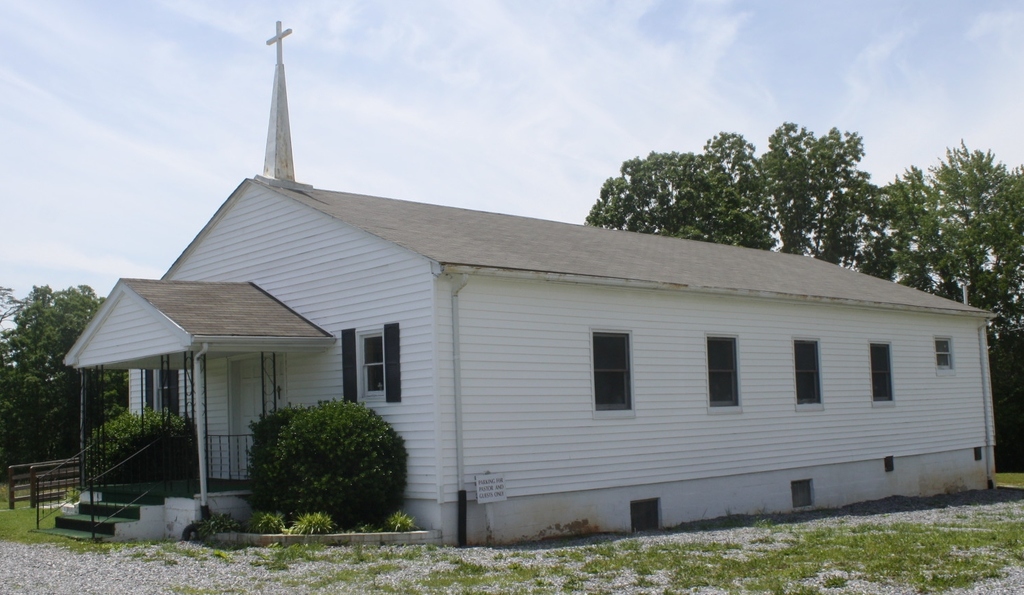
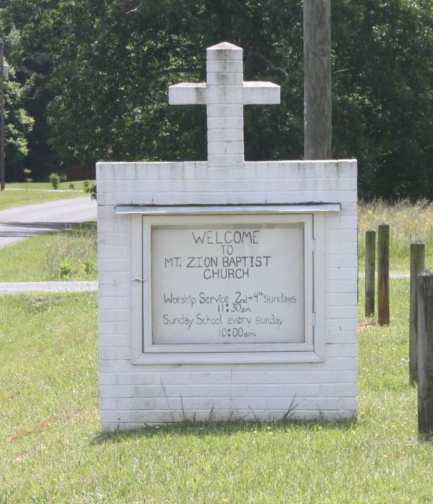
Mount Zion Baptist Church Cemetery is located at 3213 Rock Cliff Road (Rt. 735) Bedford, Bedford County ,Virginia , 24523USA.
-
Mount Zion Baptist Church Cemetery cemetery's updated grave count on graveviews.com?
0 memorials
-
Where are the coordinates of the Mount Zion Baptist Church Cemetery?
Latitude: 37.2085300
Longitude: -79.5375320
Nearby Cemetories:
1. Central Baptist Church Cemetery
Bedford County, USA
Coordinate: 37.2052935, -79.5359414
2. McConnehey-Updike Cemetery
Chestnut Fork, Bedford County, USA
Coordinate: 37.2116187, -79.5452689
3. Quaker Baptist Church Cemetery
Chestnut Fork, Bedford County, USA
Coordinate: 37.2061940, -79.5162270
4. Church of the Great Shepherd Cemetery
Bedford, Bedford County, USA
Coordinate: 37.2255209, -79.5409872
5. Mount Zion Baptist Church Cemetery
Bedford, Bedford County, USA
Coordinate: 37.2225010, -79.5123250
6. Creasey-Overstreet-Crouch Cemetery
Chestnut Fork, Bedford County, USA
Coordinate: 37.1927680, -79.5094994
7. Cheek-Lewis-Landsdown-Mayhew-Overstreet Plot
Bedford County, USA
Coordinate: 37.2269410, -79.5105890
8. Wilsons United Methodist Church Cemetery
Bedford, Bedford County, USA
Coordinate: 37.2322740, -79.5112800
9. William Sampson Mayhew Family Cemetery
Chestnut Fork, Bedford County, USA
Coordinate: 37.2172500, -79.4978900
10. Overstreet-Crowder-Foster Cemetery
Chestnut Fork, Bedford County, USA
Coordinate: 37.2243370, -79.4996150
11. Witt Family Cemetery
Bunker Hill, Bedford County, USA
Coordinate: 37.2456010, -79.5152070
12. Morgans Baptist Church Cemetery
Bedford, Bedford County, USA
Coordinate: 37.1896961, -79.5920278
13. Stephens Cemetery
Chestnut Fork, Bedford County, USA
Coordinate: 37.1777750, -79.4857920
14. Charles Fitzhugh Walker Cemetery
Bedford County, USA
Coordinate: 37.2497454, -79.4786622
15. Fred A Sims Cemetery
Bedford County, USA
Coordinate: 37.2508287, -79.4719383
16. Mount Olivet Southern Baptist Church Cemetery
Bedford, Bedford County, USA
Coordinate: 37.2761450, -79.5602720
17. Mount Olivet Missionary Baptist Church Cemetery
Bedford, Bedford County, USA
Coordinate: 37.2793050, -79.5496640
18. Wade Cemetery
Gillespie, Bedford County, USA
Coordinate: 37.2287910, -79.4475890
19. Zimmerman Family Cemetery
Bedford, Bedford County, USA
Coordinate: 37.2816850, -79.5191559
20. Witt Family Farm Cemetery
Five Forks, Bedford County, USA
Coordinate: 37.2848100, -79.5118600
21. Walker Family Cemetery
Five Forks, Bedford County, USA
Coordinate: 37.2848130, -79.5118640
22. Olive Branch Baptist Church Cemetery
Flint Hill, Bedford County, USA
Coordinate: 37.2485399, -79.6255937
23. Preston and Sinthia Leftwich Cemetery
Gillespie, Bedford County, USA
Coordinate: 37.2137880, -79.4318820
24. Hickory Grove Church Cemetery
Five Forks, Bedford County, USA
Coordinate: 37.2843338, -79.4882560