
| Memorials | : | 12 |
| Location | : | Woodsfield, Monroe County, USA |
| Coordinate | : | 39.7847300, -81.0468100 |
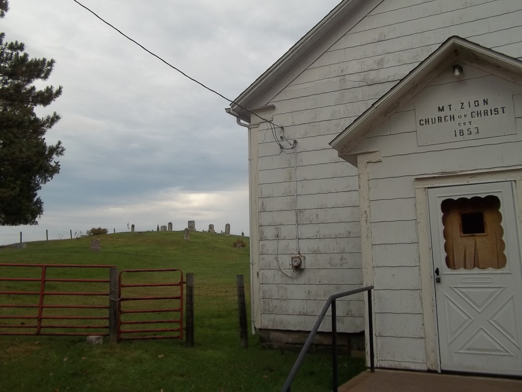
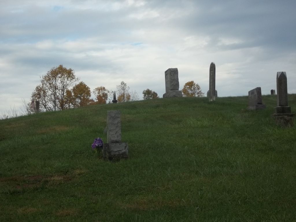
| Description | : | From Woodsfield, take Ohio State Route 26 north towards Beallsville to a point 1/2 mile north of Sunfish Creek in Adams Township at #7. This church was originally established in 1853 on Bracy family land and called The Bracy Church. A new building built in 1903 was named Mt. Zion Church of Christ. The cemetery is located in Adams Township, Monroe County, Ohio, and is # 8023 (Bracey Cemetery / Mount Zion Church of Christ Cemetery / Mount Zion Methodist Cemetery) in “Ohio Cemeteries 1803-2003”, compiled by the Ohio Genealogical Society. The U.S. Geological Survey (USGS) Geographic Names Information... Read More |
frequently asked questions (FAQ):
-
Where is Mount Zion Church of Christ Cemetery?
Mount Zion Church of Christ Cemetery is located at Hilight (Ohio State Route 26) Woodsfield, Monroe County ,Ohio , 43716USA.
-
Mount Zion Church of Christ Cemetery cemetery's updated grave count on graveviews.com?
9 memorials
-
Where are the coordinates of the Mount Zion Church of Christ Cemetery?
Latitude: 39.7847300
Longitude: -81.0468100
Nearby Cemetories:
1. Grove Cemetery
Ozark, Monroe County, USA
Coordinate: 39.8025700, -81.0517700
2. Asbery Chapel Cemetery
Coats, Monroe County, USA
Coordinate: 39.7912250, -81.0096010
3. Gillespie Cemetery
Monroe County, USA
Coordinate: 39.7528000, -81.0571976
4. Goudy Cemetery
Woodsfield, Monroe County, USA
Coordinate: 39.7503014, -81.0436020
5. Mount Carrick Cemetery
Mount Carrick, Monroe County, USA
Coordinate: 39.7494011, -81.0539017
6. Leiblig Cemetery
Cameron, Monroe County, USA
Coordinate: 39.7839012, -80.9963989
7. Immaculate Conception Roman Catholic Cemetery
Ozark, Monroe County, USA
Coordinate: 39.8135796, -81.0824509
8. Monahan Cemetery
Altitude, Monroe County, USA
Coordinate: 39.7481003, -81.0205994
9. East Sunsbury Baptist Cemetery
Monroe County, USA
Coordinate: 39.8198000, -81.0064900
10. Neuhart Cemetery
Woodsfield, Monroe County, USA
Coordinate: 39.7462000, -81.0828000
11. Ozark Cemetery
Ozark, Monroe County, USA
Coordinate: 39.8242400, -81.0812200
12. County Home Cemetery
Center Township, Monroe County, USA
Coordinate: 39.7806970, -81.1141560
13. Harmon Cemetery
Beallsville, Monroe County, USA
Coordinate: 39.8386002, -81.0385971
14. Pioneer Cemetery
Woodsfield, Monroe County, USA
Coordinate: 39.7647018, -81.1175003
15. Cooper Cemetery
Monroe County, USA
Coordinate: 39.7994003, -81.1207962
16. Hope Ridge Cemetery
Monroe County, USA
Coordinate: 39.7902985, -81.1235962
17. Saint Sylvester Catholic Church Cemetery
Woodsfield, Monroe County, USA
Coordinate: 39.7564621, -81.1176071
18. Oaklawn Cemetery
Woodsfield, Monroe County, USA
Coordinate: 39.7663994, -81.1232986
19. Beallsville Cemetery
Beallsville, Monroe County, USA
Coordinate: 39.8472800, -81.0432800
20. Beallsville Old Methodist Cemetery
Beallsville, Monroe County, USA
Coordinate: 39.8490370, -81.0404320
21. Pleasant Ridge Cemetery
Woodsfield, Monroe County, USA
Coordinate: 39.7418400, -80.9839210
22. Beallsville Presbyterian Cemetery
Beallsville, Monroe County, USA
Coordinate: 39.8503350, -81.0379830
23. Grandview Cemetery
Monroe County, USA
Coordinate: 39.8039017, -80.9638977
24. McGrary Cemetery
Woodsfield, Monroe County, USA
Coordinate: 39.7585983, -81.1299973