
| Memorials | : | 0 |
| Location | : | Saint Paul, Ramsey County, USA |
| Coordinate | : | 44.9932600, -93.0735800 |
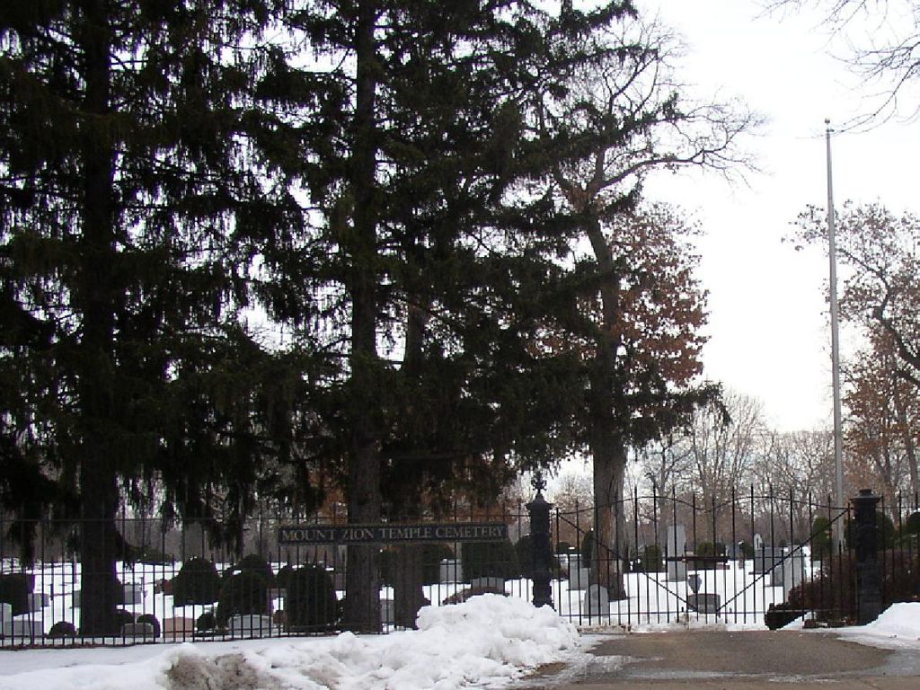
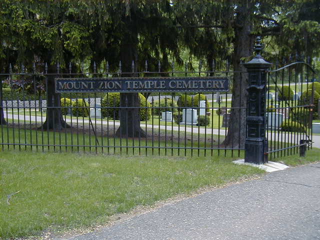
| Description | : | Mount Zion Cemetery, established about 1857, was first located on the corner of Front and Sylvan (near Oakland Cemetery), from 1856 to 1889, then the bodies were moved to this site. Records prior to 1921 are part of the congregational records. There are approximately 7 acres with 1500 burials. Records are at the Mount Zion Synagogue (Reform) at 1300 Summit Avenue, St. Paul. For almost twenty years, this was the only Jewish cemetery in Minnesota. Bodies were brought from Mankato and Minneapolis for burial here. |
frequently asked questions (FAQ):
-
Where is Mount Zion Temple Cemetery?
Mount Zion Temple Cemetery is located at 1670 Payne Ave. Saint Paul, Ramsey County ,Minnesota ,USA.
-
Mount Zion Temple Cemetery cemetery's updated grave count on graveviews.com?
0 memorials
-
Where are the coordinates of the Mount Zion Temple Cemetery?
Latitude: 44.9932600
Longitude: -93.0735800
Nearby Cemetories:
1. Sons of Moses Cemetery
Saint Paul, Ramsey County, USA
Coordinate: 44.9904785, -93.0704575
2. Sons of Jacob Cemetery
Saint Paul, Ramsey County, USA
Coordinate: 44.9911118, -93.0695496
3. Forest Lawn Memorial Park
Maplewood, Ramsey County, USA
Coordinate: 44.9975010, -93.0731570
4. Saint Johns Cemetery
Little Canada, Ramsey County, USA
Coordinate: 45.0200005, -93.0805969
5. Sons of Abraham Cemetery
Saint Paul, Ramsey County, USA
Coordinate: 44.9784900, -93.0379100
6. Chesed Shel Emes Cemetery
Saint Paul, Ramsey County, USA
Coordinate: 44.9907990, -93.0317001
7. Adath Yeshurun Cemetery
Saint Paul, Ramsey County, USA
Coordinate: 44.9791107, -93.0364609
8. West Side Hebrew Cemetery
Saint Paul, Ramsey County, USA
Coordinate: 44.9791107, -93.0364609
9. Oakland Cemetery
Saint Paul, Ramsey County, USA
Coordinate: 44.9692001, -93.0986023
10. Dale-Rice Memorial Cemetery
Roseville, Ramsey County, USA
Coordinate: 45.0061500, -93.1117800
11. Ramsey County Cemetery
Maplewood, Ramsey County, USA
Coordinate: 45.0019302, -93.0245209
12. Temple of Aaron Cemetery
Roseville, Ramsey County, USA
Coordinate: 44.9922000, -93.1259400
13. Elmhurst Cemetery
Saint Paul, Ramsey County, USA
Coordinate: 44.9872800, -93.1258300
14. Memorial Pet Cemetery
Roseville, Ramsey County, USA
Coordinate: 45.0103510, -93.1292500
15. Roselawn Cemetery
Roseville, Ramsey County, USA
Coordinate: 44.9921500, -93.1355100
16. Indian Mounds Park
Saint Paul, Ramsey County, USA
Coordinate: 44.9460060, -93.0547060
17. Calvary Cemetery
Saint Paul, Ramsey County, USA
Coordinate: 44.9674988, -93.1350021
18. Saint Paul's Monastery Cemetery
Maplewood, Ramsey County, USA
Coordinate: 44.9951500, -92.9878990
19. Saint Christophers Episcopal Church Columbarium
Roseville, Ramsey County, USA
Coordinate: 45.0114940, -93.1553760
20. Saint John the Evangelist Episcopal Columbarium
Saint Paul, Ramsey County, USA
Coordinate: 44.9428200, -93.1236700
21. Union Cemetery
Maplewood, Ramsey County, USA
Coordinate: 44.9650002, -92.9918976
22. House of Hope Presbyterian Church Memorial Garden
Saint Paul, Ramsey County, USA
Coordinate: 44.9418400, -93.1329500
23. Saint Marys Cemetery Old
North Saint Paul, Ramsey County, USA
Coordinate: 45.0280991, -92.9935989
24. Saint Marys Cemetery New
North Saint Paul, Ramsey County, USA
Coordinate: 45.0313300, -92.9940100