
| Memorials | : | 0 |
| Location | : | Mountain View, Santa Clara County, USA |
| Coordinate | : | 37.3894600, -122.0834300 |
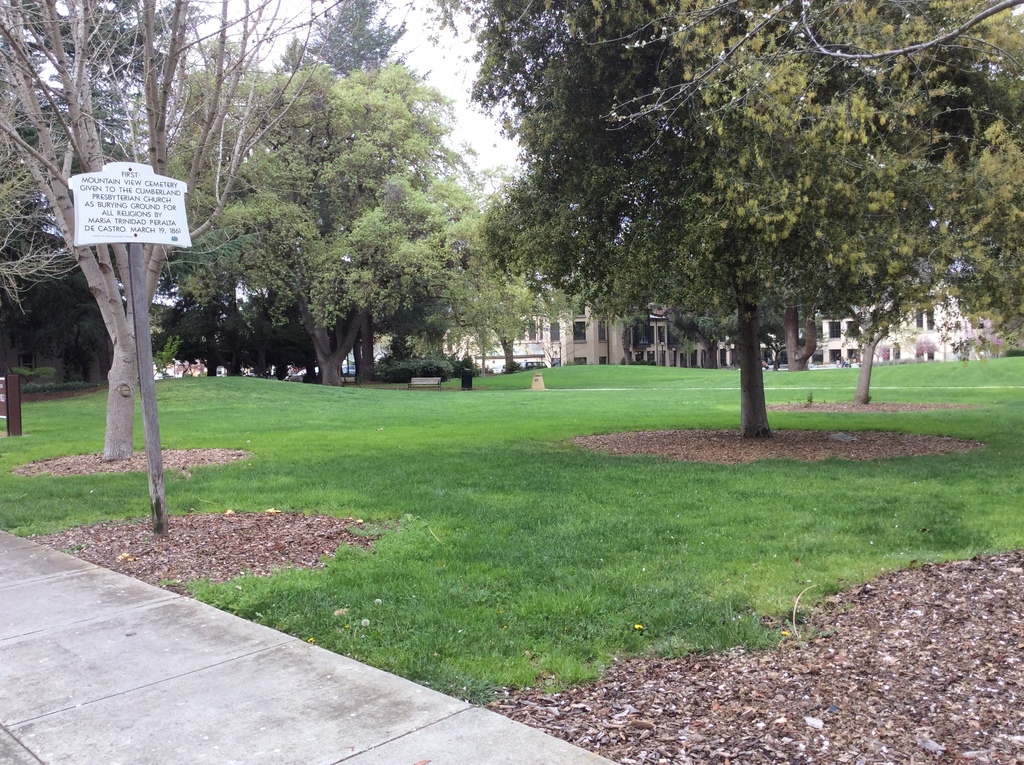
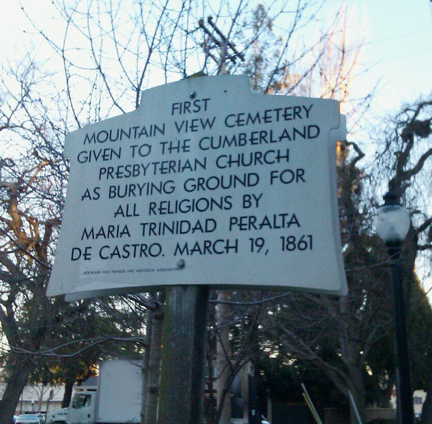
| Description | : | The Cumberland Presbyterian Church had acquired a gift of five acres of land including where its building stood and the land adjacent to it (corner of Castro and Church). This land was donated by a very generous woman who provided the land for several other worthy developments in the area. Maria Trinidad Peralta de Castro, the widow of Mariano Castro who had died in 1857 was aware of the fact that the Protestants had no regular burial place in the area, unlike the Catholics of her own faith who were buried in Santa Clara Catholic Cemetery. She, therefore, gave the... Read More |
frequently asked questions (FAQ):
-
Where is Mountain View Cemetery?
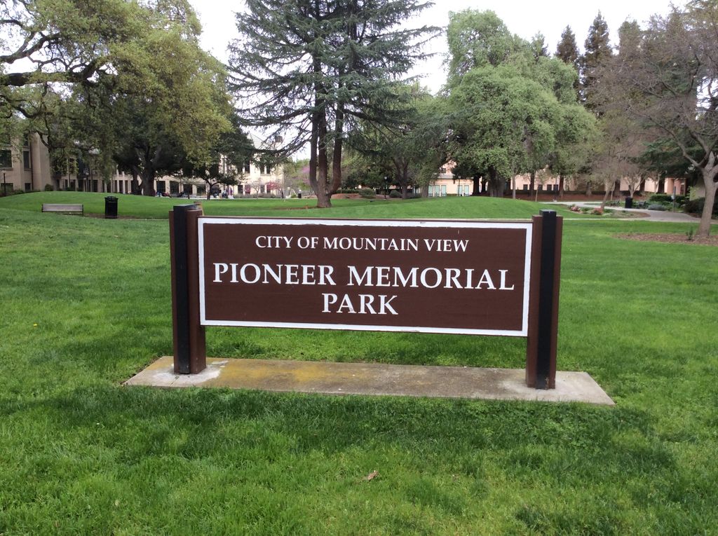
Mountain View Cemetery is located at 1146 Church Street Mountain View, Santa Clara County ,California ,USA.
-
Mountain View Cemetery cemetery's updated grave count on graveviews.com?
0 memorials
-
Where are the coordinates of the Mountain View Cemetery?
Latitude: 37.3894600
Longitude: -122.0834300
Nearby Cemetories:
1. Mountain View Buddhist Church
Mountain View, Santa Clara County, USA
Coordinate: 37.4020680, -122.0774160
2. Saint Timothy's Episcopal Church Columbarium
Mountain View, Santa Clara County, USA
Coordinate: 37.3725650, -122.0782480
3. Christ Episcopal Church Columbarium
Los Altos, Santa Clara County, USA
Coordinate: 37.3642210, -122.1044590
4. Saint Thomas Episcopal Church Columbarium
Sunnyvale, Santa Clara County, USA
Coordinate: 37.3773110, -122.0432030
5. Alta Mesa Memorial Park
Palo Alto, Santa Clara County, USA
Coordinate: 37.3990200, -122.1288300
6. Saint Luke Lutheran Church Columbarium
Sunnyvale, Santa Clara County, USA
Coordinate: 37.3453400, -122.0560300
7. Presbyterian Church of Sunnyvale Memorial Gardens
Sunnyvale, Santa Clara County, USA
Coordinate: 37.3520012, -122.0422974
8. Maryknoll Fathers Seminary Cemetery
Los Altos, Santa Clara County, USA
Coordinate: 37.3340500, -122.0825500
9. Saint Marks Episcopal Church All Souls Garden
Palo Alto, Santa Clara County, USA
Coordinate: 37.4318900, -122.1299000
10. Gate Of Heaven Catholic Cemetery
Los Altos, Santa Clara County, USA
Coordinate: 37.3289030, -122.0802930
11. Saint Judes Episcopal Church Memorial Garden
Cupertino, Santa Clara County, USA
Coordinate: 37.3147400, -122.0407300
12. All Saints Episcopal Church Memorial Garden
Palo Alto, Santa Clara County, USA
Coordinate: 37.4466933, -122.1592525
13. Stanford Family Mausoleum
Palo Alto, Santa Clara County, USA
Coordinate: 37.4364929, -122.1698990
14. First United Methodist Church Memorial Garden
Palo Alto, Santa Clara County, USA
Coordinate: 37.4493870, -122.1568630
15. Saint Patricks Seminary Chapel Crypt
Menlo Park, San Mateo County, USA
Coordinate: 37.4595050, -122.1680330
16. Trinity Episcopal Church Memorial Garden
Menlo Park, San Mateo County, USA
Coordinate: 37.4562300, -122.1789300
17. Holy Cross Catholic Cemetery
Menlo Park, San Mateo County, USA
Coordinate: 37.4350420, -122.1978540
18. Corpus Christi Monastery
Menlo Park, San Mateo County, USA
Coordinate: 37.4589200, -122.1801900
19. Saint Bedes Episcopal Church Cemetery
Menlo Park, San Mateo County, USA
Coordinate: 37.4218750, -122.2075210
20. Agnews Historical Cemetery
Santa Clara, Santa Clara County, USA
Coordinate: 37.4008100, -121.9533800
21. Oakwood Community Cemetery
Atherton, San Mateo County, USA
Coordinate: 37.4503120, -122.1956310
22. Dennis Martin Cemetery
San Mateo County, USA
Coordinate: 37.4203440, -122.2181370
23. Carmelite Monastery Cemetery
Santa Clara, Santa Clara County, USA
Coordinate: 37.3469200, -121.9533400
24. Christ Episcopal Church Churchyard Columbarium
Portola Valley, San Mateo County, USA
Coordinate: 37.3821670, -122.2304160