| Memorials | : | 78 |
| Location | : | Palo Alto, Santa Clara County, USA |
| Phone | : | 650-493-1041 |
| Website | : | www.altamesacemetery.com/index2.html |
| Coordinate | : | 37.3990200, -122.1288300 |
| Description | : | NOTE: Find A Grave received the following information regarding photo requests: Alta Mesa is a privately endowed park and they do not allow photographs without permission from the family. They can take a photo for you, but charge $30.00 to do so. There is no charge for a volunteer with permission from the family to take a photo. Please send an email to Robin Mclaughlin, cemetery counselor at [email protected] requesting permission to photgraph the marker and your relationship and reason for the request. describing your relationship to the individual in question, and requesting permission for a volunteer photo. In the... Read More |
frequently asked questions (FAQ):
-
Where is Alta Mesa Memorial Park?
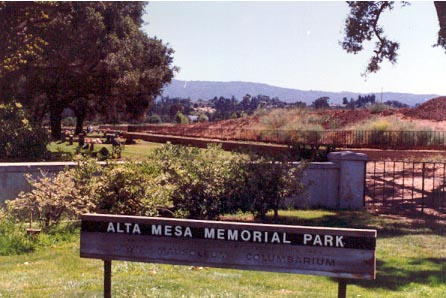
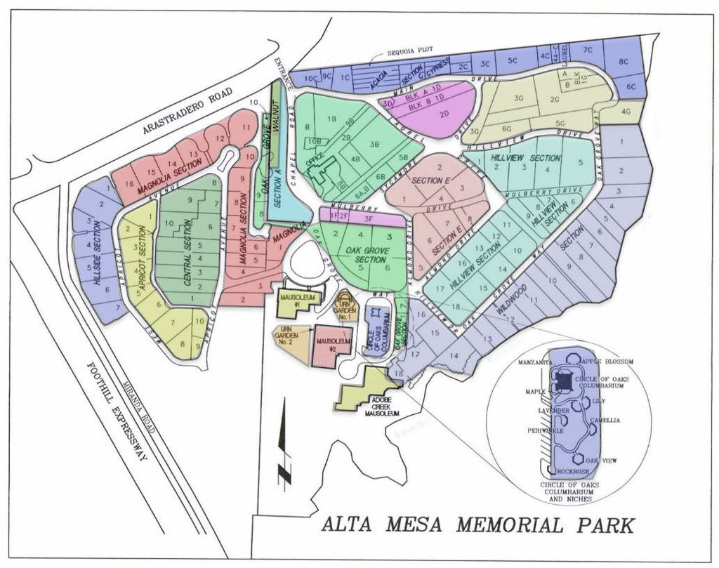
Alta Mesa Memorial Park is located at 695 Arastradero Rd Palo Alto, Santa Clara County ,California , 94306-3840USA.
-
Alta Mesa Memorial Park cemetery's updated grave count on graveviews.com?
75 memorials
-
Where are the coordinates of the Alta Mesa Memorial Park?
Latitude: 37.3990200
Longitude: -122.1288300
Nearby Cemetories:
1. Saint Marks Episcopal Church All Souls Garden
Palo Alto, Santa Clara County, USA
Coordinate: 37.4318900, -122.1299000
2. Mountain View Cemetery
Mountain View, Santa Clara County, USA
Coordinate: 37.3894600, -122.0834300
3. Christ Episcopal Church Columbarium
Los Altos, Santa Clara County, USA
Coordinate: 37.3642210, -122.1044590
4. Mountain View Buddhist Church
Mountain View, Santa Clara County, USA
Coordinate: 37.4020680, -122.0774160
5. Saint Timothy's Episcopal Church Columbarium
Mountain View, Santa Clara County, USA
Coordinate: 37.3725650, -122.0782480
6. Stanford Family Mausoleum
Palo Alto, Santa Clara County, USA
Coordinate: 37.4364929, -122.1698990
7. All Saints Episcopal Church Memorial Garden
Palo Alto, Santa Clara County, USA
Coordinate: 37.4466933, -122.1592525
8. First United Methodist Church Memorial Garden
Palo Alto, Santa Clara County, USA
Coordinate: 37.4493870, -122.1568630
9. Holy Cross Catholic Cemetery
Menlo Park, San Mateo County, USA
Coordinate: 37.4350420, -122.1978540
10. Saint Bedes Episcopal Church Cemetery
Menlo Park, San Mateo County, USA
Coordinate: 37.4218750, -122.2075210
11. Saint Patricks Seminary Chapel Crypt
Menlo Park, San Mateo County, USA
Coordinate: 37.4595050, -122.1680330
12. Trinity Episcopal Church Memorial Garden
Menlo Park, San Mateo County, USA
Coordinate: 37.4562300, -122.1789300
13. Saint Thomas Episcopal Church Columbarium
Sunnyvale, Santa Clara County, USA
Coordinate: 37.3773110, -122.0432030
14. Corpus Christi Monastery
Menlo Park, San Mateo County, USA
Coordinate: 37.4589200, -122.1801900
15. Oakwood Community Cemetery
Atherton, San Mateo County, USA
Coordinate: 37.4503120, -122.1956310
16. Dennis Martin Cemetery
San Mateo County, USA
Coordinate: 37.4203440, -122.2181370
17. Maryknoll Fathers Seminary Cemetery
Los Altos, Santa Clara County, USA
Coordinate: 37.3340500, -122.0825500
18. Saint Luke Lutheran Church Columbarium
Sunnyvale, Santa Clara County, USA
Coordinate: 37.3453400, -122.0560300
19. Gate Of Heaven Catholic Cemetery
Los Altos, Santa Clara County, USA
Coordinate: 37.3289030, -122.0802930
20. Christ Episcopal Church Churchyard Columbarium
Portola Valley, San Mateo County, USA
Coordinate: 37.3821670, -122.2304160
21. Presbyterian Church of Sunnyvale Memorial Gardens
Sunnyvale, Santa Clara County, USA
Coordinate: 37.3520012, -122.0422974
22. Union Cemetery
Redwood City, San Mateo County, USA
Coordinate: 37.4732700, -122.2231360
23. Gorilla Foundation Sanctuary
Woodside, San Mateo County, USA
Coordinate: 37.3750160, -122.2604360
24. Saint Judes Episcopal Church Memorial Garden
Cupertino, Santa Clara County, USA
Coordinate: 37.3147400, -122.0407300


